Denver to Everett is 1,035 miles (1,665 km), a flight of about 2 hours 25 minutes.
Left side wins at both ends of the flight. During the cruise over Idaho and eastern Washington, the left side also tracks closer to the Cascade Range foothills and offers glimpses of volcanic peaks like Mount Adams on approach into the Pacific Northwest.
Flight Path
After crossing the Rockies, the flight tracks northwest over Wyoming's high desert basin, then crosses into southern Idaho over the Snake River Plain. The broad flat lava fields and agricultural pivot-irrigation circles of the Snake River Plain are visible mid-flight. Approaching Washington, the Columbia Plateau's dry channeled scablands give way to the Cascade foothills. On clear days, Mount Rainier and Mount Adams are visible to the left as you descend into the Puget Sound lowlands.
Great circle distance and headings ›.jpg?width=600)

Phase by phase
Takeoff from DEN
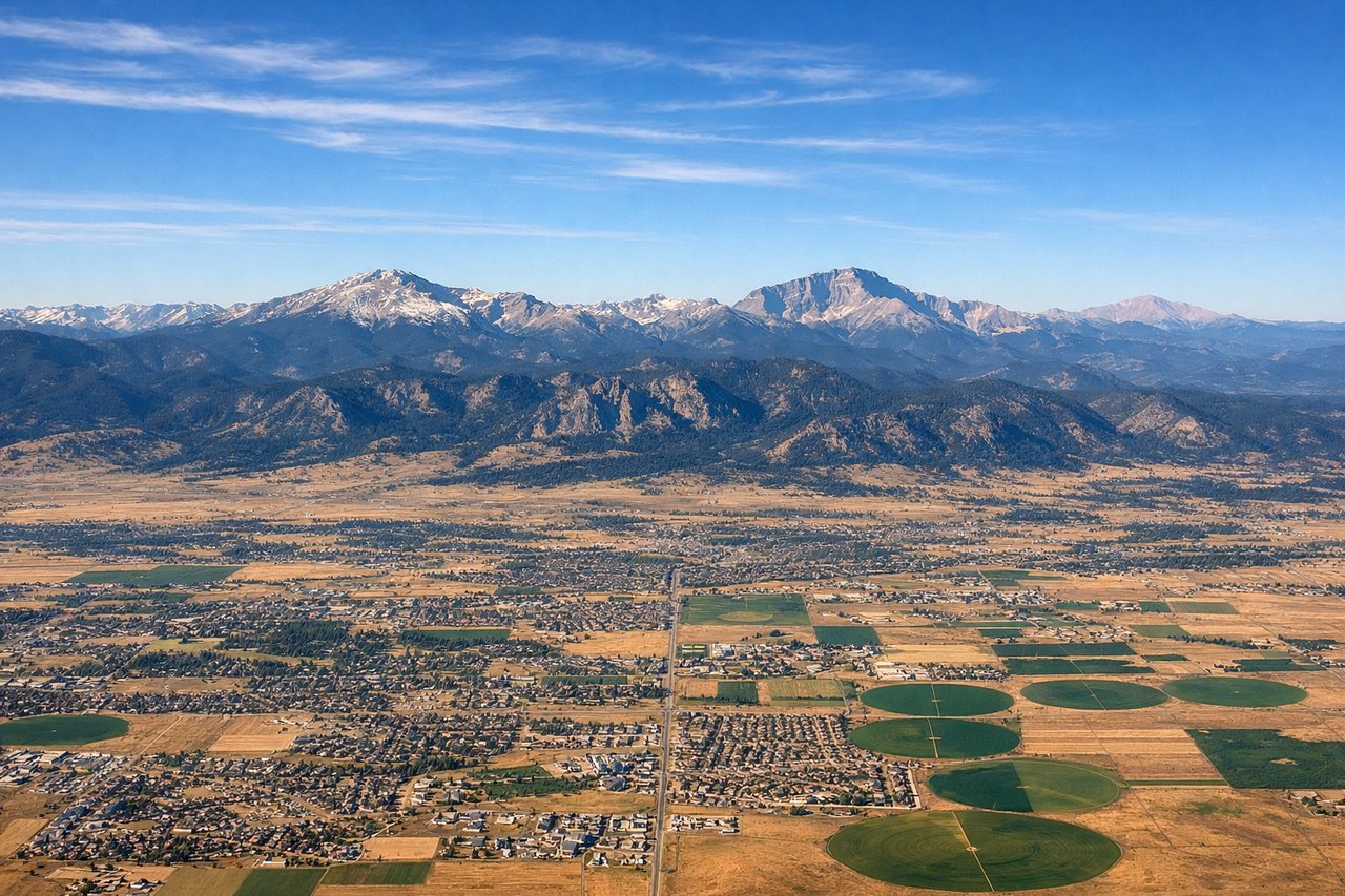
LEFTDEN's primary departure runway 35L/34R sends aircraft northwest, putting the entire Front Range and Rocky Mountain wall on the left side. You get a sweeping view of the Rockies from Pikes Peak in the south up through the Indian Peaks and beyond as you climb out heading northwest.
Landing at PAE
LEFTPAE sits just east of Puget Sound, and aircraft typically approach from the south or southeast on runway 34L/34R heading northwest. A left window seat gives you views over Puget Sound, the Seattle skyline to the south, and the Olympic Mountains across the water to the west.
Landmarks on this routeAll landmarks →
Will your flight be in sunlight?
Pick a date and time in the Sun Map to watch the sun move across your whole flight.
About This Route
Which side of the plane should I sit on flying from Denver International (DEN) to Snohomish Co (PAE)?
Sit on the Left side of the plane for the best views on flights from Denver to Everett. Left side wins at both ends of the flight. During the cruise over Idaho and eastern Washington, the left side also tracks closer to the Cascade Range foothills and offers glimpses of volcanic peaks like Mount Adams on approach into the Pacific Northwest.
What can I see during takeoff from Denver International in Denver?
During takeoff from Denver International (DEN), sit on the Left side for the best views. DEN's primary departure runway 35L/34R sends aircraft northwest, putting the entire Front Range and Rocky Mountain wall on the left side. You get a sweeping view of the Rockies from Pikes Peak in the south up through the Indian Peaks and beyond as you climb out heading northwest. Notable sights include: Front Range Rocky Mountains, Denver metro grid, Pikes Peak (south), Longs Peak and Indian Peaks (northwest).
What can I see when landing at Snohomish Co in Everett?
When landing at Snohomish Co (PAE), sit on the Left side for the best views. PAE sits just east of Puget Sound, and aircraft typically approach from the south or southeast on runway 34L/34R heading northwest. A left window seat gives you views over Puget Sound, the Seattle skyline to the south, and the Olympic Mountains across the water to the west. Notable sights include: Puget Sound, Seattle skyline (south), Olympic Mountains (west across the Sound), Cascade foothills (east).
How long is the flight from Denver to Everett?
The flight from Denver International (DEN) to Snohomish Co (PAE) takes about 2 hours 25 minutes. The shortest flight path between them is 1,035 miles (1,665 km); winds and air traffic control usually add a few percent.
What does the Denver to Everett flight path pass over?
After crossing the Rockies, the flight tracks northwest over Wyoming's high desert basin, then crosses into southern Idaho over the Snake River Plain. The broad flat lava fields and agricultural pivot-irrigation circles of the Snake River Plain are visible mid-flight. Approaching Washington, the Columbia Plateau's dry channeled scablands give way to the Cascade foothills. On clear days, Mount Rainier and Mount Adams are visible to the left as you descend into the Puget Sound lowlands.