The right side maintains stronger mountain scenery throughout the flight, from Rocky Mountain National Park's peaks near Denver to the Uinta Mountains and the dramatic Wasatch Range wall on descent into Salt Lake City.
Flight Path
The flight path crosses the high Colorado Rockies near the Continental Divide, passes over the Yampa River valley and Uinta Mountains in northeastern Utah, before descending toward the Wasatch Range and Salt Lake Valley.
Great circle distance and headings ›.jpg?width=600)

Phase by phase

Takeoff from DEN
RIGHTDeparting DEN and turning west toward SLC, the right side offers views of the Front Range foothills and the jagged peaks of Rocky Mountain National Park, including Longs Peak, rising just north of the flight path. The left side mostly shows the flat, receding High Plains of eastern Colorado before the turn.
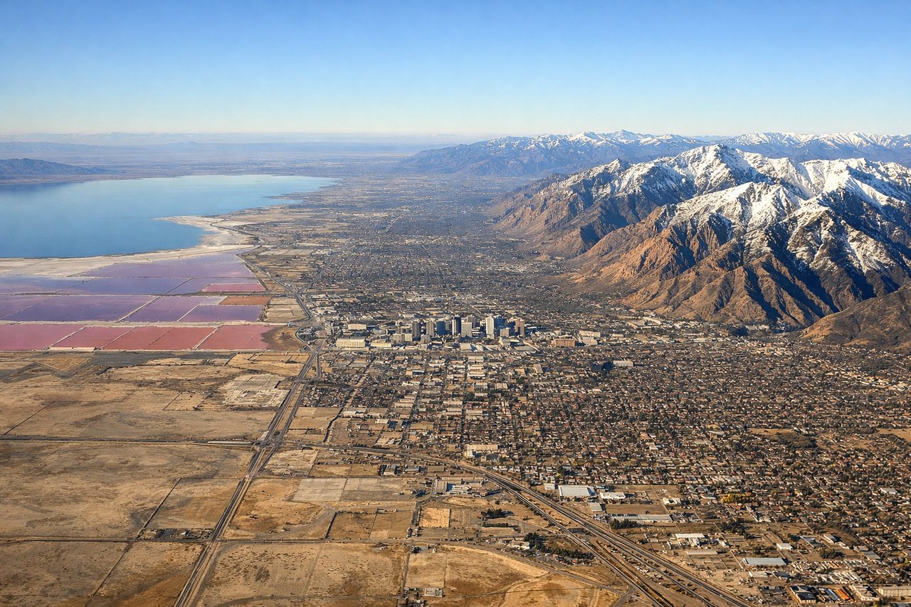
Landing at SLC
RIGHTOn descent into SLC, the aircraft crosses the Uinta Mountains and drops into the Salt Lake Valley with the steep, snow-capped Wasatch Range dominating the right side, rising abruptly from the valley floor. The left side shows the flatter Great Salt Lake basin, scenic but less dramatic than the close mountain wall.
Landmarks on this routeAll landmarks →
Will your flight be in sunlight?
See exactly which side of the plane gets sun and shade at your departure time.
About This Route
Which side of the plane should I sit on flying from Denver International (DEN) to Salt Lake City International (SLC)?
Sit on the Right side of the plane for the best views on flights from Denver to Salt Lake City. The right side maintains stronger mountain scenery throughout the flight, from Rocky Mountain National Park's peaks near Denver to the Uinta Mountains and the dramatic Wasatch Range wall on descent into Salt Lake City.
What can I see during takeoff from Denver International in Denver?
During takeoff from Denver International (DEN), sit on the Right side for the best views. Departing DEN and turning west toward SLC, the right side offers views of the Front Range foothills and the jagged peaks of Rocky Mountain National Park, including Longs Peak, rising just north of the flight path. The left side mostly shows the flat, receding High Plains of eastern Colorado before the turn. Notable sights include: Front Range foothills, Longs Peak, Rocky Mountain National Park, Continental Divide.
What can I see when landing at Salt Lake City International in Salt Lake City?
When landing at Salt Lake City International (SLC), sit on the Right side for the best views. On descent into SLC, the aircraft crosses the Uinta Mountains and drops into the Salt Lake Valley with the steep, snow-capped Wasatch Range dominating the right side, rising abruptly from the valley floor. The left side shows the flatter Great Salt Lake basin, scenic but less dramatic than the close mountain wall. Notable sights include: Wasatch Range, Salt Lake Valley, Uinta Mountains, Oquirrh Mountains.
How long is the flight from Denver to Salt Lake City?
The flight from Denver International (DEN) to Salt Lake City International (SLC) takes 1h 25m.
What does the Denver to Salt Lake City flight path pass over?
The flight path crosses the high Colorado Rockies near the Continental Divide, passes over the Yampa River valley and Uinta Mountains in northeastern Utah, before descending toward the Wasatch Range and Salt Lake Valley.