Detroit to Anchorage is 2,979 miles (4,794 km), a flight of about 6 hours 50 minutes.
The right side wins both the Detroit takeoff, with its skyline and lakeshore, and the Anchorage arrival, which offers the Chugach Mountains, Knik Arm, and a chance at seeing Denali — landmarks with far more visual drama than the flatter scenery on the left.
Flight Path
Boreal forest and lake country of the Canadian Shield across Ontario and Manitoba, followed by the wide river valleys of Saskatchewan, then the rugged Yukon plateau and the outer ranges of the Wrangell-St. Elias massif as the route enters Alaska.
Great circle distance and headings ›
.jpg?width=600)


Phase by phase
Takeoff from DET
RIGHTDeparting DET on runway 33 heading northwest, the initial turn puts Detroit's downtown skyline and the Detroit River/Lake St. Clair shoreline on the right side of the aircraft. The left side shows mostly flat suburban Michigan with little visual interest.
Landing at ANC
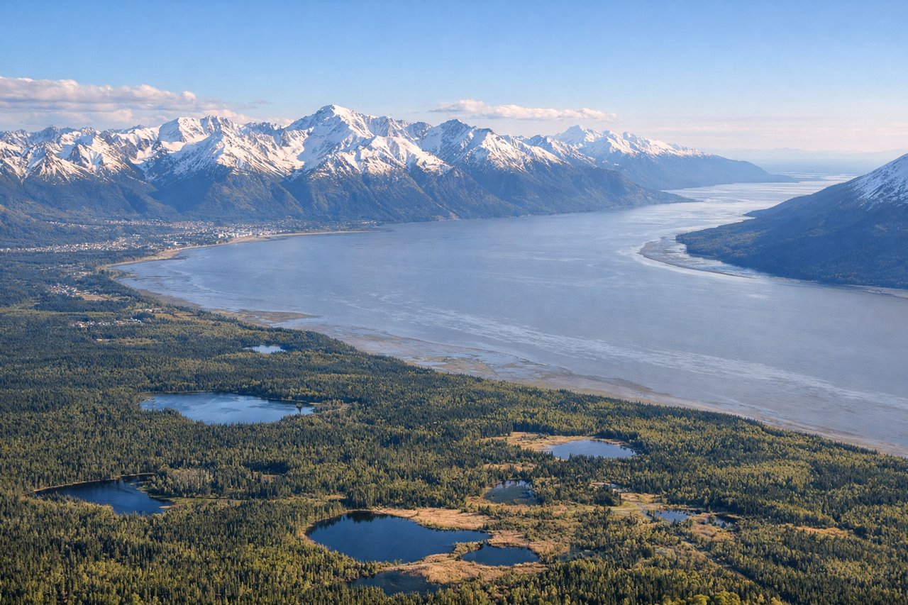
RIGHTOn approach into Anchorage from the east, the descent path skirts the Chugach Mountains before the final turn toward the runway, with the Alaska Range and Denali sometimes visible far to the north on clear days. The right side captures these peaks and Knik Arm, while the left side mostly faces south toward Turnagain Arm and the Kenai Mountains, which are also nice but less dramatic in daylight approach sequencing.
Landmarks on this routeAll landmarks →
Will your flight be in sunlight?
Pick a date and time in the Sun Map to watch the sun move across your whole flight.
About This Route
Which side of the plane should I sit on flying from Detroit City (DET) to Ted Stevens Anchorage International (ANC)?
Sit on the Right side of the plane for the best views on flights from Detroit to Anchorage. The right side wins both the Detroit takeoff, with its skyline and lakeshore, and the Anchorage arrival, which offers the Chugach Mountains, Knik Arm, and a chance at seeing Denali — landmarks with far more visual drama than the flatter scenery on the left.
What can I see during takeoff from Detroit City in Detroit?
During takeoff from Detroit City (DET), sit on the Right side for the best views. Departing DET on runway 33 heading northwest, the initial turn puts Detroit's downtown skyline and the Detroit River/Lake St. Clair shoreline on the right side of the aircraft. The left side shows mostly flat suburban Michigan with little visual interest. Notable sights include: Detroit skyline, Detroit River, Lake St. Clair, Belle Isle.
What can I see when landing at Ted Stevens Anchorage International in Anchorage?
When landing at Ted Stevens Anchorage International (ANC), sit on the Right side for the best views. On approach into Anchorage from the east, the descent path skirts the Chugach Mountains before the final turn toward the runway, with the Alaska Range and Denali sometimes visible far to the north on clear days. The right side captures these peaks and Knik Arm, while the left side mostly faces south toward Turnagain Arm and the Kenai Mountains, which are also nice but less dramatic in daylight approach sequencing. Notable sights include: Chugach Mountains, Knik Arm, Mount Susitna, Denali (weather permitting).
How long is the flight from Detroit to Anchorage?
The flight from Detroit City (DET) to Ted Stevens Anchorage International (ANC) takes about 6 hours 50 minutes. The shortest flight path between them is 2,979 miles (4,794 km); winds and air traffic control usually add a few percent.
What does the Detroit to Anchorage flight path pass over?
Boreal forest and lake country of the Canadian Shield across Ontario and Manitoba, followed by the wide river valleys of Saskatchewan, then the rugged Yukon plateau and the outer ranges of the Wrangell-St. Elias massif as the route enters Alaska.