Anchorage to Detroit is 2,979 miles (4,794 km), a flight of about 4 hours 45 minutes.
The takeoff experience from Anchorage with the Chugach Mountains is more visually dramatic and sustained than the landing approach into Detroit. The mountains provide continuous scenic interest during the first 30-45 minutes of flight, whereas the Detroit landing offers only brief river views in the final descent.
Flight Path
The flight path crosses interior Alaska (Brooks Range visible to the north if flying at higher altitude), then transitions over western Canada including the Rocky Mountains in British Columbia and Alberta, the Canadian prairies of Saskatchewan and Manitoba, and the Great Lakes region. Lake Superior is typically visible during the eastern portion of the flight path, appearing as a massive freshwater body with distinctive irregular shoreline. The transition from mountainous terrain to flat prairie is gradual but noticeable over central Canada.
Great circle distance and headings ›

.jpg?width=600)

Phase by phase
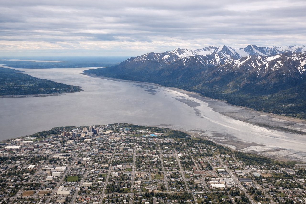
Takeoff from ANC
LEFTLeft seats offer immediate views of the Chugach Mountains as the aircraft climbs southeast from Anchorage. The range dominates the landscape immediately east of the airport and is visible throughout the initial climb phase.
Landing at DET
RIGHTRight seats provide views of the Detroit River and Windsor, Ontario as the aircraft descends toward Coleman A. Young International Airport (formerly Detroit City Airport). The river and Canadian shoreline are distinctive features visible on final approach from the east.
Landmarks on this routeAll landmarks →
Will your flight be in sunlight?
Pick a date and time in the Sun Map to watch the sun move across your whole flight.
About This Route
Which side of the plane should I sit on flying from Ted Stevens Anchorage International (ANC) to Detroit City (DET)?
Sit on the Left side of the plane for the best views on flights from Anchorage to Detroit. The takeoff experience from Anchorage with the Chugach Mountains is more visually dramatic and sustained than the landing approach into Detroit. The mountains provide continuous scenic interest during the first 30-45 minutes of flight, whereas the Detroit landing offers only brief river views in the final descent.
What can I see during takeoff from Ted Stevens Anchorage International in Anchorage?
During takeoff from Ted Stevens Anchorage International (ANC), sit on the Left side for the best views. Left seats offer immediate views of the Chugach Mountains as the aircraft climbs southeast from Anchorage. The range dominates the landscape immediately east of the airport and is visible throughout the initial climb phase. Notable sights include: Chugach Mountains, Cook Inlet (southwest), Knik Arm (south), Anchorage urban area.
What can I see when landing at Detroit City in Detroit?
When landing at Detroit City (DET), sit on the Right side for the best views. Right seats provide views of the Detroit River and Windsor, Ontario as the aircraft descends toward Coleman A. Young International Airport (formerly Detroit City Airport). The river and Canadian shoreline are distinctive features visible on final approach from the east. Notable sights include: Detroit River, Windsor Ontario skyline, Lake St. Clair (northeast), Detroit urban core.
How long is the flight from Anchorage to Detroit?
The flight from Ted Stevens Anchorage International (ANC) to Detroit City (DET) takes about 4 hours 45 minutes. The shortest flight path between them is 2,979 miles (4,794 km); winds and air traffic control usually add a few percent.
What does the Anchorage to Detroit flight path pass over?
The flight path crosses interior Alaska (Brooks Range visible to the north if flying at higher altitude), then transitions over western Canada including the Rocky Mountains in British Columbia and Alberta, the Canadian prairies of Saskatchewan and Manitoba, and the Great Lakes region. Lake Superior is typically visible during the eastern portion of the flight path, appearing as a massive freshwater body with distinctive irregular shoreline. The transition from mountainous terrain to flat prairie is gradual but noticeable over central Canada.