The left side wins at both ends of the flight. Over the Persian Gulf and Arabian Sea the left side tracks the coastline of Pakistan and the Makran coast in the distance, and on descent into Kolkata the Hooghly River and city center are on the left. Right side is mostly open water and flat plains with little to distinguish it.
Flight Path
The route crosses the Persian Gulf, then the Pakistani coastline near Karachi and the Sindh plains, followed by the Thar Desert and Rajasthan's flat arid landscape, then the Indo-Gangetic Plain across Uttar Pradesh and Bihar — largely flat agricultural land with the Ganges river system visible as a network of brown waterways before descending into the Bengal delta near Kolkata
Great circle distance and headings ›
_and_the_Dubai_skyline_(25781049892).jpg?width=600)

Phase by phase
Takeoff from DOH
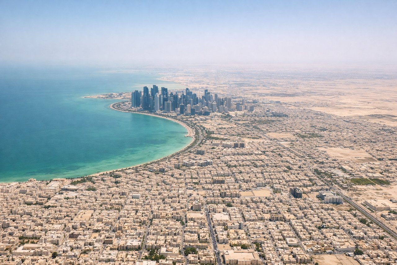
LEFTDoha's main runways (16L/34R and 16R/34L) mean departures heading northeast toward India will bank left, putting the left side over Doha city center and the southern end of the Qatar peninsula. You get a clear view of the dense urban grid, the West Bay skyscraper cluster, and the shallow turquoise waters of the Persian Gulf.
Landing at CCU
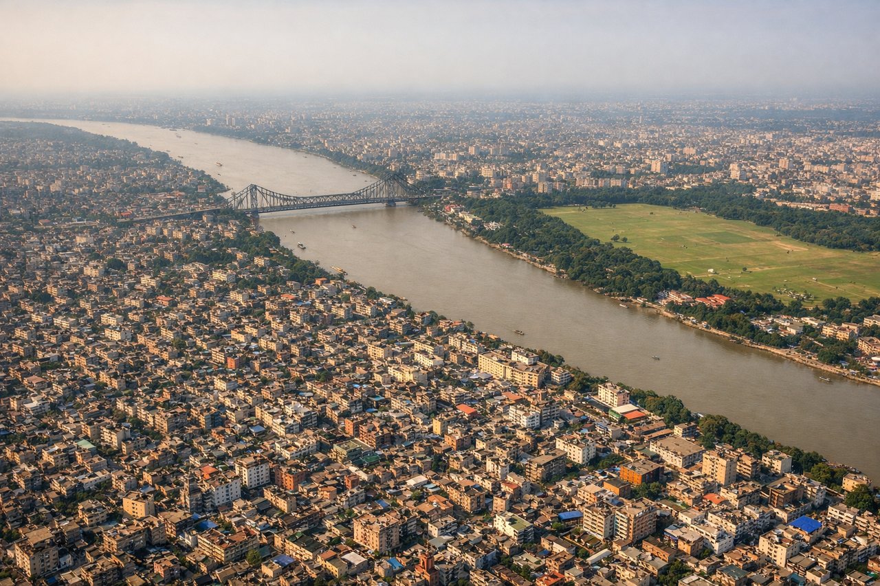
LEFTKolkata's primary runway orientation (01L/19R and 01R/19L) means aircraft typically approach from the south or north. On a southward approach to runway 19, the left side looks east over the Hooghly River and the dense urban fabric of central Kolkata, including the distinctive bend in the river and the Howrah Bridge area. This is the more visually interesting side.
Landmarks on this routeAll landmarks →
Will your flight be in sunlight?
See exactly which side of the plane gets sun and shade at your departure time.
About This Route
Which side of the plane should I sit on flying from Hamad International Airport (DOH) to Netaji Subhash Chandra Bose International (CCU)?
Sit on the Left side of the plane for the best views on flights from Doha to Calcutta. The left side wins at both ends of the flight. Over the Persian Gulf and Arabian Sea the left side tracks the coastline of Pakistan and the Makran coast in the distance, and on descent into Kolkata the Hooghly River and city center are on the left. Right side is mostly open water and flat plains with little to distinguish it.
What can I see during takeoff from Hamad International Airport in Doha?
During takeoff from Hamad International Airport (DOH), sit on the Left side for the best views. Doha's main runways (16L/34R and 16R/34L) mean departures heading northeast toward India will bank left, putting the left side over Doha city center and the southern end of the Qatar peninsula. You get a clear view of the dense urban grid, the West Bay skyscraper cluster, and the shallow turquoise waters of the Persian Gulf. Notable sights include: West Bay skyline and Corniche waterfront, Qatar peninsula coastline, shallow Persian Gulf waters with visible sandbars, Doha port area.
What can I see when landing at Netaji Subhash Chandra Bose International in Calcutta?
When landing at Netaji Subhash Chandra Bose International (CCU), sit on the Left side for the best views. Kolkata's primary runway orientation (01L/19R and 01R/19L) means aircraft typically approach from the south or north. On a southward approach to runway 19, the left side looks east over the Hooghly River and the dense urban fabric of central Kolkata, including the distinctive bend in the river and the Howrah Bridge area. This is the more visually interesting side. Notable sights include: Hooghly River and its distinctive meander through Kolkata, Howrah Bridge spanning the river, dense urban grid of central Kolkata, Maidan open parkland visible as a large green rectangle.
How long is the flight from Doha to Calcutta?
The flight from Hamad International Airport (DOH) to Netaji Subhash Chandra Bose International (CCU) takes Approximately 4 hours 15 minutes.
What does the Doha to Calcutta flight path pass over?
The route crosses the Persian Gulf, then the Pakistani coastline near Karachi and the Sindh plains, followed by the Thar Desert and Rajasthan's flat arid landscape, then the Indo-Gangetic Plain across Uttar Pradesh and Bihar — largely flat agricultural land with the Ganges river system visible as a network of brown waterways before descending into the Bengal delta near Kolkata