Doha to Hanoi is 3,429 miles (5,519 km), a flight of about 5 hours 30 minutes.
The right side wins overall because the Hanoi approach delivers genuinely spectacular geography — the Red River Delta, West Lake, and the city itself — which is more visually rewarding than the takeoff view. During the cruise the right side also faces slightly more toward the Himalayas and Yunnan highlands in the far distance, though at typical cruising altitude these are horizon features only.
Flight Path
The route crosses the Arabian Sea coast of Pakistan near Karachi, then tracks northeast over the Indian subcontinent crossing Rajasthan desert and the Gangetic Plain. It then crosses into Myanmar airspace over the Irrawaddy basin before descending into northern Vietnam. The southern Himalayas and Yunnan Plateau highlands of southwest China appear as distant elevated terrain on the right side during the latter half of the flight. The Bay of Bengal is largely avoided as the route stays overland.
Great circle distance and headings ›
_and_the_Dubai_skyline_(25781049892).jpg?width=600)


Phase by phase
Takeoff from DOH
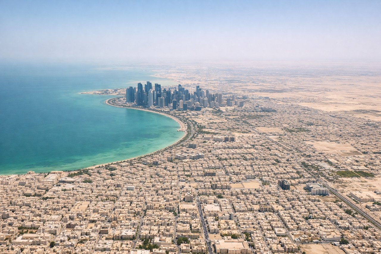
LEFTDoha's main runways (16L/34R orientation) mean a northbound departure climbs out over the city center and the West Bay skyline before banking east. The left side catches the Doha corniche, the dense cluster of West Bay towers, and the shallow turquoise waters of the inner bay. The right side faces the industrial port and featureless desert.
Landing at HAN
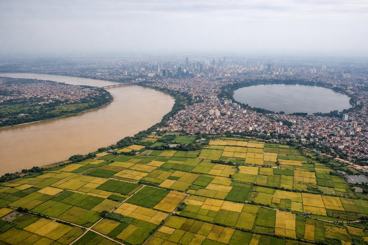
RIGHTNoi Bai's primary runway (11L/29R orientation) means aircraft typically approach from the east or northeast, putting the Red River and Hanoi's urban core on the right side during final approach. The right seat gets the Red River's wide brown curves and the city's lake-dotted urban fabric including Hoan Kiem district. The left side faces flat agricultural paddies to the north.
Landmarks on this routeAll landmarks →
Will your flight be in sunlight?
Pick a date and time in the Sun Map to watch the sun move across your whole flight.
About This Route
Which side of the plane should I sit on flying from Hamad International Airport (DOH) to Noibai International (HAN)?
Sit on the Right side of the plane for the best views on flights from Doha to Hanoi. The right side wins overall because the Hanoi approach delivers genuinely spectacular geography — the Red River Delta, West Lake, and the city itself — which is more visually rewarding than the takeoff view. During the cruise the right side also faces slightly more toward the Himalayas and Yunnan highlands in the far distance, though at typical cruising altitude these are horizon features only.
What can I see during takeoff from Hamad International Airport in Doha?
During takeoff from Hamad International Airport (DOH), sit on the Left side for the best views. Doha's main runways (16L/34R orientation) mean a northbound departure climbs out over the city center and the West Bay skyline before banking east. The left side catches the Doha corniche, the dense cluster of West Bay towers, and the shallow turquoise waters of the inner bay. The right side faces the industrial port and featureless desert. Notable sights include: West Bay skyscraper cluster, Doha Corniche waterfront, inner bay turquoise shallows, Qatar peninsula coastline.
What can I see when landing at Noibai International in Hanoi?
When landing at Noibai International (HAN), sit on the Right side for the best views. Noi Bai's primary runway (11L/29R orientation) means aircraft typically approach from the east or northeast, putting the Red River and Hanoi's urban core on the right side during final approach. The right seat gets the Red River's wide brown curves and the city's lake-dotted urban fabric including Hoan Kiem district. The left side faces flat agricultural paddies to the north. Notable sights include: Red River broad meanders, Hanoi urban core, West Lake (Ho Tay) large urban lake, patchwork Red River Delta rice paddies.
How long is the flight from Doha to Hanoi?
The flight from Hamad International Airport (DOH) to Noibai International (HAN) takes about 5 hours 30 minutes. The shortest flight path between them is 3,429 miles (5,519 km); winds and air traffic control usually add a few percent.
What does the Doha to Hanoi flight path pass over?
The route crosses the Arabian Sea coast of Pakistan near Karachi, then tracks northeast over the Indian subcontinent crossing Rajasthan desert and the Gangetic Plain. It then crosses into Myanmar airspace over the Irrawaddy basin before descending into northern Vietnam. The southern Himalayas and Yunnan Plateau highlands of southwest China appear as distant elevated terrain on the right side during the latter half of the flight. The Bay of Bengal is largely avoided as the route stays overland.