The left side delivers Doha's coastal skyline on departure, a long cruise view north across Iran's Zagros Mountains and the Himalayan foothills, and a dramatic final approach with the Himalayan range visible ahead and to the north. The right side stays over comparatively flat terrain — Gulf waters, Pakistani desert, and the Gangetic plain — for most of the flight.
Flown DOH to KTM? Did we get it right?
Flight Path
Doha to Kathmandu is 2,088 miles (3,360 km), a flight of about 4 hours 45 minutes.
Southern Zagros Mountains of Iran, the arid Balochistan plateau of Pakistan, the Thar Desert and Indo-Gangetic Plain of northern India, with Himalayan foothills rising as the route nears the Nepal border
Great circle distance and headings ›


Phase by phase
Takeoff from DOH
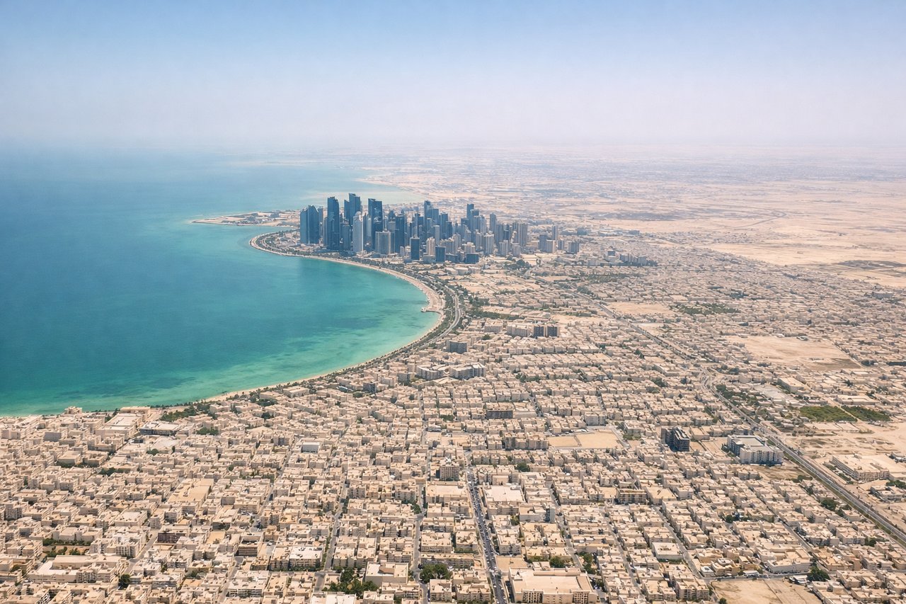
LEFTDeparting DOH on runway 16L, the aircraft climbs southeast before banking left to pick up its easterly track toward Iran. That left turn swings Doha's skyline, the Pearl-Qatar island, and the curving West Bay coastline directly under the left-side windows.
Landing at KTM
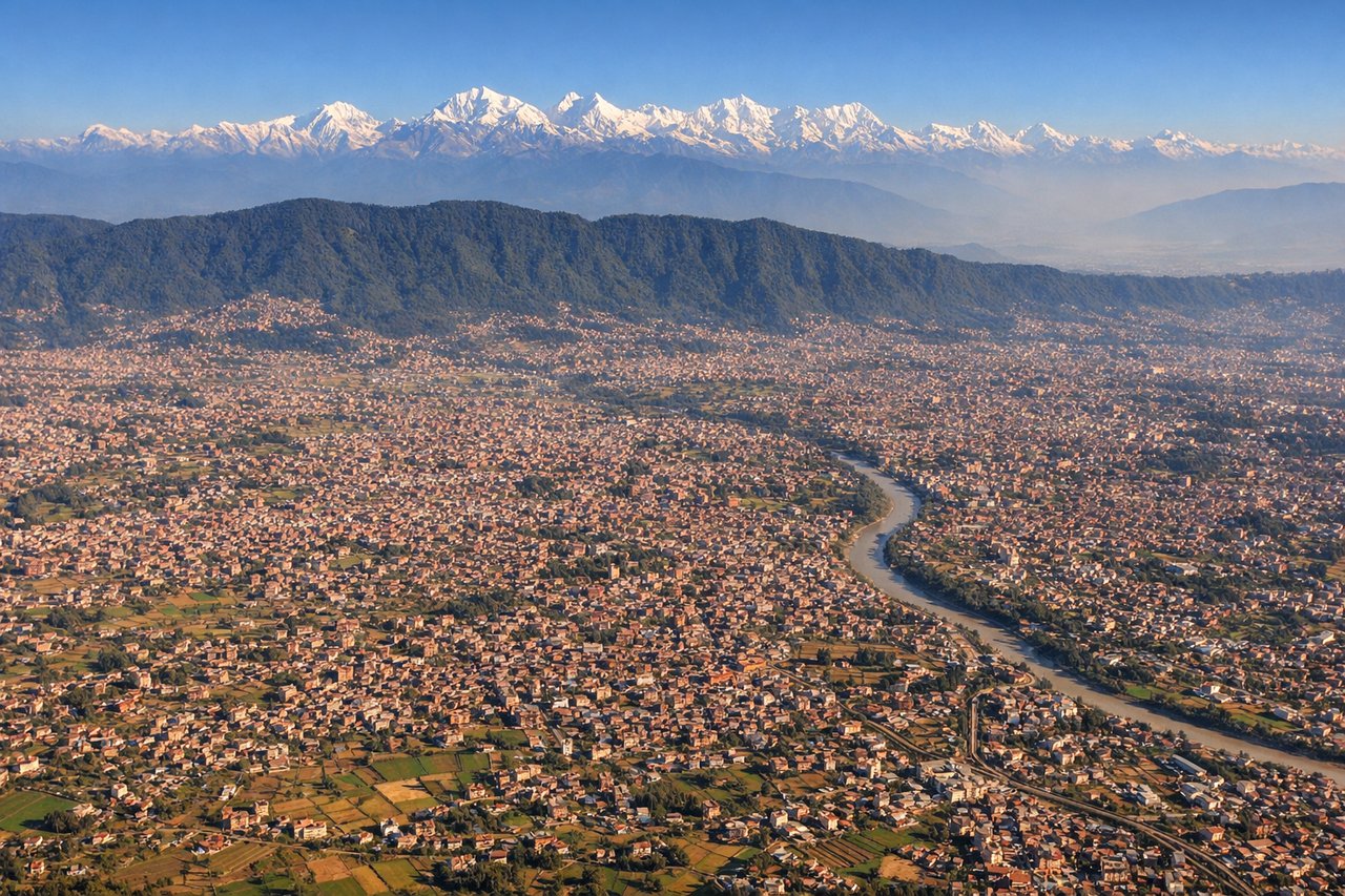
LEFTOn the descent into Kathmandu the aircraft tracks up from the flat Terai plains and curves into the valley from the south, with the Himalayan wall — including the Ganesh Himal and Langtang ranges — filling the view to the north on the left side. The right side mostly shows the lower green hills ringing the valley's southern rim.
Will your flight be in sunlight?
Pick a date and time in the Sun Map to watch the sun move across your whole flight.
About This Route
Which side of the plane should I sit on flying from Hamad International Airport (DOH) to Tribhuvan International (KTM)?
Sit on the Left side of the plane for the best views on flights from Doha to Kathmandu. The left side delivers Doha's coastal skyline on departure, a long cruise view north across Iran's Zagros Mountains and the Himalayan foothills, and a dramatic final approach with the Himalayan range visible ahead and to the north. The right side stays over comparatively flat terrain — Gulf waters, Pakistani desert, and the Gangetic plain — for most of the flight.
What can I see during takeoff from Hamad International Airport in Doha?
During takeoff from Hamad International Airport (DOH), sit on the Left side for the best views. Departing DOH on runway 16L, the aircraft climbs southeast before banking left to pick up its easterly track toward Iran. That left turn swings Doha's skyline, the Pearl-Qatar island, and the curving West Bay coastline directly under the left-side windows. Notable sights include: West Bay skyline, The Pearl-Qatar artificial island, Doha Corniche coastline, Persian Gulf shoreline.
What can I see when landing at Tribhuvan International in Kathmandu?
When landing at Tribhuvan International (KTM), sit on the Left side for the best views. On the descent into Kathmandu the aircraft tracks up from the flat Terai plains and curves into the valley from the south, with the Himalayan wall — including the Ganesh Himal and Langtang ranges — filling the view to the north on the left side. The right side mostly shows the lower green hills ringing the valley's southern rim. Notable sights include: Himalayan front range including Ganesh Himal and Langtang peaks, terraced hillsides of the Kathmandu Valley rim, Bagmati River valley, Kathmandu's dense urban sprawl below.
How long is the flight from Doha to Kathmandu?
The flight from Hamad International Airport (DOH) to Tribhuvan International (KTM) takes about 4 hours 45 minutes. The shortest flight path between them is 2,088 miles (3,360 km); winds and air traffic control usually add a few percent.
What does the Doha to Kathmandu flight path pass over?
Southern Zagros Mountains of Iran, the arid Balochistan plateau of Pakistan, the Thar Desert and Indo-Gangetic Plain of northern India, with Himalayan foothills rising as the route nears the Nepal border