The left side scores higher due to the dramatic San Juan Mountains during takeoff from Durango, which provide substantial terrain relief and visual interest. Although the right side offers Phoenix's urban scenery during landing, the takeoff experience from a mountain airport with immediate alpine views outweighs the landing advantage. The flight path itself crosses high desert plateau with limited mid-cruise landmarks, so the bookend experiences (mountain departure vs. urban arrival) favor the left side's stronger opening.
Flown DRO to PHX? Did we get it right?
Flight Path
Durango to Phoenix is 351 miles (565 km), a flight of about 1 hour 15 minutes.
High desert plateau between Durango and Phoenix; Navajo Reservation terrain (north of direct route); transition from Colorado high country (9,000–10,000 ft elevation) to Arizona basin (3,000–5,000 ft); sparse vegetation, mesas, and arroyos typical of the Colorado Plateau and upper Sonoran Desert; no major rivers or lakes visible along the direct route; distant views of the Mogollon Rim (south-southwest) during cruise phase
Great circle distance and headings ›Phase by phase
Takeoff from DRO
LEFTDeparting Durango on Runway 21 (southwest heading) or Runway 03 (northeast heading) — the left side captures the San Juan Mountains immediately west and north of the airport. These peaks rise dramatically to 13,000+ feet and dominate the initial climb-out. The right side shows the high desert plateau extending toward New Mexico with minimal relief.
Landing at PHX
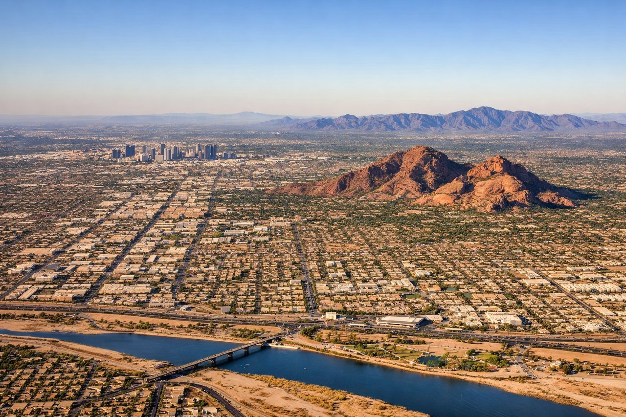
RIGHTApproaching Phoenix Sky Harbor on typical west-flow conditions (runways 25L/25R for arrivals, or 26 for larger aircraft), the aircraft descends from the northeast. The right side reveals Phoenix's urban sprawl, the Salt River, and the surrounding desert basin. The left side shows only open Sonoran Desert with minimal landmarks until final approach.
Will your flight be in sunlight?
Pick a date and time in the Sun Map to watch the sun move across your whole flight.
About This Route
Which side of the plane should I sit on flying from Durango La Plata Co (DRO) to Phoenix Sky Harbor International (PHX)?
Sit on the Left side of the plane for the best views on flights from Durango to Phoenix. The left side scores higher due to the dramatic San Juan Mountains during takeoff from Durango, which provide substantial terrain relief and visual interest. Although the right side offers Phoenix's urban scenery during landing, the takeoff experience from a mountain airport with immediate alpine views outweighs the landing advantage. The flight path itself crosses high desert plateau with limited mid-cruise landmarks, so the bookend experiences (mountain departure vs. urban arrival) favor the left side's stronger opening.
What can I see during takeoff from Durango La Plata Co in Durango?
During takeoff from Durango La Plata Co (DRO), sit on the Left side for the best views. Departing Durango on Runway 21 (southwest heading) or Runway 03 (northeast heading) — the left side captures the San Juan Mountains immediately west and north of the airport. These peaks rise dramatically to 13,000+ feet and dominate the initial climb-out. The right side shows the high desert plateau extending toward New Mexico with minimal relief. Notable sights include: San Juan Mountains (west/northwest), Animas River valley (north), La Plata Peak area (northwest), high desert plateau (south/southeast).
What can I see when landing at Phoenix Sky Harbor International in Phoenix?
When landing at Phoenix Sky Harbor International (PHX), sit on the Right side for the best views. Approaching Phoenix Sky Harbor on typical west-flow conditions (runways 25L/25R for arrivals, or 26 for larger aircraft), the aircraft descends from the northeast. The right side reveals Phoenix's urban sprawl, the Salt River, and the surrounding desert basin. The left side shows only open Sonoran Desert with minimal landmarks until final approach. Notable sights include: Phoenix metropolitan area and downtown skyline, Salt River, South Mountain Park (southwest of downtown), Camelback Mountain (northeast of downtown).
How long is the flight from Durango to Phoenix?
The flight from Durango La Plata Co (DRO) to Phoenix Sky Harbor International (PHX) takes about 1 hour 15 minutes. The shortest flight path between them is 351 miles (565 km); winds and air traffic control usually add a few percent.
What does the Durango to Phoenix flight path pass over?
High desert plateau between Durango and Phoenix; Navajo Reservation terrain (north of direct route); transition from Colorado high country (9,000–10,000 ft elevation) to Arizona basin (3,000–5,000 ft); sparse vegetation, mesas, and arroyos typical of the Colorado Plateau and upper Sonoran Desert; no major rivers or lakes visible along the direct route; distant views of the Mogollon Rim (south-southwest) during cruise phase