Left side scores higher due to superior terrain drama on both legs. Phoenix departure offers urban context plus immediate mountain views (McDowell and Camelback ranges). The cruise segment northward crosses the Sonoran Desert with scattered mountains and mesas. Durango approach delivers the most dramatic scenery: extended views of the San Juan Mountains' high peaks, the Animas River valley, and significant topographic relief. Right side offers flatter desert terrain during cruise with less landmark density and less impressive mountain approach.
Flown PHX to DRO? Did we get it right?
Flight Path
Phoenix to Durango is 351 miles (565 km), a flight of about 1 hour 15 minutes.
Sonoran Desert terrain with scattered buttes and mesas, transition from low desert (Phoenix area, 1,100 feet) to high-altitude plateau (Durango area, 6,685 feet), Verde Valley region, Mogollon Rim escarpment visible to the east, transition into San Juan Mountains foothills
Great circle distance and headings ›


Phase by phase
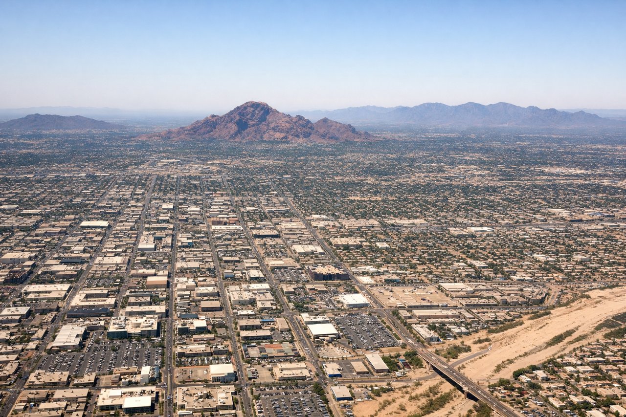
Takeoff from PHX
LEFTPhoenix Sky Harbor sits in the Salt River Valley with the Phoenix metropolitan area sprawling across the terrain. Left-side departures northbound offer immediate views of the city grid, the Salt River, and the McDowell Mountains to the northeast, providing urban context and dramatic desert mountain backdrop.
Landing at DRO
LEFTDurango La Plata County Airport sits at 6,685 feet elevation in the San Juan Mountains. Left-side descents from the north offer extended views of the San Juan range's dramatic peaks, the Animas River valley, and the town of Durango nestled in the high-altitude basin. The approach showcases significant topographic relief and mountain scenery.
Will your flight be in sunlight?
Pick a date and time in the Sun Map to watch the sun move across your whole flight.
About This Route
Which side of the plane should I sit on flying from Phoenix Sky Harbor International (PHX) to Durango La Plata Co (DRO)?
Sit on the Left side of the plane for the best views on flights from Phoenix to Durango. Left side scores higher due to superior terrain drama on both legs. Phoenix departure offers urban context plus immediate mountain views (McDowell and Camelback ranges). The cruise segment northward crosses the Sonoran Desert with scattered mountains and mesas. Durango approach delivers the most dramatic scenery: extended views of the San Juan Mountains' high peaks, the Animas River valley, and significant topographic relief. Right side offers flatter desert terrain during cruise with less landmark density and less impressive mountain approach.
What can I see during takeoff from Phoenix Sky Harbor International in Phoenix?
During takeoff from Phoenix Sky Harbor International (PHX), sit on the Left side for the best views. Phoenix Sky Harbor sits in the Salt River Valley with the Phoenix metropolitan area sprawling across the terrain. Left-side departures northbound offer immediate views of the city grid, the Salt River, and the McDowell Mountains to the northeast, providing urban context and dramatic desert mountain backdrop. Notable sights include: Phoenix downtown skyline and urban sprawl, Salt River, McDowell Mountains, Camelback Mountain (visible to the northeast).
What can I see when landing at Durango La Plata Co in Durango?
When landing at Durango La Plata Co (DRO), sit on the Left side for the best views. Durango La Plata County Airport sits at 6,685 feet elevation in the San Juan Mountains. Left-side descents from the north offer extended views of the San Juan range's dramatic peaks, the Animas River valley, and the town of Durango nestled in the high-altitude basin. The approach showcases significant topographic relief and mountain scenery. Notable sights include: San Juan Mountains peaks, Animas River valley, Durango town and surrounding high-altitude basin, forested ridgelines.
How long is the flight from Phoenix to Durango?
The flight from Phoenix Sky Harbor International (PHX) to Durango La Plata Co (DRO) takes about 1 hour 15 minutes. The shortest flight path between them is 351 miles (565 km); winds and air traffic control usually add a few percent.
What does the Phoenix to Durango flight path pass over?
Sonoran Desert terrain with scattered buttes and mesas, transition from low desert (Phoenix area, 1,100 feet) to high-altitude plateau (Durango area, 6,685 feet), Verde Valley region, Mogollon Rim escarpment visible to the east, transition into San Juan Mountains foothills