While takeoff favors the right, the landing view of the St. Johns River and Jacksonville's downtown is more visually distinctive and memorable. The river's northward loop is a genuine geographic highlight that dominates the approach, making left-side seating the better overall choice for this route.
Flown DTW to JAX? Did we get it right?
Flight Path
Detroit to Jacksonville is 815 miles (1,312 km), a flight of about 2 hours 55 minutes.
The flight path crosses central Georgia and northern Florida. Notable features include the Chattahoochee River valley (visible around 1 hour into flight), the rolling terrain of central Georgia, and the transition into Florida's flatter topography. The Ocmulgee River and various lakes in central Georgia may be visible depending on exact routing. No major mountain ranges are visible on this route; the terrain gradually flattens as the aircraft moves south.
Great circle distance and headings ›Phase by phase
Takeoff from DTW
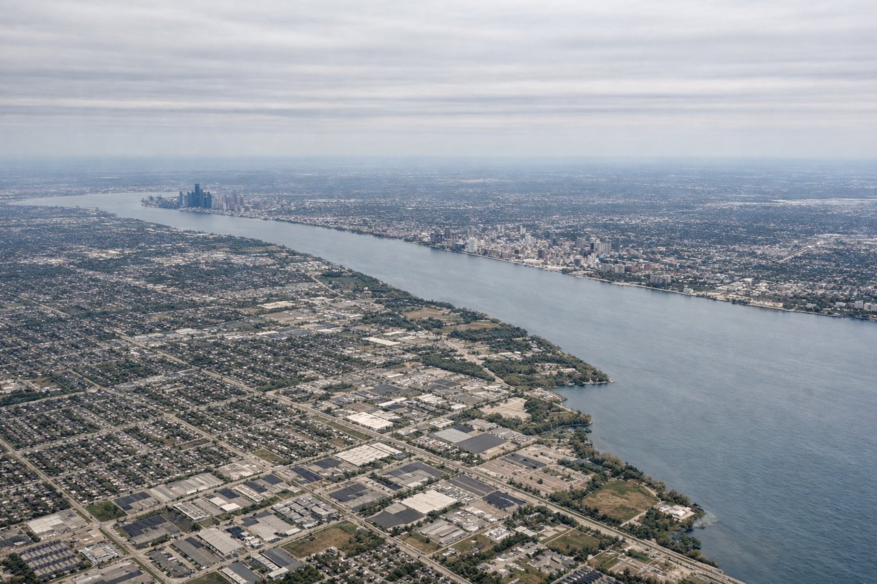
RIGHTRight-side seats capture the Detroit River and Windsor, Ontario immediately after departure. DTW typically departs runways 03L/03R or 21L/21R depending on wind; southbound departures on 03R offer the clearest view of the river corridor and the urban waterfront before climbing over Lake St. Clair.
Landing at JAX
LEFTLeft-side seats provide the best approach view of the St. Johns River and downtown Jacksonville. JAX typically lands on runways 08L/08R or 26L/26R; eastbound approaches on 08L bring the river into clear view on the left side during final descent, with the river's distinctive curves and the downtown core visible before touchdown.
Will your flight be in sunlight?
Pick a date and time in the Sun Map to watch the sun move across your whole flight.
About This Route
Which side of the plane should I sit on flying from Detroit Metro Wayne Co (DTW) to Jacksonville International (JAX)?
Sit on the Left side of the plane for the best views on flights from Detroit to Jacksonville. While takeoff favors the right, the landing view of the St. Johns River and Jacksonville's downtown is more visually distinctive and memorable. The river's northward loop is a genuine geographic highlight that dominates the approach, making left-side seating the better overall choice for this route.
What can I see during takeoff from Detroit Metro Wayne Co in Detroit?
During takeoff from Detroit Metro Wayne Co (DTW), sit on the Right side for the best views. Right-side seats capture the Detroit River and Windsor, Ontario immediately after departure. DTW typically departs runways 03L/03R or 21L/21R depending on wind; southbound departures on 03R offer the clearest view of the river corridor and the urban waterfront before climbing over Lake St. Clair. Notable sights include: Detroit River (flowing north-south between Detroit and Windsor), Windsor skyline across the Canadian border, Lake St. Clair to the northeast, downtown Detroit skyline to the northwest.
What can I see when landing at Jacksonville International in Jacksonville?
When landing at Jacksonville International (JAX), sit on the Left side for the best views. Left-side seats provide the best approach view of the St. Johns River and downtown Jacksonville. JAX typically lands on runways 08L/08R or 26L/26R; eastbound approaches on 08L bring the river into clear view on the left side during final descent, with the river's distinctive curves and the downtown core visible before touchdown. Notable sights include: St. Johns River (with its characteristic northward loop through Jacksonville), downtown Jacksonville skyline, San Marco neighborhood across the river, Atlantic Ocean horizon to the east.
How long is the flight from Detroit to Jacksonville?
The flight from Detroit Metro Wayne Co (DTW) to Jacksonville International (JAX) takes about 2 hours 55 minutes. The shortest flight path between them is 815 miles (1,312 km); winds and air traffic control usually add a few percent.
What does the Detroit to Jacksonville flight path pass over?
The flight path crosses central Georgia and northern Florida. Notable features include the Chattahoochee River valley (visible around 1 hour into flight), the rolling terrain of central Georgia, and the transition into Florida's flatter topography. The Ocmulgee River and various lakes in central Georgia may be visible depending on exact routing. No major mountain ranges are visible on this route; the terrain gradually flattens as the aircraft moves south.