Both sides score equally at 2.0 due to the short flight duration (approximately 1 hour) over predominantly flat to gently rolling Midwest and Bluegrass terrain with no mountains, coastlines, or dramatic geographic features. The left side edges ahead marginally for the Detroit River and urban skyline visible during takeoff, providing slightly more visual interest during the departure phase than the right side's farmland climb-out.
Flown DTW to LEX? Did we get it right?
Flight Path
Detroit to Lexington is 296 miles (477 km), a flight of about 1 hour 5 minutes.
Ohio farmland, scattered lakes and reservoirs in central Ohio, transition from flat Midwest plains to rolling Bluegrass topography near the Kentucky border
Great circle distance and headings ›Phase by phase
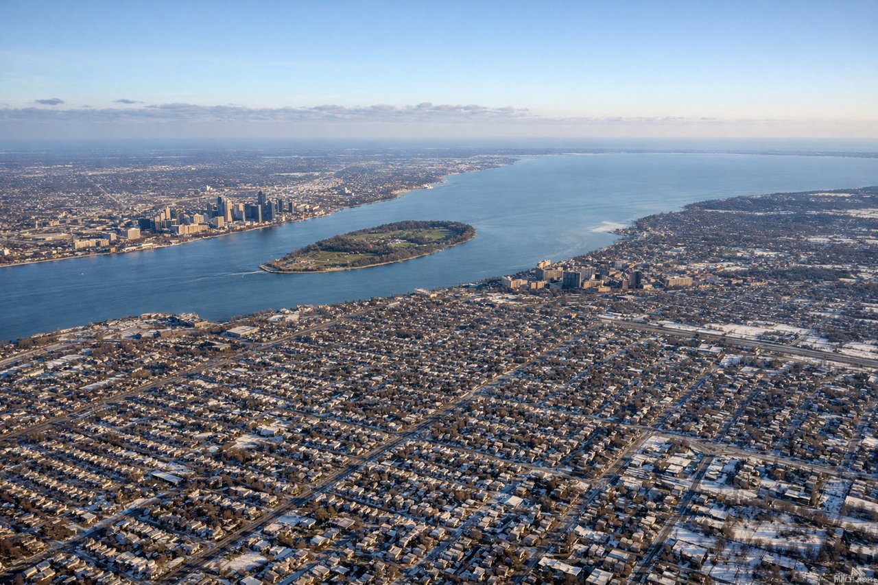
Takeoff from DTW
LEFTLeft side (south/southeast) offers views of Detroit's urban sprawl and the Detroit River delta as the aircraft climbs southwest from runway 22. Right side faces inland toward flat Michigan farmland with minimal visual interest during initial climb.
Landing at LEX
RIGHTRight side (north/northeast) during approach to Lexington on runway 22 (southwest heading) provides views of the Bluegrass region's rolling terrain and horse farm country. Left side faces toward flat agricultural plains with less topographic variation.
Will your flight be in sunlight?
Pick a date and time in the Sun Map to watch the sun move across your whole flight.
About This Route
Which side of the plane should I sit on flying from Detroit Metro Wayne Co (DTW) to Blue Grass Airport (LEX)?
Sit on the Left side of the plane for the best views on flights from Detroit to Lexington. Both sides score equally at 2.0 due to the short flight duration (approximately 1 hour) over predominantly flat to gently rolling Midwest and Bluegrass terrain with no mountains, coastlines, or dramatic geographic features. The left side edges ahead marginally for the Detroit River and urban skyline visible during takeoff, providing slightly more visual interest during the departure phase than the right side's farmland climb-out.
What can I see during takeoff from Detroit Metro Wayne Co in Detroit?
During takeoff from Detroit Metro Wayne Co (DTW), sit on the Left side for the best views. Left side (south/southeast) offers views of Detroit's urban sprawl and the Detroit River delta as the aircraft climbs southwest from runway 22. Right side faces inland toward flat Michigan farmland with minimal visual interest during initial climb. Notable sights include: Detroit River, downtown Detroit skyline, Lake St. Clair shoreline, suburban sprawl of Dearborn and Wyandotte.
What can I see when landing at Blue Grass Airport in Lexington?
When landing at Blue Grass Airport (LEX), sit on the Right side for the best views. Right side (north/northeast) during approach to Lexington on runway 22 (southwest heading) provides views of the Bluegrass region's rolling terrain and horse farm country. Left side faces toward flat agricultural plains with less topographic variation. Notable sights include: Bluegrass rolling hills, horse farm pastures and fencing patterns, Lexington urban area, Kentucky River valley.
How long is the flight from Detroit to Lexington?
The flight from Detroit Metro Wayne Co (DTW) to Blue Grass Airport (LEX) takes about 1 hour 5 minutes. The shortest flight path between them is 296 miles (477 km); winds and air traffic control usually add a few percent.
What does the Detroit to Lexington flight path pass over?
Ohio farmland, scattered lakes and reservoirs in central Ohio, transition from flat Midwest plains to rolling Bluegrass topography near the Kentucky border