Both sides score equally for the transatlantic cruise phase (5+ hours of open ocean limits scenic value on both sides). However, the right side gains advantage during landing with Brasilia's striking modernist architecture and geometric urban plan visible from altitude—a unique and recognizable landmark. The left side's Dublin Bay departure is scenic but brief; the right side's Brasilia approach offers more sustained visual interest during the critical landing phase.
Flown DUB to BSB? Did we get it right?
Flight Path
Dublin to Brasilia is 5,387 miles (8,669 km), a flight of about 10 hours 15 minutes.
North Atlantic Ocean (5+ hours of open water with no visible landmarks), Azores archipelago (occasionally visible at cruise altitude if flight path passes nearby, though typically 200+ miles south of standard routing), West African coast near Senegal/Mauritania (approaching African continent), Sahara Desert (southern edge visible during descent into equatorial Africa), Congo Basin rainforest (central Africa, green landscape), Central African plateau terrain, Brazilian Amazon basin (northern Brazil, dense green forest), Brazilian cerrado plateau (central Brazil, grassland and scrubland approaching Brasilia)
Great circle distance and headings ›Phase by phase
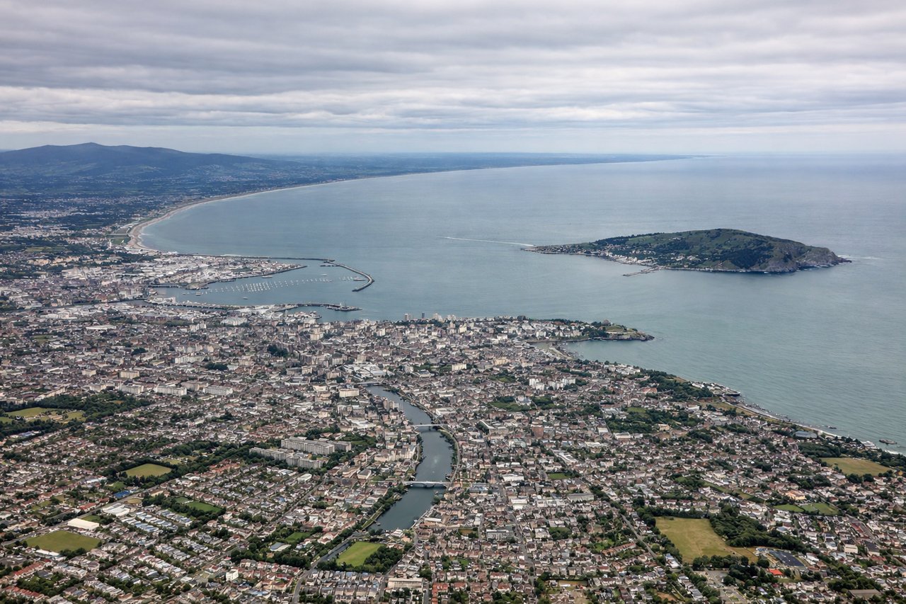
Takeoff from DUB
LEFTLeft side (north) captures Dublin Bay, the Irish coastline, and the Wicklow Mountains during initial climb. Right side faces inland toward the Irish midlands with minimal visual interest during departure.
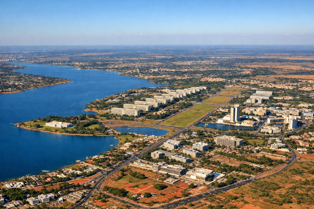
Landing at BSB
RIGHTRight side (south) provides views of Brasilia's distinctive modernist urban layout and the surrounding cerrado plateau landscape during approach. Left side faces open cerrado grassland with minimal urban features until final descent.
Will your flight be in sunlight?
Pick a date and time in the Sun Map to watch the sun move across your whole flight.
About This Route
Which side of the plane should I sit on flying from Dublin (DUB) to Presidente Juscelino Kubitschek (BSB)?
Sit on the Right side of the plane for the best views on flights from Dublin to Brasilia. Both sides score equally for the transatlantic cruise phase (5+ hours of open ocean limits scenic value on both sides). However, the right side gains advantage during landing with Brasilia's striking modernist architecture and geometric urban plan visible from altitude—a unique and recognizable landmark. The left side's Dublin Bay departure is scenic but brief; the right side's Brasilia approach offers more sustained visual interest during the critical landing phase.
What can I see during takeoff from Dublin in Dublin?
During takeoff from Dublin (DUB), sit on the Left side for the best views. Left side (north) captures Dublin Bay, the Irish coastline, and the Wicklow Mountains during initial climb. Right side faces inland toward the Irish midlands with minimal visual interest during departure. Notable sights include: Dublin Bay with harbor infrastructure, Howth Peninsula, Wicklow Mountains (distant, southeast), Irish Sea coastline.
What can I see when landing at Presidente Juscelino Kubitschek in Brasilia?
When landing at Presidente Juscelino Kubitschek (BSB), sit on the Right side for the best views. Right side (south) provides views of Brasilia's distinctive modernist urban layout and the surrounding cerrado plateau landscape during approach. Left side faces open cerrado grassland with minimal urban features until final descent. Notable sights include: Brasilia's geometric city plan (Three Powers Plaza, Esplanade of Ministries), Paranoá Lake, cerrado plateau terrain, approach corridor over central Brazilian highlands.
How long is the flight from Dublin to Brasilia?
The flight from Dublin (DUB) to Presidente Juscelino Kubitschek (BSB) takes about 10 hours 15 minutes. The shortest flight path between them is 5,387 miles (8,669 km); winds and air traffic control usually add a few percent.
What does the Dublin to Brasilia flight path pass over?
North Atlantic Ocean (5+ hours of open water with no visible landmarks), Azores archipelago (occasionally visible at cruise altitude if flight path passes nearby, though typically 200+ miles south of standard routing), West African coast near Senegal/Mauritania (approaching African continent), Sahara Desert (southern edge visible during descent into equatorial Africa), Congo Basin rainforest (central Africa, green landscape), Central African plateau terrain, Brazilian Amazon basin (northern Brazil, dense green forest), Brazilian cerrado plateau (central Brazil, grassland and scrubland approaching Brasilia)