While the left side offers Irish coastal scenery on departure, the right side on approach captures the Cascade Range and Mount Hood—far more visually dramatic and the highlight of this transatlantic route.
Flown DUB to PDX? Did we get it right?
Flight Path
Dublin to Portland is 4,638 miles (7,464 km), a flight of about 9 hours.
The flight crosses the Atlantic at high altitude (typically 33,000-35,000 feet), passing over the North Atlantic with no significant landmarks visible. After crossing Greenland's southern tip and Canadian Arctic, the route descends over western Canada, passing over the Canadian Rockies (visible on clear days) and British Columbia before reaching the Pacific Northwest. The most notable midpoint feature is the Rocky Mountain chain visible during descent into North America, though this is typically at altitude where detail is limited.
Great circle distance and headings ›


Phase by phase
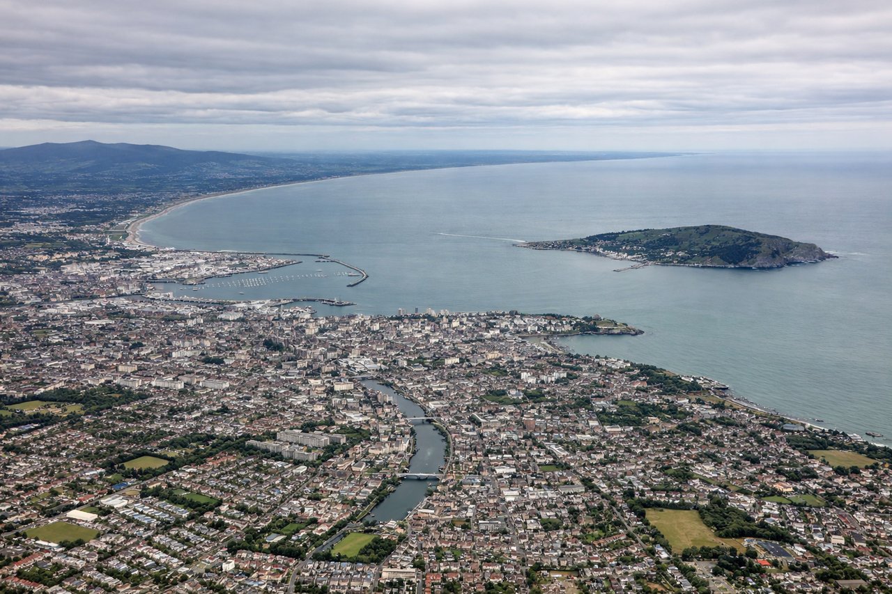
Takeoff from DUB
LEFTDublin Airport uses runways 10L/28R and 10R/28L, with westbound departures typically using runway 28. Banking left after takeoff gives you views of the Irish coastline, Dublin Bay, and the Wicklow Mountains to the south.
Landing at PDX
RIGHTPDX typically lands on runways 10L/28R or 10R/28L depending on wind. Eastbound approaches descending from the west give right-side views of the Cascade Range, Mount Hood, and the Columbia River Gorge—the most dramatic scenery on the approach.
Will your flight be in sunlight?
Pick a date and time in the Sun Map to watch the sun move across your whole flight.
About This Route
Which side of the plane should I sit on flying from Dublin (DUB) to Portland International (PDX)?
Sit on the Right side of the plane for the best views on flights from Dublin to Portland. While the left side offers Irish coastal scenery on departure, the right side on approach captures the Cascade Range and Mount Hood—far more visually dramatic and the highlight of this transatlantic route.
What can I see during takeoff from Dublin in Dublin?
During takeoff from Dublin (DUB), sit on the Left side for the best views. Dublin Airport uses runways 10L/28R and 10R/28L, with westbound departures typically using runway 28. Banking left after takeoff gives you views of the Irish coastline, Dublin Bay, and the Wicklow Mountains to the south. Notable sights include: Dublin Bay (immediate offshore), Wicklow Mountains (south, ~30 miles), Irish Sea coastline, Howth Peninsula (north of bay).
What can I see when landing at Portland International in Portland?
When landing at Portland International (PDX), sit on the Right side for the best views. PDX typically lands on runways 10L/28R or 10R/28L depending on wind. Eastbound approaches descending from the west give right-side views of the Cascade Range, Mount Hood, and the Columbia River Gorge—the most dramatic scenery on the approach. Notable sights include: Mount Hood (11,240 ft, ~50 miles east), Cascade Range, Columbia River Gorge, Willamette Valley.
How long is the flight from Dublin to Portland?
The flight from Dublin (DUB) to Portland International (PDX) takes about 9 hours. The shortest flight path between them is 4,638 miles (7,464 km); winds and air traffic control usually add a few percent.
What does the Dublin to Portland flight path pass over?
The flight crosses the Atlantic at high altitude (typically 33,000-35,000 feet), passing over the North Atlantic with no significant landmarks visible. After crossing Greenland's southern tip and Canadian Arctic, the route descends over western Canada, passing over the Canadian Rockies (visible on clear days) and British Columbia before reaching the Pacific Northwest. The most notable midpoint feature is the Rocky Mountain chain visible during descent into North America, though this is typically at altitude where detail is limited.