Unalaska to Tokyo is 2,804 miles (4,512 km), a flight of about 5 hours 30 minutes.
Left side wins both ends of the flight. During the long overwater crossing of the North Pacific, the left side also faces south toward the Kuril Islands chain as the route arcs across the great circle path, offering occasional glimpses of volcanic island peaks on clear days. The right side faces north toward open ocean for most of the journey.
Flight Path
The great circle route from Unalaska to Narita tracks southwest across the North Pacific, passing south of the Komandorski Islands, then over or near the Kuril Island chain — a 1,200-kilometer arc of volcanic islands stretching from Kamchatka to Hokkaido. On clear days the volcanic peaks of islands like Paramushir and Iturup may be visible. The route then crosses the Oyashio Current zone and descends toward Hokkaido and Honshu before reaching the Kanto Plain.
Great circle distance and headings ›

Phase by phase
Takeoff from DUT
LEFTUnalaska's runway 13/31 means a departure toward the northwest or southeast. Climbing out over Dutch Harbor, the left side gives you views across Iliuliuk Bay and the volcanic peaks of Unalaska Island, including the prominent cone of Makushin Volcano rising to 5,691 feet about 25 miles northwest. The right side faces toward the open Bering Sea with less geographic interest.
Landing at NRT
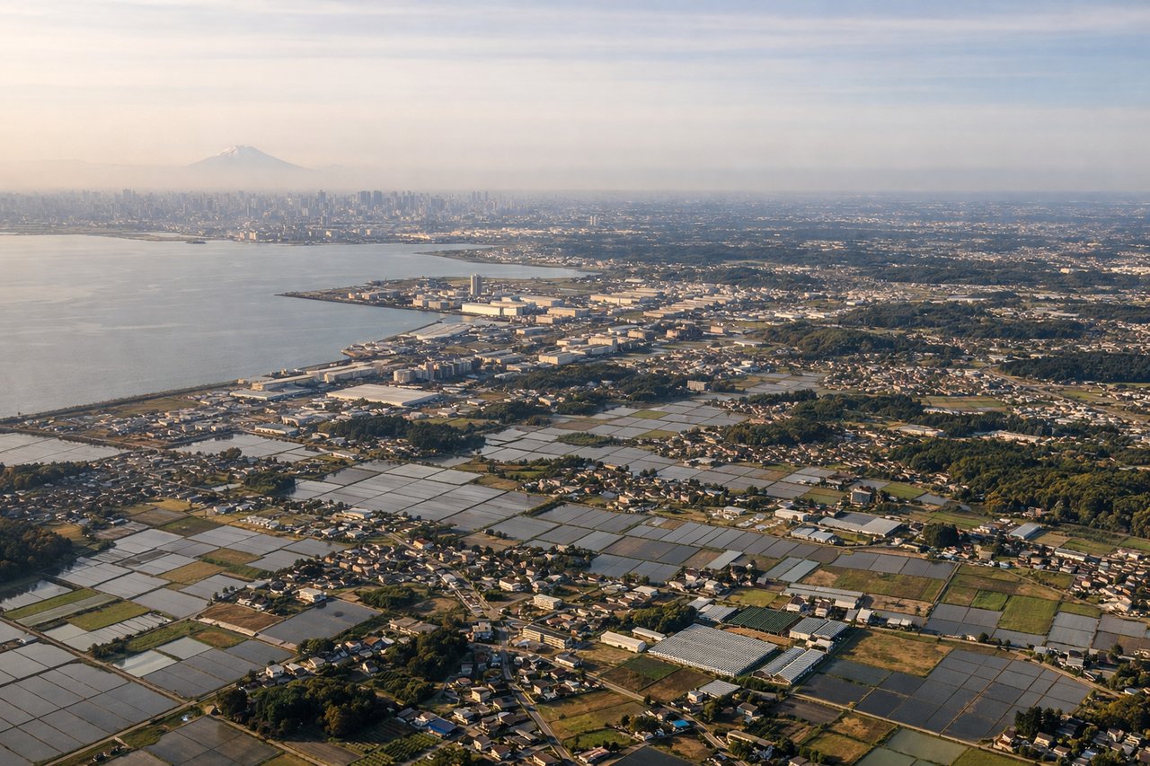
LEFTNRT's primary arrival runways 34L/34R bring aircraft in from the south over the Chiba Peninsula and Tokyo Bay. The left side on approach from the north gives views over the western edge of Tokyo Bay and the urban sprawl of eastern Tokyo and Chiba. Right side faces open Pacific and less interesting terrain.
Landmarks on this routeAll landmarks →
Will your flight be in sunlight?
Pick a date and time in the Sun Map to watch the sun move across your whole flight.
About This Route
Which side of the plane should I sit on flying from Unalaska (DUT) to New Tokyo International (NRT)?
Sit on the Left side of the plane for the best views on flights from Unalaska to Tokyo. Left side wins both ends of the flight. During the long overwater crossing of the North Pacific, the left side also faces south toward the Kuril Islands chain as the route arcs across the great circle path, offering occasional glimpses of volcanic island peaks on clear days. The right side faces north toward open ocean for most of the journey.
What can I see during takeoff from Unalaska in Unalaska?
During takeoff from Unalaska (DUT), sit on the Left side for the best views. Unalaska's runway 13/31 means a departure toward the northwest or southeast. Climbing out over Dutch Harbor, the left side gives you views across Iliuliuk Bay and the volcanic peaks of Unalaska Island, including the prominent cone of Makushin Volcano rising to 5,691 feet about 25 miles northwest. The right side faces toward the open Bering Sea with less geographic interest. Notable sights include: Makushin Volcano, Iliuliuk Bay, Dutch Harbor port facilities, Unalaska Bay.
What can I see when landing at New Tokyo International in Tokyo?
When landing at New Tokyo International (NRT), sit on the Left side for the best views. NRT's primary arrival runways 34L/34R bring aircraft in from the south over the Chiba Peninsula and Tokyo Bay. The left side on approach from the north gives views over the western edge of Tokyo Bay and the urban sprawl of eastern Tokyo and Chiba. Right side faces open Pacific and less interesting terrain. Notable sights include: Tokyo Bay, Chiba urban area, Tokyo metropolitan sprawl, Narita city.
How long is the flight from Unalaska to Tokyo?
The flight from Unalaska (DUT) to New Tokyo International (NRT) takes about 5 hours 30 minutes. The shortest flight path between them is 2,804 miles (4,512 km); winds and air traffic control usually add a few percent.
What does the Unalaska to Tokyo flight path pass over?
The great circle route from Unalaska to Narita tracks southwest across the North Pacific, passing south of the Komandorski Islands, then over or near the Kuril Island chain — a 1,200-kilometer arc of volcanic islands stretching from Kamchatka to Hokkaido. On clear days the volcanic peaks of islands like Paramushir and Iturup may be visible. The route then crosses the Oyashio Current zone and descends toward Hokkaido and Honshu before reaching the Kanto Plain.