While takeoff offers striking urban and coastal views, the landing approach provides more varied and dramatic natural scenery with the Appalachian terrain and river valleys. Left side captures the geographic transition that makes this route visually interesting.
Flown DXB to BWI? Did we get it right?
Flight Path
Dubai to Baltimore is 7,016 miles (11,291 km), a flight of about 13 hours 30 minutes.
This westbound flight crosses the Arabian Peninsula (Oman and Saudi Arabia deserts), the Persian Gulf, Iraq and Syria (Euphrates River valley visible), Turkey (Anatolian plateau and Mediterranean coast), southern Europe (Mediterranean Sea, possibly Greek islands), Atlantic Ocean crossing, and approaches North America over Newfoundland and Nova Scotia before descending into the Mid-Atlantic region. The most visually striking midpoint features are the Euphrates River valley in Iraq/Syria (visible as a green ribbon through desert), the Mediterranean coastline of southern Turkey, and the Atlantic approach showing the Appalachian mountain system's foothills as you near the US East Coast.
Great circle distance and headings ›


Phase by phase

Takeoff from DXB
RIGHTRight-side seats capture the Persian Gulf coastline and the Dubai urban sprawl as you climb out. You'll see the distinctive Palm Jumeirah artificial islands and the contrast between the developed coast and the desert inland.
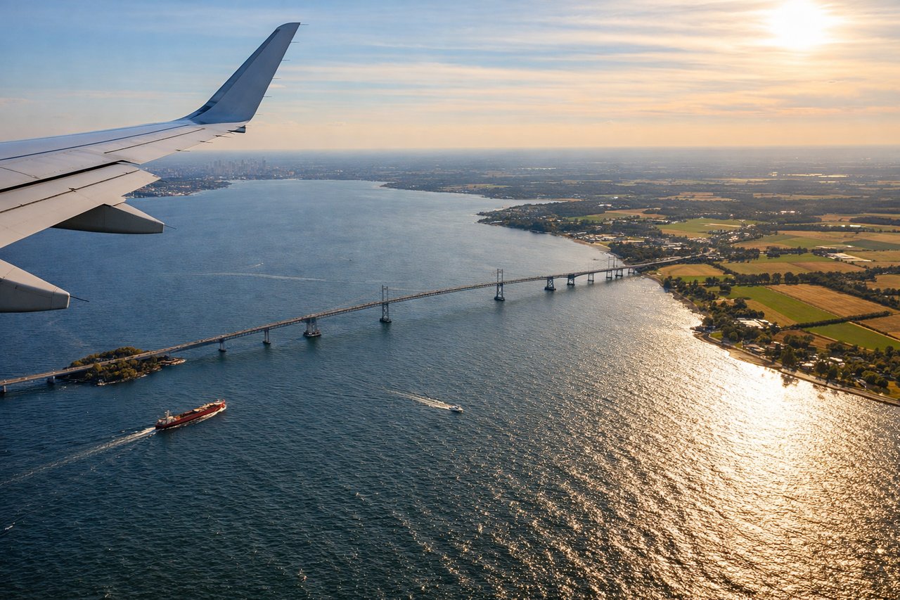
Landing at BWI
LEFTLeft-side seats offer views of the Appalachian foothills and the Patapsco River valley as you descend into BWI. You'll see the transition from rural Maryland terrain into the Baltimore metropolitan area, with the river's distinctive curves visible before final approach.
Will your flight be in sunlight?
Pick a date and time in the Sun Map to watch the sun move across your whole flight.
About This Route
Which side of the plane should I sit on flying from Dubai International (DXB) to Baltimore Washington International (BWI)?
Sit on the Left side of the plane for the best views on flights from Dubai to Baltimore. While takeoff offers striking urban and coastal views, the landing approach provides more varied and dramatic natural scenery with the Appalachian terrain and river valleys. Left side captures the geographic transition that makes this route visually interesting.
What can I see during takeoff from Dubai International in Dubai?
During takeoff from Dubai International (DXB), sit on the Right side for the best views. Right-side seats capture the Persian Gulf coastline and the Dubai urban sprawl as you climb out. You'll see the distinctive Palm Jumeirah artificial islands and the contrast between the developed coast and the desert inland. Notable sights include: Persian Gulf (immediate right), Palm Jumeirah and Dubai Marina (right foreground), Jebel Ali Port (right mid-distance), Arabian Desert extending inland (left and center).
What can I see when landing at Baltimore Washington International in Baltimore?
When landing at Baltimore Washington International (BWI), sit on the Left side for the best views. Left-side seats offer views of the Appalachian foothills and the Patapsco River valley as you descend into BWI. You'll see the transition from rural Maryland terrain into the Baltimore metropolitan area, with the river's distinctive curves visible before final approach. Notable sights include: Patapsco River and its valley (left and center during descent), Appalachian foothills (left, receding to horizon), Baltimore-Washington corridor urban sprawl (center-right), Chesapeake Bay (visible far distance on left).
How long is the flight from Dubai to Baltimore?
The flight from Dubai International (DXB) to Baltimore Washington International (BWI) takes about 13 hours 30 minutes. The shortest flight path between them is 7,016 miles (11,291 km); winds and air traffic control usually add a few percent.
What does the Dubai to Baltimore flight path pass over?
This westbound flight crosses the Arabian Peninsula (Oman and Saudi Arabia deserts), the Persian Gulf, Iraq and Syria (Euphrates River valley visible), Turkey (Anatolian plateau and Mediterranean coast), southern Europe (Mediterranean Sea, possibly Greek islands), Atlantic Ocean crossing, and approaches North America over Newfoundland and Nova Scotia before descending into the Mid-Atlantic region. The most visually striking midpoint features are the Euphrates River valley in Iraq/Syria (visible as a green ribbon through desert), the Mediterranean coastline of southern Turkey, and the Atlantic approach showing the Appalachian mountain system's foothills as you near the US East Coast.