Dubai to Dhaka is 2,197 miles (3,536 km), a flight of about 4 hours 30 minutes.
The right side wins overall because the landing approach into Dhaka delivers a genuinely spectacular view of the world's most densely populated delta — the braided Brahmaputra channels, flooded paddyfields, and the sprawling city are all on the right. The takeoff from Dubai is good on the left but the Dhaka arrival is the more memorable geographic spectacle.
Flight Path
The flight tracks east-northeast across the Arabian Sea, crossing the Pakistani coastline near Karachi, then over the Sindh desert and the Indus River valley. The route then crosses the Thar Desert of Rajasthan before descending over the vast Gangetic Plain of northern India and into the Bengal delta. The Indus and Ganges river systems are the dominant geographic features at cruising altitude, along with the flat alluvial plains of the Indo-Gangetic basin stretching to the horizon in all directions.
Great circle distance and headings ›.jpg?width=600)
_and_the_Dubai_skyline_(25781049892).jpg?width=600)

Phase by phase
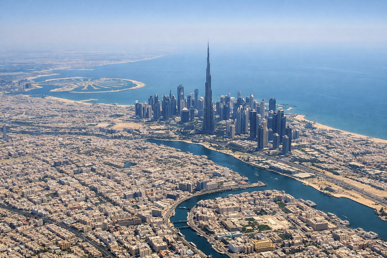
Takeoff from DXB
LEFTDubai International's primary departure runway 30L/30R sends aircraft northwest before turning east. A left-side seat captures the Dubai Creek, Deira district, and the coastline of the Arabian Gulf as the aircraft banks right toward the east. You get a sweeping view back over the city grid and the palm-fringed shoreline.
Landing at DAC
RIGHTHazrat Shahjalal International (DAC) primarily uses runway 14/32. On a typical approach from the west on runway 14, aircraft track southeast, placing the Buriganga River and the dense urban mass of old Dhaka on the right side. The Meghna and Brahmaputra river systems are visible to the right during descent through the floodplain.
Landmarks on this routeAll landmarks →
Will your flight be in sunlight?
Pick a date and time in the Sun Map to watch the sun move across your whole flight.
About This Route
Which side of the plane should I sit on flying from Dubai International (DXB) to Hazrat Shahjalal International Airport (DAC)?
Sit on the Right side of the plane for the best views on flights from Dubai to Dhaka. The right side wins overall because the landing approach into Dhaka delivers a genuinely spectacular view of the world's most densely populated delta — the braided Brahmaputra channels, flooded paddyfields, and the sprawling city are all on the right. The takeoff from Dubai is good on the left but the Dhaka arrival is the more memorable geographic spectacle.
What can I see during takeoff from Dubai International in Dubai?
During takeoff from Dubai International (DXB), sit on the Left side for the best views. Dubai International's primary departure runway 30L/30R sends aircraft northwest before turning east. A left-side seat captures the Dubai Creek, Deira district, and the coastline of the Arabian Gulf as the aircraft banks right toward the east. You get a sweeping view back over the city grid and the palm-fringed shoreline. Notable sights include: Dubai Creek and Deira waterfront, downtown Dubai skyline including Burj Khalifa visible to the south, Arabian Gulf coastline, Dubai International Airport terminal complex below.
What can I see when landing at Hazrat Shahjalal International Airport in Dhaka?
When landing at Hazrat Shahjalal International Airport (DAC), sit on the Right side for the best views. Hazrat Shahjalal International (DAC) primarily uses runway 14/32. On a typical approach from the west on runway 14, aircraft track southeast, placing the Buriganga River and the dense urban mass of old Dhaka on the right side. The Meghna and Brahmaputra river systems are visible to the right during descent through the floodplain. Notable sights include: Buriganga River winding through old Dhaka, Turag River to the north of the city, vast Brahmaputra-Jamuna floodplain with braided river channels, dense urban grid of Dhaka city.
How long is the flight from Dubai to Dhaka?
The flight from Dubai International (DXB) to Hazrat Shahjalal International Airport (DAC) takes about 4 hours 30 minutes. The shortest flight path between them is 2,197 miles (3,536 km); winds and air traffic control usually add a few percent.
What does the Dubai to Dhaka flight path pass over?
The flight tracks east-northeast across the Arabian Sea, crossing the Pakistani coastline near Karachi, then over the Sindh desert and the Indus River valley. The route then crosses the Thar Desert of Rajasthan before descending over the vast Gangetic Plain of northern India and into the Bengal delta. The Indus and Ganges river systems are the dominant geographic features at cruising altitude, along with the flat alluvial plains of the Indo-Gangetic basin stretching to the horizon in all directions.