While takeoff offers compelling Buenos Aires and estuary views on the left, the landing approach on the right provides more visually distinctive scenery—the Colorado River's dramatic urban corridor and the Hill Country's rolling topography are more photogenic and geographically interesting than the flat Pampas that dominate the flight's middle and northern sections.
Flight Path
The flight path crosses the Gran Chaco region of Paraguay and northern Argentina, then continues over the flat terrain of central Brazil. Visible landmarks include the Paraguay River (forming the border between Paraguay and Argentina), the vast agricultural plains of Mato Grosso do Sul, and eventually the transition to the flatter terrain of central Texas. The Mississippi River valley becomes visible during the approach to US airspace. Most of the midpoint flight crosses relatively featureless agricultural and savanna terrain with limited dramatic visual features.
Great circle distance and headings ›_(cropped).jpg?width=600)


.jpg?width=600)
.jpg?width=600)

Phase by phase

Takeoff from EZE
LEFTLeft side offers views of the Río de la Plata estuary and the sprawling Buenos Aires metropolitan area as the aircraft climbs northwestward. The river's wide, distinctive muddy-brown waters and the city's grid pattern are clearly visible during initial climb.
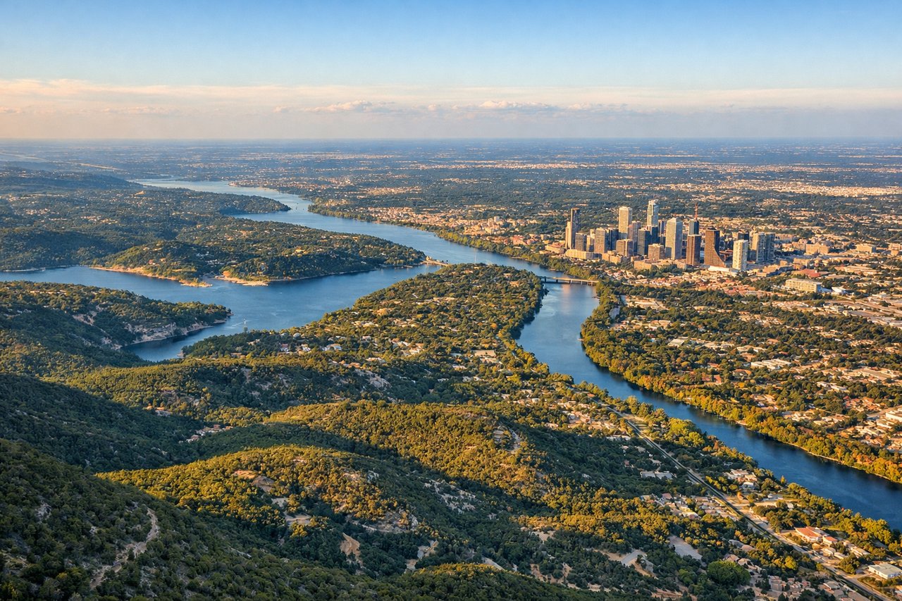
Landing at AUS
RIGHTRight side provides views of the Colorado River as it winds through central Austin, plus the Hill Country's rolling terrain to the west. During descent into Austin Bergstrom, the right side captures the city's distinctive geography along the river corridor.
Landmarks on this routeAll landmarks →
Will your flight be in sunlight?
See exactly which side of the plane gets sun and shade at your departure time.
About This Route
Which side of the plane should I sit on flying from Ezeiza Ministro Pistarini (EZE) to Austin Bergstrom International (AUS)?
Sit on the Right side of the plane for the best views on flights from Buenos Aires to Austin. While takeoff offers compelling Buenos Aires and estuary views on the left, the landing approach on the right provides more visually distinctive scenery—the Colorado River's dramatic urban corridor and the Hill Country's rolling topography are more photogenic and geographically interesting than the flat Pampas that dominate the flight's middle and northern sections.
What can I see during takeoff from Ezeiza Ministro Pistarini in Buenos Aires?
During takeoff from Ezeiza Ministro Pistarini (EZE), sit on the Left side for the best views. Left side offers views of the Río de la Plata estuary and the sprawling Buenos Aires metropolitan area as the aircraft climbs northwestward. The river's wide, distinctive muddy-brown waters and the city's grid pattern are clearly visible during initial climb. Notable sights include: Río de la Plata estuary, Buenos Aires city grid and suburbs, Paraná River delta to the north.
What can I see when landing at Austin Bergstrom International in Austin?
When landing at Austin Bergstrom International (AUS), sit on the Right side for the best views. Right side provides views of the Colorado River as it winds through central Austin, plus the Hill Country's rolling terrain to the west. During descent into Austin Bergstrom, the right side captures the city's distinctive geography along the river corridor. Notable sights include: Colorado River through downtown Austin, Lake Travis to the northwest, Hill Country rolling terrain, downtown Austin skyline.
How long is the flight from Buenos Aires to Austin?
The flight from Ezeiza Ministro Pistarini (EZE) to Austin Bergstrom International (AUS) takes 9h 15m.
What does the Buenos Aires to Austin flight path pass over?
The flight path crosses the Gran Chaco region of Paraguay and northern Argentina, then continues over the flat terrain of central Brazil. Visible landmarks include the Paraguay River (forming the border between Paraguay and Argentina), the vast agricultural plains of Mato Grosso do Sul, and eventually the transition to the flatter terrain of central Texas. The Mississippi River valley becomes visible during the approach to US airspace. Most of the midpoint flight crosses relatively featureless agricultural and savanna terrain with limited dramatic visual features.