The takeoff from Buenos Aires offers more dramatic and visually distinctive scenery—the Río de la Plata estuary and sprawling metropolitan area are more striking than Indianapolis's approach over flat farmland. Right-side seats capture the most memorable portion of this transatlantic route.
Flown EZE to IND? Did we get it right?
Flight Path
Buenos Aires to Indianapolis is 5,446 miles (8,764 km), a flight of about 9 hours 15 minutes.
The flight path crosses the Atlantic Ocean for approximately 5,000 nautical miles with no significant landmarks visible mid-ocean. Upon approaching North America, the eastern seaboard becomes visible, including the Appalachian Mountains (distant, on the horizon during descent into the U.S.), and various river valleys. The Great Lakes region lies north of the direct flight path. The final approach into Indianapolis crosses the Ohio River valley and the flat agricultural plains of Indiana and Ohio.
Great circle distance and headings ›


Phase by phase
Takeoff from EZE
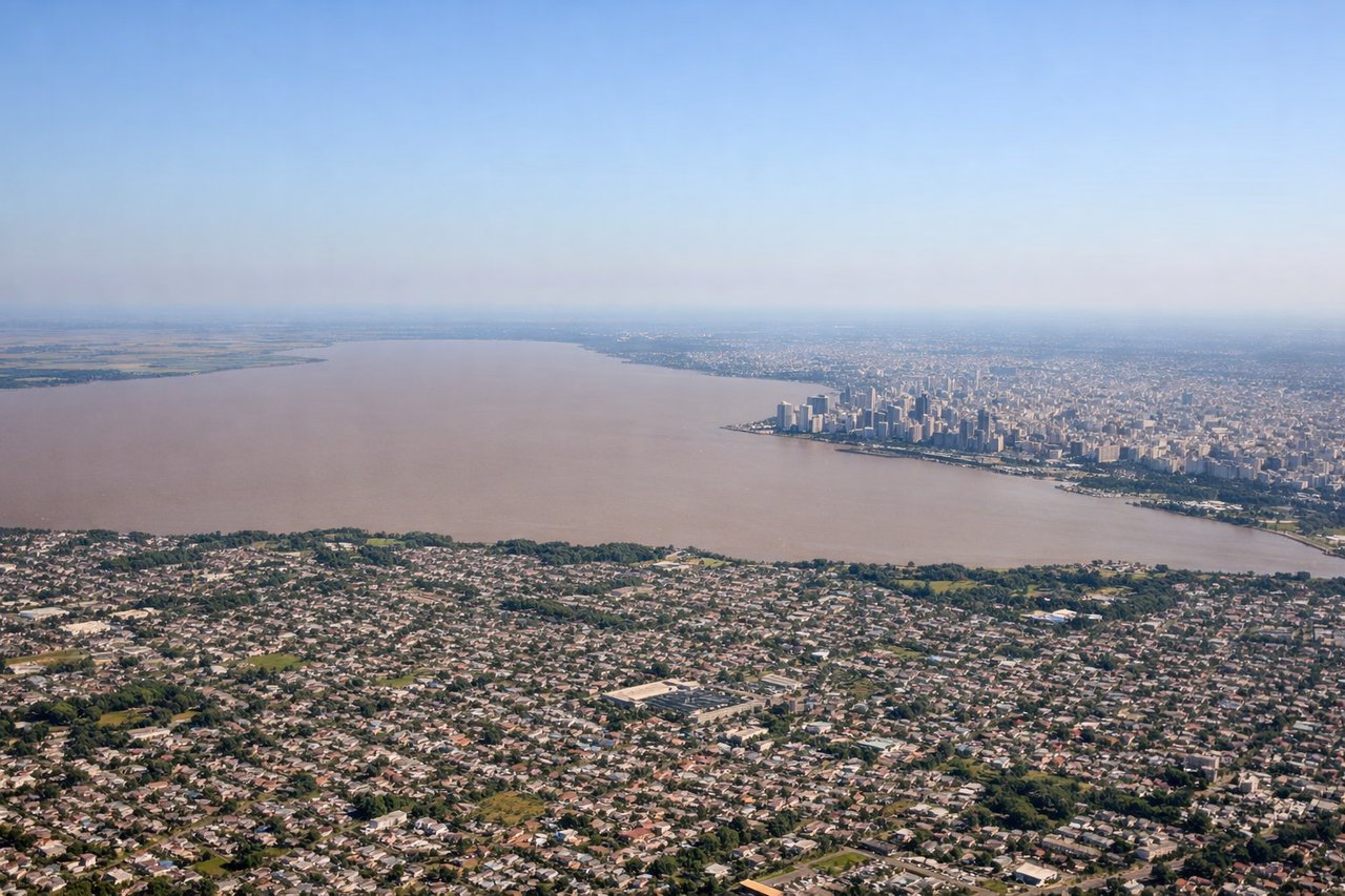
RIGHTRight-side seats offer views of the Río de la Plata estuary and the Buenos Aires metropolitan area as the aircraft climbs northwestward from Ezeiza. The wide, muddy waters of the estuary and the sprawling city grid are distinctive from altitude.

Landing at IND
LEFTLeft-side seats provide views of the Ohio River valley and Indianapolis's urban core during the final approach from the northeast. The river's distinctive meandering path and the city's downtown skyline are clearly visible during descent.
Will your flight be in sunlight?
Pick a date and time in the Sun Map to watch the sun move across your whole flight.
About This Route
Which side of the plane should I sit on flying from Ezeiza Ministro Pistarini (EZE) to Indianapolis International (IND)?
Sit on the Right side of the plane for the best views on flights from Buenos Aires to Indianapolis. The takeoff from Buenos Aires offers more dramatic and visually distinctive scenery—the Río de la Plata estuary and sprawling metropolitan area are more striking than Indianapolis's approach over flat farmland. Right-side seats capture the most memorable portion of this transatlantic route.
What can I see during takeoff from Ezeiza Ministro Pistarini in Buenos Aires?
During takeoff from Ezeiza Ministro Pistarini (EZE), sit on the Right side for the best views. Right-side seats offer views of the Río de la Plata estuary and the Buenos Aires metropolitan area as the aircraft climbs northwestward from Ezeiza. The wide, muddy waters of the estuary and the sprawling city grid are distinctive from altitude. Notable sights include: Río de la Plata estuary, Buenos Aires urban grid, Paraná River delta (northern distance), Atlantic coastal plains.
What can I see when landing at Indianapolis International in Indianapolis?
When landing at Indianapolis International (IND), sit on the Left side for the best views. Left-side seats provide views of the Ohio River valley and Indianapolis's urban core during the final approach from the northeast. The river's distinctive meandering path and the city's downtown skyline are clearly visible during descent. Notable sights include: Ohio River valley, Indianapolis downtown and grid pattern, White River (local tributary), surrounding flat Indiana plains.
How long is the flight from Buenos Aires to Indianapolis?
The flight from Ezeiza Ministro Pistarini (EZE) to Indianapolis International (IND) takes about 9 hours 15 minutes. The shortest flight path between them is 5,446 miles (8,764 km); winds and air traffic control usually add a few percent.
What does the Buenos Aires to Indianapolis flight path pass over?
The flight path crosses the Atlantic Ocean for approximately 5,000 nautical miles with no significant landmarks visible mid-ocean. Upon approaching North America, the eastern seaboard becomes visible, including the Appalachian Mountains (distant, on the horizon during descent into the U.S.), and various river valleys. The Great Lakes region lies north of the direct flight path. The final approach into Indianapolis crosses the Ohio River valley and the flat agricultural plains of Indiana and Ohio.