While takeoff offers excellent Buenos Aires and river views from the left, the landing approach into Madrid provides more dramatic and varied geography—the Guadarrama Mountains are a major visual landmark, and the transition from mountains to plateau is more geographically distinctive than the relatively uniform estuary and city views on departure.
Flown EZE to MAD? Did we get it right?
Flight Path
Buenos Aires to Madrid is 6,267 miles (10,087 km), a flight of about 14 hours.
The flight path crosses the South Atlantic over open ocean for roughly 9-10 hours with no visible landmarks. Approaching Africa, the Sahara Desert becomes visible as vast tan expanses (around 8-9 hours into flight). The Atlas Mountains in Morocco appear as a distant ridge on the southern horizon before the aircraft turns northeast toward Spain. The Iberian Peninsula's western coast (Portugal/Spain) becomes visible approximately 1.5-2 hours before landing, with the Tagus River valley and Portuguese highlands visible before crossing into Spain.
Great circle distance and headings ›


Phase by phase

Takeoff from EZE
LEFTEZE typically departs runways 09 (eastbound) or 27 (westbound). Left seats on eastbound departures offer views of the Río de la Plata estuary and the sprawling Buenos Aires metropolitan area receding southward. The river's wide, muddy waters and the city's grid pattern are distinctive from altitude.
Landing at MAD
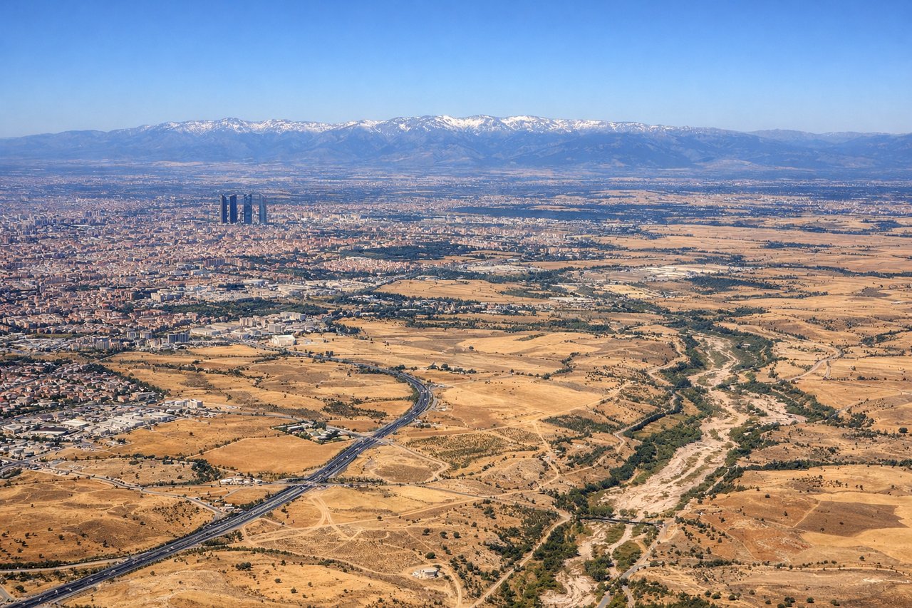
RIGHTMadrid's Barajas typically uses runways 32L/32R (northwesterly approach) or 14L/14R (southeasterly approach). Right seats on standard northwest approaches offer views of the Guadarrama Mountains to the northwest and the Meseta Central plateau stretching eastward. The terrain transition from mountains to flat central Spanish plateau is visually striking.
Will your flight be in sunlight?
Pick a date and time in the Sun Map to watch the sun move across your whole flight.
About This Route
Which side of the plane should I sit on flying from Ezeiza Ministro Pistarini (EZE) to Barajas (MAD)?
Sit on the Right side of the plane for the best views on flights from Buenos Aires to Madrid. While takeoff offers excellent Buenos Aires and river views from the left, the landing approach into Madrid provides more dramatic and varied geography—the Guadarrama Mountains are a major visual landmark, and the transition from mountains to plateau is more geographically distinctive than the relatively uniform estuary and city views on departure.
What can I see during takeoff from Ezeiza Ministro Pistarini in Buenos Aires?
During takeoff from Ezeiza Ministro Pistarini (EZE), sit on the Left side for the best views. EZE typically departs runways 09 (eastbound) or 27 (westbound). Left seats on eastbound departures offer views of the Río de la Plata estuary and the sprawling Buenos Aires metropolitan area receding southward. The river's wide, muddy waters and the city's grid pattern are distinctive from altitude. Notable sights include: Río de la Plata (wide brownish estuary), Buenos Aires urban sprawl extending inland, Aeroparque Jorge Newbery (smaller airport visible north across the river), Tigre Delta wetlands to the northeast.
What can I see when landing at Barajas in Madrid?
When landing at Barajas (MAD), sit on the Right side for the best views. Madrid's Barajas typically uses runways 32L/32R (northwesterly approach) or 14L/14R (southeasterly approach). Right seats on standard northwest approaches offer views of the Guadarrama Mountains to the northwest and the Meseta Central plateau stretching eastward. The terrain transition from mountains to flat central Spanish plateau is visually striking. Notable sights include: Guadarrama Mountains (Sierra de Guadarrama) to the northwest, Meseta Central plateau, Manzanares River valley, Madrid's urban sprawl with visible ring roads (M-40, M-45).
How long is the flight from Buenos Aires to Madrid?
The flight from Ezeiza Ministro Pistarini (EZE) to Barajas (MAD) takes about 14 hours. The shortest flight path between them is 6,267 miles (10,087 km); winds and air traffic control usually add a few percent.
What does the Buenos Aires to Madrid flight path pass over?
The flight path crosses the South Atlantic over open ocean for roughly 9-10 hours with no visible landmarks. Approaching Africa, the Sahara Desert becomes visible as vast tan expanses (around 8-9 hours into flight). The Atlas Mountains in Morocco appear as a distant ridge on the southern horizon before the aircraft turns northeast toward Spain. The Iberian Peninsula's western coast (Portugal/Spain) becomes visible approximately 1.5-2 hours before landing, with the Tagus River valley and Portuguese highlands visible before crossing into Spain.