Rome to Beauvais is 719 miles (1,158 km), a flight of about 2 hours 15 minutes.
While landing favors the left, takeoff from Rome offers more dramatic and recognizable scenery (the Tiber, Alban Hills, and Rome's urban center). The flight path northwestward across central Italy and into France provides moderate scenery on both sides, but the Rome departure is the visual highlight.
Flight Path
The flight crosses the Apennine Mountains (visible as a north-south spine running down central Italy, typically at 10,000-15,000 feet altitude), then transitions over Tuscany's rolling hills and the Arno River valley. As the aircraft continues northwest, it passes over the Alps' western foothills near the France-Italy border (Mont Blanc visible on clear days to the north), then descends over the Burgundy plateau and Île-de-France agricultural plains. The Rhône-Saône corridor lies to the east of the typical flight path. Most of the midpoint flight occurs over relatively undistinguished terrain—forested hills and farmland—with the Apennines being the most visually striking feature.
Great circle distance and headings ›
_-_24_(50543603956).jpg?width=600)


_Panoramica_del_centro_della_citt%C3%A0_dal_lago.jpg?width=600)
.jpg?width=600)
Phase by phase
Takeoff from FCO
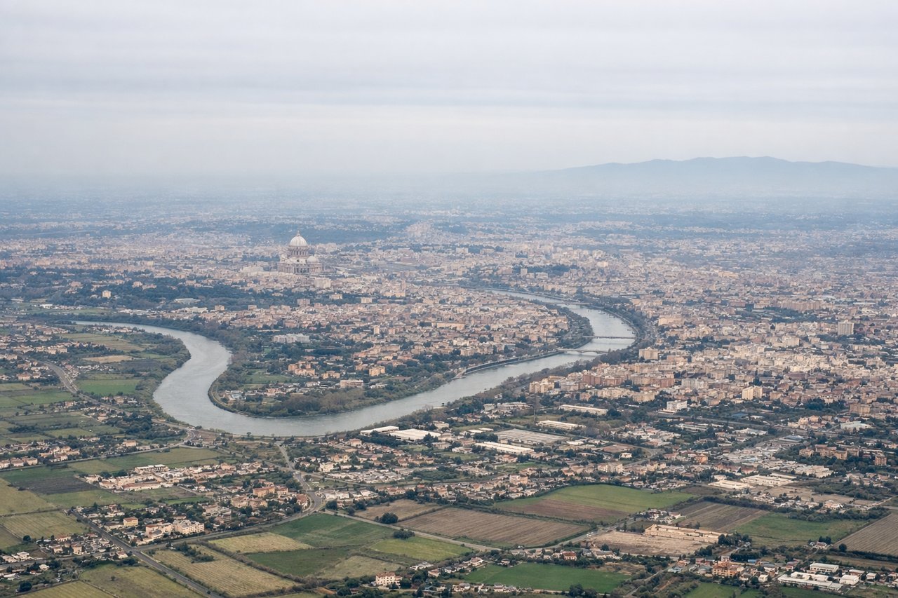
RIGHTRight side offers immediate views of the Tiber River winding through Rome's urban sprawl, and the Alban Hills rising to the southeast. Left side faces the Tyrrhenian Sea but offers less distinctive scenery during the initial climb.
Landing at BVA
LEFTLeft side provides views of the Seine River valley and the Île-de-France agricultural landscape approaching Beauvais. The descent path typically brings the Seine into view on the left, with its characteristic meanders visible from altitude. Right side faces less distinctive terrain.
Landmarks on this routeAll landmarks →
Will your flight be in sunlight?
Pick a date and time in the Sun Map to watch the sun move across your whole flight.
About This Route
Which side of the plane should I sit on flying from Fiumicino (FCO) to Tille (BVA)?
Sit on the Right side of the plane for the best views on flights from Rome to Beauvais. While landing favors the left, takeoff from Rome offers more dramatic and recognizable scenery (the Tiber, Alban Hills, and Rome's urban center). The flight path northwestward across central Italy and into France provides moderate scenery on both sides, but the Rome departure is the visual highlight.
What can I see during takeoff from Fiumicino in Rome?
During takeoff from Fiumicino (FCO), sit on the Right side for the best views. Right side offers immediate views of the Tiber River winding through Rome's urban sprawl, and the Alban Hills rising to the southeast. Left side faces the Tyrrhenian Sea but offers less distinctive scenery during the initial climb. Notable sights include: Tiber River (visible as a ribbon through central Rome), Alban Hills (volcanic ridge southeast of the airport), Rome's urban grid and dome of St. Peter's Basilica (recognizable in the cityscape), Castelli Romani hills.
What can I see when landing at Tille in Beauvais?
When landing at Tille (BVA), sit on the Left side for the best views. Left side provides views of the Seine River valley and the Île-de-France agricultural landscape approaching Beauvais. The descent path typically brings the Seine into view on the left, with its characteristic meanders visible from altitude. Right side faces less distinctive terrain. Notable sights include: Seine River and its meanders (clearly visible from 8,000+ feet), Île-de-France farmland (patchwork of fields in greens and golds), Beauvais Cathedral spire (recognizable in the town center), Oise River valley.
How long is the flight from Rome to Beauvais?
The flight from Fiumicino (FCO) to Tille (BVA) takes about 2 hours 15 minutes. The shortest flight path between them is 719 miles (1,158 km); winds and air traffic control usually add a few percent.
What does the Rome to Beauvais flight path pass over?
The flight crosses the Apennine Mountains (visible as a north-south spine running down central Italy, typically at 10,000-15,000 feet altitude), then transitions over Tuscany's rolling hills and the Arno River valley. As the aircraft continues northwest, it passes over the Alps' western foothills near the France-Italy border (Mont Blanc visible on clear days to the north), then descends over the Burgundy plateau and Île-de-France agricultural plains. The Rhône-Saône corridor lies to the east of the typical flight path. Most of the midpoint flight occurs over relatively undistinguished terrain—forested hills and farmland—with the Apennines being the most visually striking feature.