While the takeoff offers compelling Tuscan mountain and river views, the landing into Phoenix provides more dramatic and visually distinctive scenery—the contrast between urban sprawl and desert, the Salt River corridor, and volcanic peaks. Right seats capture the approach corridor more effectively.
Flown FLR to PHX? Did we get it right?
Flight Path
Firenze to Phoenix is 6,014 miles (9,679 km), a flight of about 10 hours 15 minutes.
The flight crosses the Alps (visible from both sides during the initial climb and crossing—Mont Blanc and Gran Paradiso massifs are notable), then proceeds over the Mediterranean Sea (southern coast of France and Spain visible on left during cruise), the Strait of Gibraltar (narrow passage between Europe and Africa), the Atlantic Ocean (open water for most of the transatlantic segment), and finally the North American continent with the Rocky Mountains visible on the left during descent into Arizona.
Great circle distance and headings ›


Phase by phase
Takeoff from FLR
LEFTLeft seats offer views of the Arno River valley and the Apennine Mountains as the aircraft climbs northwestward out of Florence. The terrain rises immediately to the north, providing dramatic relief and clear geographic context.
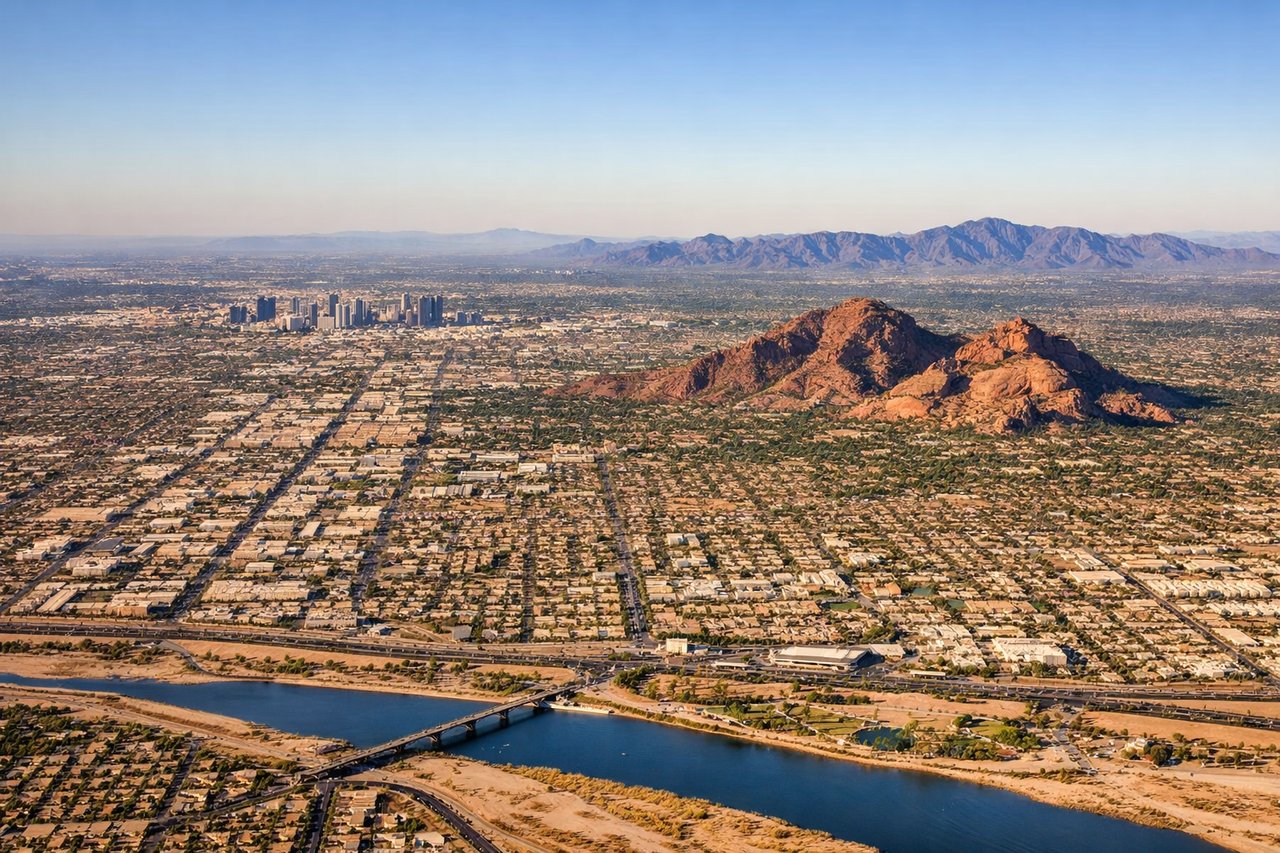
Landing at PHX
RIGHTRight seats provide excellent views of the Phoenix metropolitan area, the Salt River, and the surrounding desert mountains during descent into Sky Harbor. The approach typically comes from the east, making right-side views of the city and immediate terrain most dramatic.
Will your flight be in sunlight?
Pick a date and time in the Sun Map to watch the sun move across your whole flight.
About This Route
Which side of the plane should I sit on flying from Peretola (FLR) to Phoenix Sky Harbor International (PHX)?
Sit on the Right side of the plane for the best views on flights from Firenze to Phoenix. While the takeoff offers compelling Tuscan mountain and river views, the landing into Phoenix provides more dramatic and visually distinctive scenery—the contrast between urban sprawl and desert, the Salt River corridor, and volcanic peaks. Right seats capture the approach corridor more effectively.
What can I see during takeoff from Peretola in Firenze?
During takeoff from Peretola (FLR), sit on the Left side for the best views. Left seats offer views of the Arno River valley and the Apennine Mountains as the aircraft climbs northwestward out of Florence. The terrain rises immediately to the north, providing dramatic relief and clear geographic context. Notable sights include: Arno River (visible as a ribbon through the Tuscan valley), Apennine Mountains (northern horizon), Florence city grid (directly below during initial climb), Mugello Valley (northeast, visible as the aircraft banks).
What can I see when landing at Phoenix Sky Harbor International in Phoenix?
When landing at Phoenix Sky Harbor International (PHX), sit on the Right side for the best views. Right seats provide excellent views of the Phoenix metropolitan area, the Salt River, and the surrounding desert mountains during descent into Sky Harbor. The approach typically comes from the east, making right-side views of the city and immediate terrain most dramatic. Notable sights include: Phoenix city grid (downtown and sprawl), Salt River (visible as a green riparian corridor through the desert), South Mountain Park (dark volcanic peaks southwest of downtown), Sierra Estrella Mountains (western horizon, appearing as a distant range).
How long is the flight from Firenze to Phoenix?
The flight from Peretola (FLR) to Phoenix Sky Harbor International (PHX) takes about 10 hours 15 minutes. The shortest flight path between them is 6,014 miles (9,679 km); winds and air traffic control usually add a few percent.
What does the Firenze to Phoenix flight path pass over?
The flight crosses the Alps (visible from both sides during the initial climb and crossing—Mont Blanc and Gran Paradiso massifs are notable), then proceeds over the Mediterranean Sea (southern coast of France and Spain visible on left during cruise), the Strait of Gibraltar (narrow passage between Europe and Africa), the Atlantic Ocean (open water for most of the transatlantic segment), and finally the North American continent with the Rocky Mountains visible on the left during descent into Arizona.