The right side wins on both ends of the flight and during the polar-route cruise: Frankfurt's skyline at departure, Greenland's ice sheet visible to the north during the Atlantic crossing, and the Coast Mountains with Vancouver's skyline on arrival. The left side spends most of the flight over open ocean, Hudson Bay, and flat Canadian prairie with far fewer distinctive landmarks.
Flight Path
Southern Greenland ice sheet, Davis Strait, Baffin Island, Hudson Bay
Great circle distance and headings ›


.jpg?width=600)

Phase by phase

Takeoff from FRA
RIGHTFRA departures on this routing typically take off to the west then swing right onto a north-northwest heading toward the North Sea, and that turn briefly puts Frankfurt's skyline and the Taunus hills on the right side. The left side mostly shows flat Rhine-Main farmland fading into haze.
Landing at YVR
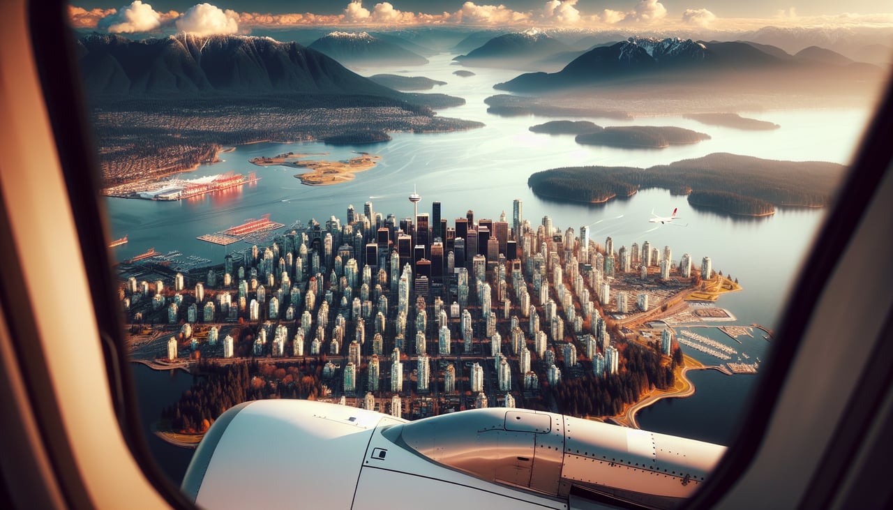
RIGHTArrivals into YVR from the east on runway 26 pass north of downtown, giving the right side clear views of the North Shore Mountains and Burrard Inlet as the city skyline slides past below. The left side instead faces the flatter Fraser Delta and Boundary Bay toward the US border.
Landmarks on this routeAll landmarks →
Will your flight be in sunlight?
See exactly which side of the plane gets sun and shade at your departure time.
About This Route
Which side of the plane should I sit on flying from Frankfurt Main (FRA) to Vancouver International (YVR)?
Sit on the Right side of the plane for the best views on flights from Frankfurt to Vancouver. The right side wins on both ends of the flight and during the polar-route cruise: Frankfurt's skyline at departure, Greenland's ice sheet visible to the north during the Atlantic crossing, and the Coast Mountains with Vancouver's skyline on arrival. The left side spends most of the flight over open ocean, Hudson Bay, and flat Canadian prairie with far fewer distinctive landmarks.
What can I see during takeoff from Frankfurt Main in Frankfurt?
During takeoff from Frankfurt Main (FRA), sit on the Right side for the best views. FRA departures on this routing typically take off to the west then swing right onto a north-northwest heading toward the North Sea, and that turn briefly puts Frankfurt's skyline and the Taunus hills on the right side. The left side mostly shows flat Rhine-Main farmland fading into haze. Notable sights include: Frankfurt skyline (Bankenviertel), Main River, Taunus hills, Rhine-Main plain.
What can I see when landing at Vancouver International in Vancouver?
When landing at Vancouver International (YVR), sit on the Right side for the best views. Arrivals into YVR from the east on runway 26 pass north of downtown, giving the right side clear views of the North Shore Mountains and Burrard Inlet as the city skyline slides past below. The left side instead faces the flatter Fraser Delta and Boundary Bay toward the US border. Notable sights include: North Shore Mountains (Grouse, Seymour, Cypress), Burrard Inlet, downtown Vancouver skyline, Strait of Georgia.
How long is the flight from Frankfurt to Vancouver?
The flight from Frankfurt Main (FRA) to Vancouver International (YVR) takes 10h 30m.
What does the Frankfurt to Vancouver flight path pass over?
Southern Greenland ice sheet, Davis Strait, Baffin Island, Hudson Bay