While takeoff offers dramatic coastal and mountain scenery, the landing approach into Bogotá's high-altitude basin surrounded by the Cordillera Oriental provides more sustained and visually striking geography. Right seats dominate both the approach descent and the final views of the city's unique plateau setting.
Flown GIG to BOG? Did we get it right?
Flight Path
Rio De Janeiro to Bogota is 2,822 miles (4,541 km), a flight of about 5 hours 55 minutes.
The flight path crosses northwest from Rio through the interior of Brazil and into Colombia. Notable features include the Paraíba River valley system (visible around 1.5 hours out), the transition from Atlantic coastal mountains to the Brazilian Shield's interior plateau, and eventually the approach to the Colombian Andes. The Magdalena River valley becomes visible in the final hour as you descend toward Bogotá. Most of the cruise altitude (around 35,000 feet) crosses sparsely populated interior terrain with limited distinctive landmarks—the real visual rewards are at departure and arrival.
Great circle distance and headings ›

Phase by phase
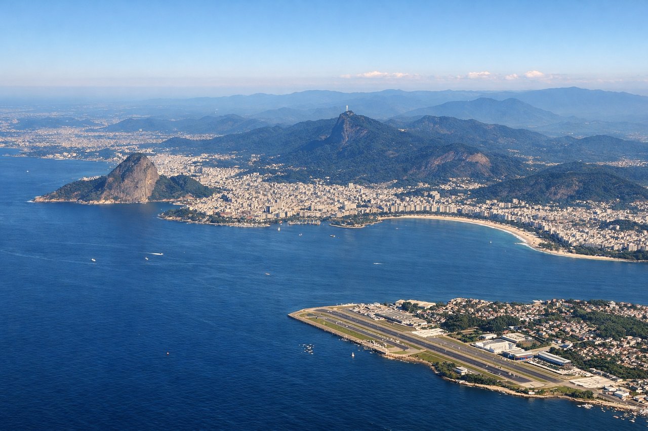
Takeoff from GIG
LEFTGIG typically departs runway 10L/28R or 10R/28L depending on wind. Northbound departures (most common) climb over Guanabara Bay and the Atlantic, but left seats capture the dramatic Serra da Carioca and the city's mountainous backdrop as you bank northwest toward Colombia.
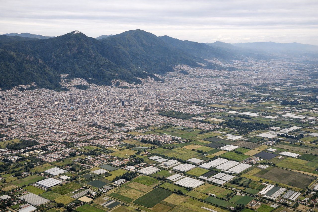
Landing at BOG
RIGHTApproaching BOG from the southeast, aircraft descend through the Cordillera Oriental. Right seats offer superior views of Bogotá's high-altitude basin (2,640m elevation) nestled between the eastern and central ranges, plus the dramatic terrain of the approach corridor through the mountains.
Will your flight be in sunlight?
Pick a date and time in the Sun Map to watch the sun move across your whole flight.
About This Route
Which side of the plane should I sit on flying from Galeao Antonio Carlos Jobim (GIG) to Eldorado International (BOG)?
Sit on the Right side of the plane for the best views on flights from Rio De Janeiro to Bogota. While takeoff offers dramatic coastal and mountain scenery, the landing approach into Bogotá's high-altitude basin surrounded by the Cordillera Oriental provides more sustained and visually striking geography. Right seats dominate both the approach descent and the final views of the city's unique plateau setting.
What can I see during takeoff from Galeao Antonio Carlos Jobim in Rio De Janeiro?
During takeoff from Galeao Antonio Carlos Jobim (GIG), sit on the Left side for the best views. GIG typically departs runway 10L/28R or 10R/28L depending on wind. Northbound departures (most common) climb over Guanabara Bay and the Atlantic, but left seats capture the dramatic Serra da Carioca and the city's mountainous backdrop as you bank northwest toward Colombia. Notable sights include: Guanabara Bay (immediate offshore), Serra da Carioca mountain range (west/northwest), Christ the Redeemer statue area (visible as terrain feature on ridge), Atlantic coastline curving north.
What can I see when landing at Eldorado International in Bogota?
When landing at Eldorado International (BOG), sit on the Right side for the best views. Approaching BOG from the southeast, aircraft descend through the Cordillera Oriental. Right seats offer superior views of Bogotá's high-altitude basin (2,640m elevation) nestled between the eastern and central ranges, plus the dramatic terrain of the approach corridor through the mountains. Notable sights include: Cordillera Oriental peaks (eastern range, right side), Bogotá's urban basin and grid pattern, Sabana de Bogotá plateau, Monserrate peak (distinctive isolated summit east of city).
How long is the flight from Rio De Janeiro to Bogota?
The flight from Galeao Antonio Carlos Jobim (GIG) to Eldorado International (BOG) takes about 5 hours 55 minutes. The shortest flight path between them is 2,822 miles (4,541 km); winds and air traffic control usually add a few percent.
What does the Rio De Janeiro to Bogota flight path pass over?
The flight path crosses northwest from Rio through the interior of Brazil and into Colombia. Notable features include the Paraíba River valley system (visible around 1.5 hours out), the transition from Atlantic coastal mountains to the Brazilian Shield's interior plateau, and eventually the approach to the Colombian Andes. The Magdalena River valley becomes visible in the final hour as you descend toward Bogotá. Most of the cruise altitude (around 35,000 feet) crosses sparsely populated interior terrain with limited distinctive landmarks—the real visual rewards are at departure and arrival.