While the takeoff offers dramatic Western Ghats views on the left, the landing provides sustained, iconic visual interest—the Hooghly River's meanders and Howrah Bridge are unmistakable landmarks visible for 15+ minutes of descent. Right seats capture this better and offer more memorable geography.
Flown GOI to CCU? Did we get it right?
Flight Path
Goa to Calcutta is 1,078 miles (1,735 km), a flight of about 2 hours 15 minutes.
The flight path crosses the Deccan Plateau's eastern edge, then descends into the Ganges Plain. Notable midpoint features include the Mahanadi River valley (around 1 hour into flight, visible as a linear depression in the plateau), the transition from Western Ghats terrain to flatter agricultural plains of Odisha and Jharkhand, and scattered lakes and reservoirs in the plateau region. The Chota Nagpur Plateau's eastern slopes appear as subtle elevation changes rather than dramatic relief. No major mountain ranges are crossed; the terrain gradually descends northeastward toward the Bengal delta.
Great circle distance and headings ›

Phase by phase
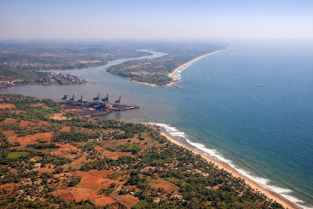
Takeoff from GOI
LEFTGoa International typically departs runway 09/27. Westbound departures (runway 09) climb over the Arabian Sea initially, but eastbound departures (runway 27) turn inland quickly. Left seats on eastbound departures capture the Western Ghats escarpment rising sharply inland—a dramatic vertical wall of forested terrain that's unmistakable from 5,000–10,000 feet.
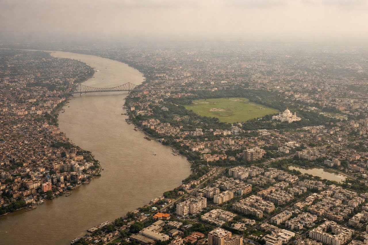
Landing at CCU
RIGHTCalcutta's Netaji Subhash Chandra Bose airport uses runways 10/28. Eastbound approaches (runway 10) descend over the Hooghly River and the city's eastern districts. Right-seat passengers see the river's distinctive meanders, the Howrah Bridge, and the urban sprawl of central Calcutta spreading across the floodplain—far more visually coherent than westbound approaches.
Will your flight be in sunlight?
Pick a date and time in the Sun Map to watch the sun move across your whole flight.
About This Route
Which side of the plane should I sit on flying from Goa Dabolim International Airport (GOI) to Netaji Subhash Chandra Bose International (CCU)?
Sit on the Right side of the plane for the best views on flights from Goa to Calcutta. While the takeoff offers dramatic Western Ghats views on the left, the landing provides sustained, iconic visual interest—the Hooghly River's meanders and Howrah Bridge are unmistakable landmarks visible for 15+ minutes of descent. Right seats capture this better and offer more memorable geography.
What can I see during takeoff from Goa Dabolim International Airport in Goa?
During takeoff from Goa Dabolim International Airport (GOI), sit on the Left side for the best views. Goa International typically departs runway 09/27. Westbound departures (runway 09) climb over the Arabian Sea initially, but eastbound departures (runway 27) turn inland quickly. Left seats on eastbound departures capture the Western Ghats escarpment rising sharply inland—a dramatic vertical wall of forested terrain that's unmistakable from 5,000–10,000 feet. Notable sights include: Western Ghats mountain range (eastern horizon), Mandovi River estuary (below during initial climb), Mormugao Harbor (visible briefly on left during turn), coastal plains of central Goa.
What can I see when landing at Netaji Subhash Chandra Bose International in Calcutta?
When landing at Netaji Subhash Chandra Bose International (CCU), sit on the Right side for the best views. Calcutta's Netaji Subhash Chandra Bose airport uses runways 10/28. Eastbound approaches (runway 10) descend over the Hooghly River and the city's eastern districts. Right-seat passengers see the river's distinctive meanders, the Howrah Bridge, and the urban sprawl of central Calcutta spreading across the floodplain—far more visually coherent than westbound approaches. Notable sights include: Hooghly River with its characteristic meanders, Howrah Bridge (iconic steel cantilever structure), Calcutta city grid and high-rises, Sundarbans mangrove forest (distant, on southern horizon).
How long is the flight from Goa to Calcutta?
The flight from Goa Dabolim International Airport (GOI) to Netaji Subhash Chandra Bose International (CCU) takes about 2 hours 15 minutes. The shortest flight path between them is 1,078 miles (1,735 km); winds and air traffic control usually add a few percent.
What does the Goa to Calcutta flight path pass over?
The flight path crosses the Deccan Plateau's eastern edge, then descends into the Ganges Plain. Notable midpoint features include the Mahanadi River valley (around 1 hour into flight, visible as a linear depression in the plateau), the transition from Western Ghats terrain to flatter agricultural plains of Odisha and Jharkhand, and scattered lakes and reservoirs in the plateau region. The Chota Nagpur Plateau's eastern slopes appear as subtle elevation changes rather than dramatic relief. No major mountain ranges are crossed; the terrain gradually descends northeastward toward the Bengal delta.