While takeoff offers dramatic volcanic scenery, the landing descent provides more varied and geographically significant views: the Guayas River delta system is one of Ecuador's most distinctive features, and the approach to Guayaquil reveals the transition from coastal ecosystems to urban development.
Flight Path
The flight path crosses the Pacific coastal plain and approaches the Andes foothills. Midway, you'll see the transition from open ocean to the coastal lowlands of Ecuador's western region, with scattered agricultural areas and the Manabí Province's terrain. The Cordillera Occidental (Western Andes) becomes increasingly visible as you approach Guayaquil from the west.
Great circle distance and headings ›Phase by phase
Takeoff from GPS
RIGHTGPS typically departs to the west or northwest. Right-side seats capture the dramatic volcanic terrain of the central Galápagos islands and the archipelago's western islands receding into the distance as you climb out over the Pacific.
Landing at GYE
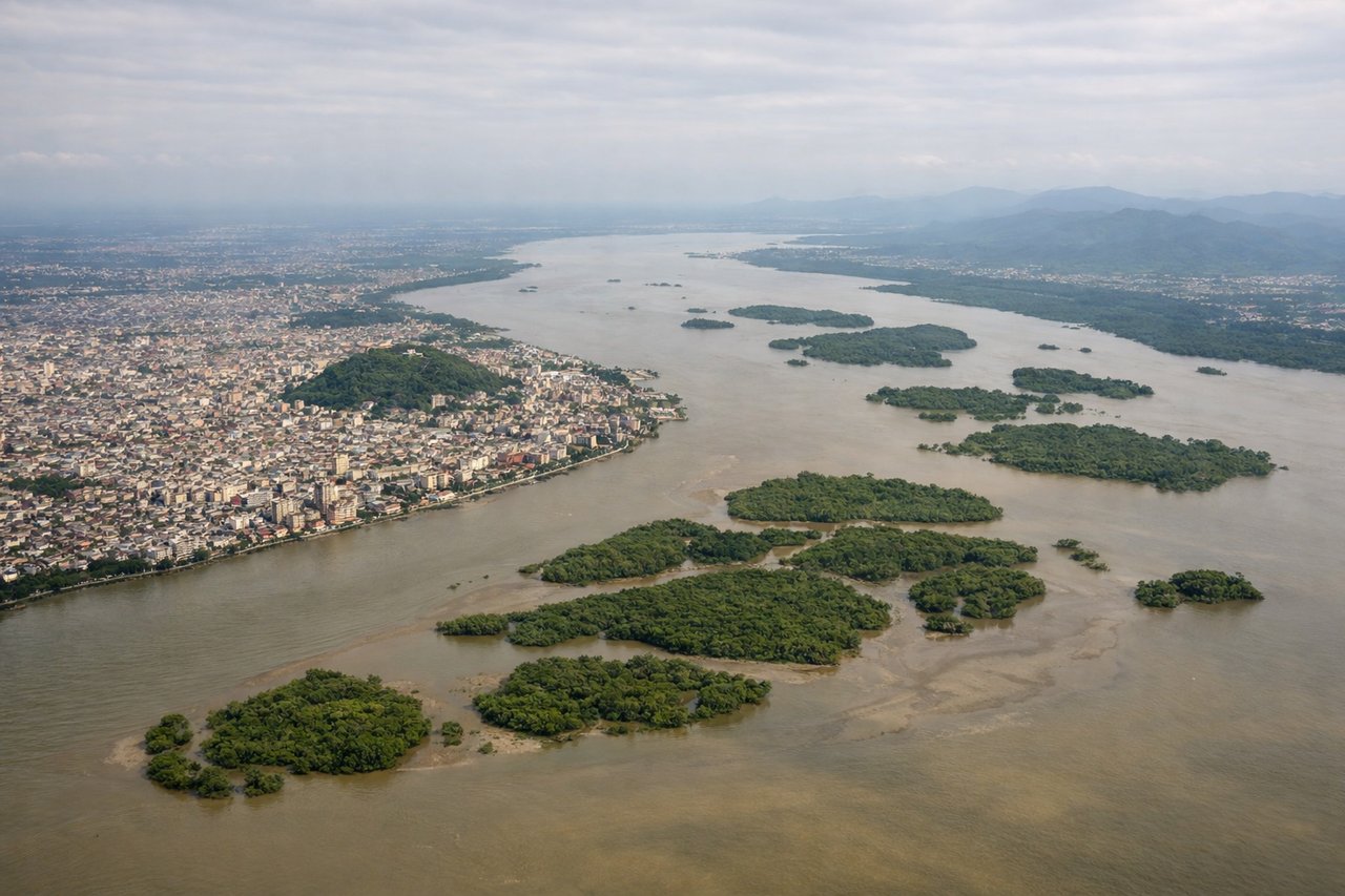
LEFTGYE typically uses runways aligned east-west. Left-side seats during descent capture the Andes foothills, the Guayas River delta system, and the transition from coastal mangrove wetlands to the city of Guayaquil on the eastern approach.
Will your flight be in sunlight?
See exactly which side of the plane gets sun and shade at your departure time.
About This Route
Which side of the plane should I sit on flying from Seymour (GPS) to Simon Bolivar International (GYE)?
Sit on the Left side of the plane for the best views on flights from Galapagos to Guayaquil. While takeoff offers dramatic volcanic scenery, the landing descent provides more varied and geographically significant views: the Guayas River delta system is one of Ecuador's most distinctive features, and the approach to Guayaquil reveals the transition from coastal ecosystems to urban development.
What can I see during takeoff from Seymour in Galapagos?
During takeoff from Seymour (GPS), sit on the Right side for the best views. GPS typically departs to the west or northwest. Right-side seats capture the dramatic volcanic terrain of the central Galápagos islands and the archipelago's western islands receding into the distance as you climb out over the Pacific. Notable sights include: Isabela Island (distinctive seahorse shape), Fernandina Island (dark volcanic slopes), Sierra Negra volcano, Pacific Ocean horizon.
What can I see when landing at Simon Bolivar International in Guayaquil?
When landing at Simon Bolivar International (GYE), sit on the Left side for the best views. GYE typically uses runways aligned east-west. Left-side seats during descent capture the Andes foothills, the Guayas River delta system, and the transition from coastal mangrove wetlands to the city of Guayaquil on the eastern approach. Notable sights include: Guayas River delta (braided waterways and mangrove forests), Andes foothills (distant ridgelines to the east), Guayaquil city sprawl, Pacific coastal plains.
How long is the flight from Galapagos to Guayaquil?
The flight from Seymour (GPS) to Simon Bolivar International (GYE) takes Approximately 1 hour 15 minutes.
What does the Galapagos to Guayaquil flight path pass over?
The flight path crosses the Pacific coastal plain and approaches the Andes foothills. Midway, you'll see the transition from open ocean to the coastal lowlands of Ecuador's western region, with scattered agricultural areas and the Manabí Province's terrain. The Cordillera Occidental (Western Andes) becomes increasingly visible as you approach Guayaquil from the west.