The left side wins on both ends of the flight: Guam's coastal bays during the turning departure and a potential Mount Fuji/Tokyo Bay view on arrival, while the right side deals mostly with featureless open Pacific during takeoff and Pacific Ocean glare on landing.
Flight Path
The route crosses the open Philippine Sea and passes near the Bonin Islands (Ogasawara chain), including the vicinity of Iwo Jima, though most of cruise is over featureless deep-blue ocean with no coastline in sight.
Great circle distance and headings ›Phase by phase
Takeoff from GUM
LEFTDeparting Guam on runway 06 heading ENE, the aircraft banks left to turn north toward Japan, tilting the left side toward the island. Passengers get a clear view of Tumon Bay's curving beaches, Apra Harbor, and the Agana coastline as Guam falls away below.
Landing at NRT
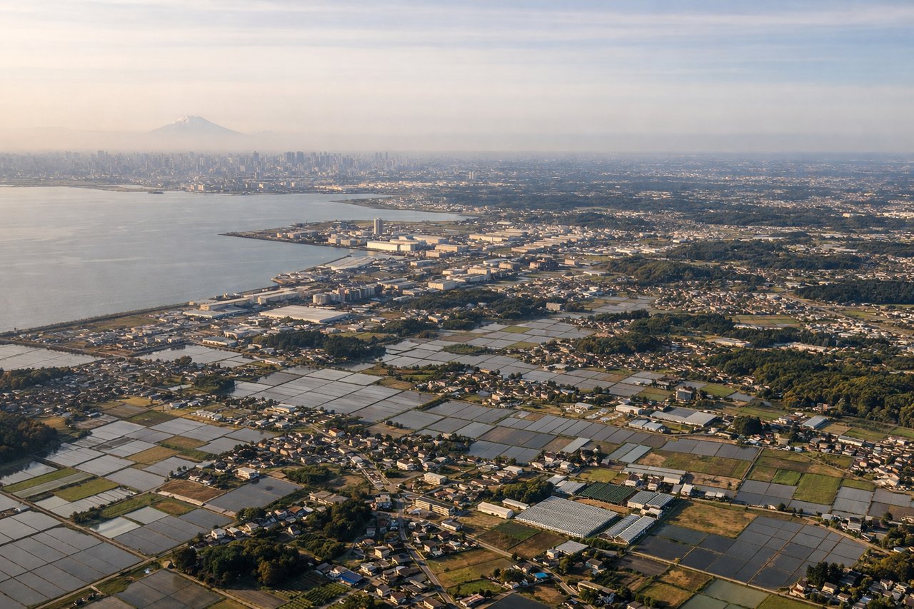
LEFTOn approach into Narita from the south (runway 34), the aircraft's left side faces west, offering a shot at Mount Fuji's snow-capped cone on clear days along with the sprawl of Tokyo Bay and the Chiba coastline below.
Landmarks on this routeAll landmarks →
Will your flight be in sunlight?
See exactly which side of the plane gets sun and shade at your departure time.
About This Route
Which side of the plane should I sit on flying from Guam International (GUM) to New Tokyo International (NRT)?
Sit on the Left side of the plane for the best views on flights from Agana to Tokyo. The left side wins on both ends of the flight: Guam's coastal bays during the turning departure and a potential Mount Fuji/Tokyo Bay view on arrival, while the right side deals mostly with featureless open Pacific during takeoff and Pacific Ocean glare on landing.
What can I see during takeoff from Guam International in Agana?
During takeoff from Guam International (GUM), sit on the Left side for the best views. Departing Guam on runway 06 heading ENE, the aircraft banks left to turn north toward Japan, tilting the left side toward the island. Passengers get a clear view of Tumon Bay's curving beaches, Apra Harbor, and the Agana coastline as Guam falls away below. Notable sights include: Tumon Bay, Apra Harbor, Agana coastline, Guam's northern limestone plateau.
What can I see when landing at New Tokyo International in Tokyo?
When landing at New Tokyo International (NRT), sit on the Left side for the best views. On approach into Narita from the south (runway 34), the aircraft's left side faces west, offering a shot at Mount Fuji's snow-capped cone on clear days along with the sprawl of Tokyo Bay and the Chiba coastline below. Notable sights include: Mount Fuji, Tokyo Bay, Chiba coastline, Boso Peninsula.
How long is the flight from Agana to Tokyo?
The flight from Guam International (GUM) to New Tokyo International (NRT) takes 3h 50m.
What does the Agana to Tokyo flight path pass over?
The route crosses the open Philippine Sea and passes near the Bonin Islands (Ogasawara chain), including the vicinity of Iwo Jima, though most of cruise is over featureless deep-blue ocean with no coastline in sight.