Left side scores higher due to the combination of coastal estuary scenery during departure and the dramatic Andean valley approach during landing. The flight path naturally favors the left side for viewing the Guayas delta and the Aburrá Valley's steep topography, whereas the right side offers only flat agricultural terrain and lower foothills.
Flown GYE to MDE? Did we get it right?
Flight Path
Guayaquil to Rio Negro is 652 miles (1,050 km), a flight of about 1 hour 25 minutes.
Cauca River valley, Pacific coastal plain transitioning to Andean foothills, agricultural zones of Valle del Cauca department, Caribbean-facing western slopes of the Cordillera Occidental
Great circle distance and headings ›


Phase by phase
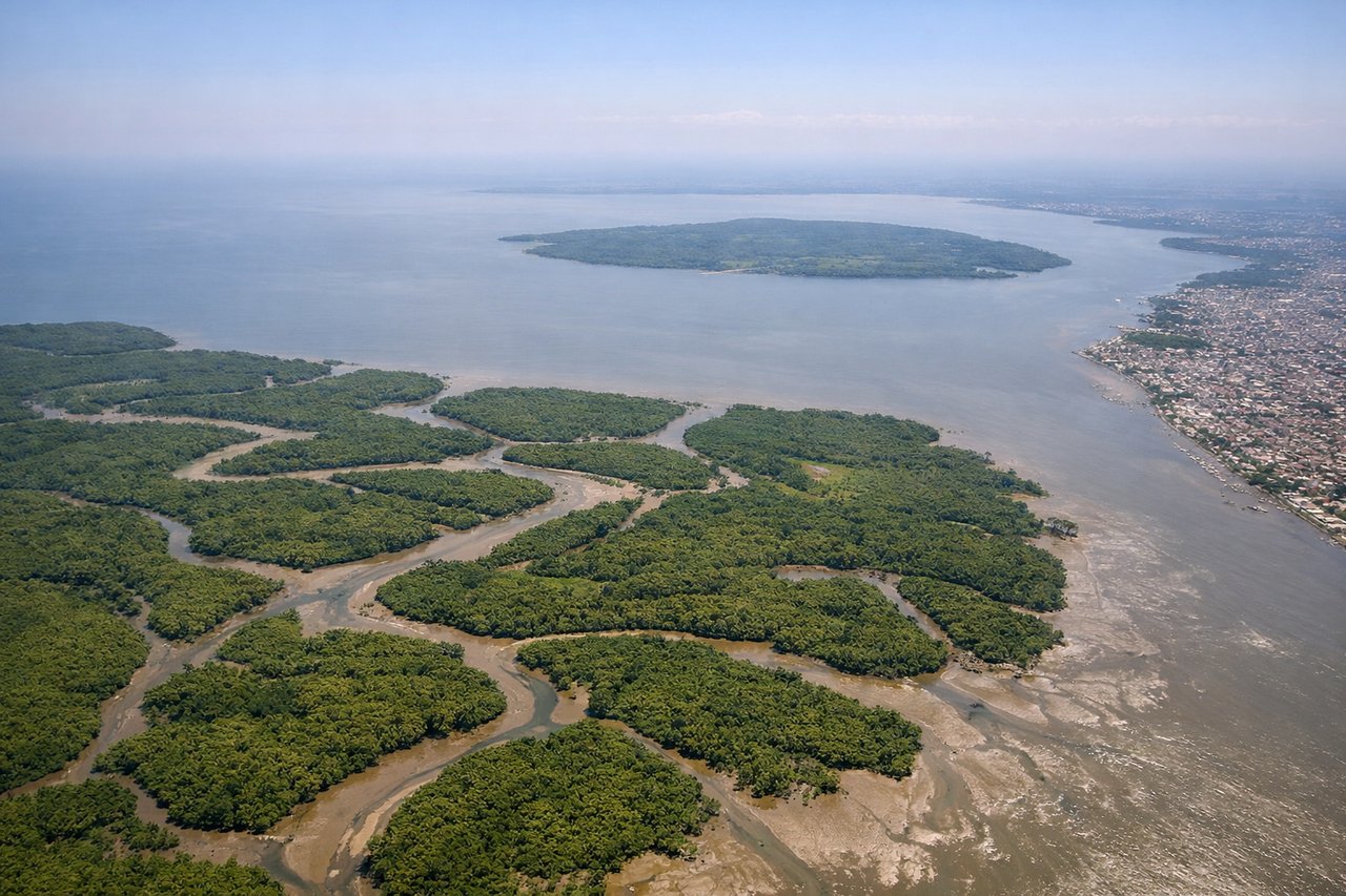
Takeoff from GYE
LEFTLeft side captures Guayaquil's harbor and estuary during departure, with the Guayas River delta and Pacific coastal plains visible. Right side shows inland agricultural flatlands with minimal visual interest during climb-out.
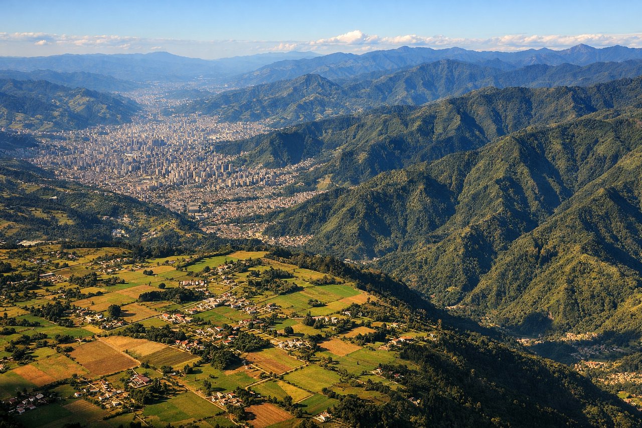
Landing at MDE
LEFTLeft side offers the dramatic approach to Medellín's mountain valley, with the Aburrá Valley's steep Andean slopes and the city nestled between ridges. Right side shows the approach over lower foothills and agricultural terrain with less topographic drama.
Will your flight be in sunlight?
Pick a date and time in the Sun Map to watch the sun move across your whole flight.
About This Route
Which side of the plane should I sit on flying from Simon Bolivar International (GYE) to Jose Maria Cordova (MDE)?
Sit on the Left side of the plane for the best views on flights from Guayaquil to Rio Negro. Left side scores higher due to the combination of coastal estuary scenery during departure and the dramatic Andean valley approach during landing. The flight path naturally favors the left side for viewing the Guayas delta and the Aburrá Valley's steep topography, whereas the right side offers only flat agricultural terrain and lower foothills.
What can I see during takeoff from Simon Bolivar International in Guayaquil?
During takeoff from Simon Bolivar International (GYE), sit on the Left side for the best views. Left side captures Guayaquil's harbor and estuary during departure, with the Guayas River delta and Pacific coastal plains visible. Right side shows inland agricultural flatlands with minimal visual interest during climb-out. Notable sights include: Guayas River estuary, Pacific coastline, Guayaquil urban sprawl, mangrove wetlands.
What can I see when landing at Jose Maria Cordova in Rio Negro?
When landing at Jose Maria Cordova (MDE), sit on the Left side for the best views. Left side offers the dramatic approach to Medellín's mountain valley, with the Aburrá Valley's steep Andean slopes and the city nestled between ridges. Right side shows the approach over lower foothills and agricultural terrain with less topographic drama. Notable sights include: Aburrá Valley ridgelines, Medellín city center in valley floor, Cauca River valley, Andean foothills.
How long is the flight from Guayaquil to Rio Negro?
The flight from Simon Bolivar International (GYE) to Jose Maria Cordova (MDE) takes about 1 hour 25 minutes. The shortest flight path between them is 652 miles (1,050 km); winds and air traffic control usually add a few percent.
What does the Guayaquil to Rio Negro flight path pass over?
Cauca River valley, Pacific coastal plain transitioning to Andean foothills, agricultural zones of Valle del Cauca department, Caribbean-facing western slopes of the Cordillera Occidental