The right side scores higher due to the Panama Canal and Gatun Lake during approach—genuinely iconic and visually distinctive features visible from altitude. While Guayaquil's departure offers estuary scenery, the cruise segment over open ocean and coastal lowlands is relatively monotonous. The landing approach on the right side provides concentrated scenic drama with the canal, rainforest, and urban skyline, making it the superior choice for window-seat views.
Flown GYE to PAC? Did we get it right?
Flight Path
Guayaquil to Panama City is 769 miles (1,238 km), a flight of about 2 hours 15 minutes.
The flight path crosses the Pacific coastal lowlands of Colombia and Panama, passing over mangrove swamps, river deltas, and tropical rainforest. The Darién Gap region (eastern Panama) features dense jungle and limited visible landmarks. No major mountain ranges or dramatic terrain features are visible along this northbound route at cruise altitude; the landscape remains predominantly flat to gently rolling with continuous forest cover and occasional river systems.
Great circle distance and headings ›

Phase by phase
Takeoff from GYE
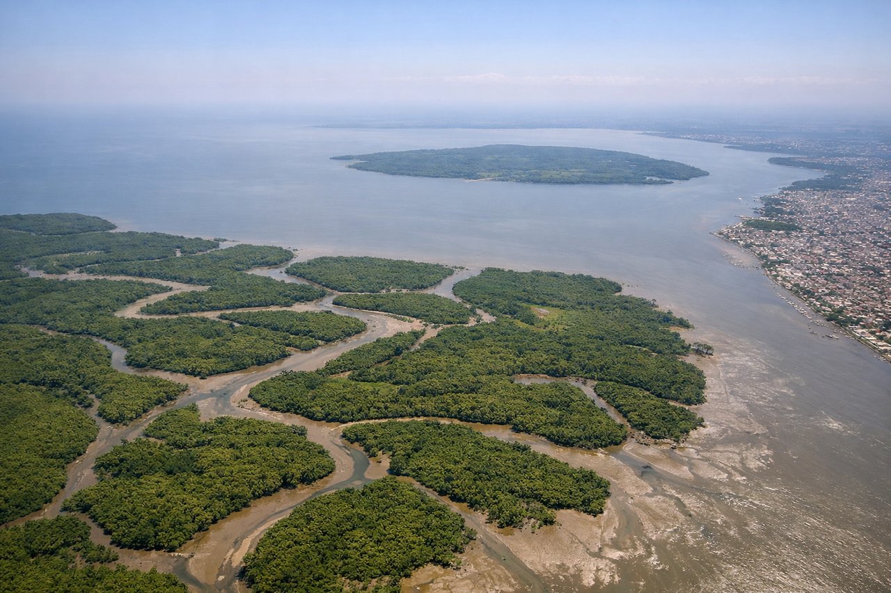
LEFTGuayaquil's departure over the Guayas River estuary and Pacific coastline offers immediate water and urban scenery. The left side captures the river delta, mangrove wetlands, and the coastal plain as the aircraft climbs northwestward.
Landing at PAC
RIGHTThe approach to Marcos A Gelabert (Panama City) from the south offers views of the Panama Canal, Gatun Lake, and the Panamanian landscape. The right side captures the canal's locks, the surrounding rainforest, and urban Panama City as the aircraft descends.
Will your flight be in sunlight?
Pick a date and time in the Sun Map to watch the sun move across your whole flight.
About This Route
Which side of the plane should I sit on flying from Simon Bolivar International (GYE) to Marcos A Gelabert International (PAC)?
Sit on the Right side of the plane for the best views on flights from Guayaquil to Panama City. The right side scores higher due to the Panama Canal and Gatun Lake during approach—genuinely iconic and visually distinctive features visible from altitude. While Guayaquil's departure offers estuary scenery, the cruise segment over open ocean and coastal lowlands is relatively monotonous. The landing approach on the right side provides concentrated scenic drama with the canal, rainforest, and urban skyline, making it the superior choice for window-seat views.
What can I see during takeoff from Simon Bolivar International in Guayaquil?
During takeoff from Simon Bolivar International (GYE), sit on the Left side for the best views. Guayaquil's departure over the Guayas River estuary and Pacific coastline offers immediate water and urban scenery. The left side captures the river delta, mangrove wetlands, and the coastal plain as the aircraft climbs northwestward. Notable sights include: Guayas River estuary, Pacific coastline, Guayaquil urban sprawl, mangrove-lined waterways.
What can I see when landing at Marcos A Gelabert International in Panama City?
When landing at Marcos A Gelabert International (PAC), sit on the Right side for the best views. The approach to Marcos A Gelabert (Panama City) from the south offers views of the Panama Canal, Gatun Lake, and the Panamanian landscape. The right side captures the canal's locks, the surrounding rainforest, and urban Panama City as the aircraft descends. Notable sights include: Panama Canal and Gatun Lake, Panamanian rainforest canopy, Panama City skyline, Bridge of the Americas.
How long is the flight from Guayaquil to Panama City?
The flight from Simon Bolivar International (GYE) to Marcos A Gelabert International (PAC) takes about 2 hours 15 minutes. The shortest flight path between them is 769 miles (1,238 km); winds and air traffic control usually add a few percent.
What does the Guayaquil to Panama City flight path pass over?
The flight path crosses the Pacific coastal lowlands of Colombia and Panama, passing over mangrove swamps, river deltas, and tropical rainforest. The Darién Gap region (eastern Panama) features dense jungle and limited visible landmarks. No major mountain ranges or dramatic terrain features are visible along this northbound route at cruise altitude; the landscape remains predominantly flat to gently rolling with continuous forest cover and occasional river systems.