While right offers excellent departure views over the Finnish archipelago, left provides superior scenery for the majority of the flight and the entire landing sequence. The approach into Venice from the left side is genuinely spectacular and compensates for missing the takeoff views.
Flown HEL to VCE? Did we get it right?
Flight Path
Helsinki to Venice is 1,146 miles (1,844 km), a flight of about 3 hours 15 minutes.
The flight path crosses the Baltic Sea, then over Poland and the Carpathian Mountains (visible as a distant ridge on clear days), continues over the Danube River valley in Hungary and Austria, then follows the Dinaric Alps and Italian pre-Alps before descending into the Venetian plain. The Alps become increasingly prominent as you approach Italy, with the Julian Alps visible on the left side during the descent phase.
Great circle distance and headings ›


Phase by phase
Takeoff from HEL
RIGHTRight side captures the Gulf of Finland and the archipelago east of Helsinki as the aircraft climbs southwestward. You'll see the complex pattern of islands and waterways that define the Finnish coastline immediately after departure.
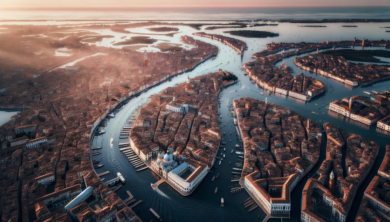
Landing at VCE
LEFTLeft side provides the best approach views into Venice. As the aircraft descends toward Tessera, the left wing reveals the Venetian Lagoon, the barrier islands (Lido and Pellestrina), and the distinctive pattern of canals and islands that form Venice itself.
Will your flight be in sunlight?
Pick a date and time in the Sun Map to watch the sun move across your whole flight.
About This Route
Which side of the plane should I sit on flying from Helsinki Vantaa (HEL) to Venezia Tessera (VCE)?
Sit on the Left side of the plane for the best views on flights from Helsinki to Venice. While right offers excellent departure views over the Finnish archipelago, left provides superior scenery for the majority of the flight and the entire landing sequence. The approach into Venice from the left side is genuinely spectacular and compensates for missing the takeoff views.
What can I see during takeoff from Helsinki Vantaa in Helsinki?
During takeoff from Helsinki Vantaa (HEL), sit on the Right side for the best views. Right side captures the Gulf of Finland and the archipelago east of Helsinki as the aircraft climbs southwestward. You'll see the complex pattern of islands and waterways that define the Finnish coastline immediately after departure. Notable sights include: Gulf of Finland, Helsinki archipelago (Suomenlinna visible as islands), Lake Tuusula to the north, Finnish mainland forests.
What can I see when landing at Venezia Tessera in Venice?
When landing at Venezia Tessera (VCE), sit on the Left side for the best views. Left side provides the best approach views into Venice. As the aircraft descends toward Tessera, the left wing reveals the Venetian Lagoon, the barrier islands (Lido and Pellestrina), and the distinctive pattern of canals and islands that form Venice itself. Notable sights include: Venetian Lagoon, Venice city islands, Lido barrier island, Adriatic Sea coastline.
How long is the flight from Helsinki to Venice?
The flight from Helsinki Vantaa (HEL) to Venezia Tessera (VCE) takes about 3 hours 15 minutes. The shortest flight path between them is 1,146 miles (1,844 km); winds and air traffic control usually add a few percent.
What does the Helsinki to Venice flight path pass over?
The flight path crosses the Baltic Sea, then over Poland and the Carpathian Mountains (visible as a distant ridge on clear days), continues over the Danube River valley in Hungary and Austria, then follows the Dinaric Alps and Italian pre-Alps before descending into the Venetian plain. The Alps become increasingly prominent as you approach Italy, with the Julian Alps visible on the left side during the descent phase.