Right side scores higher (3.5 vs 2.5) due to superior scenic variety across the full flight. Takeoff offers Hong Kong's iconic harbor and mountain scenery; cruise crosses the South China Sea with occasional island views; landing delivers Borneo's dramatic rainforest-to-industrial contrast and Balikpapan Bay's distinctive geography. Left side faces open ocean for most of cruise and lacks the visual drama of either endpoint.
Flown HKG to BPN? Did we get it right?
Flight Path
Hong Kong to Balikpapan is 1,642 miles (2,642 km), a flight of about 4 hours 15 minutes.
South China Sea (open water, occasional small islands and shipping lanes visible), Sulu Archipelago's scattered islands (if visible during daylight), transition from Malaysian/Brunei airspace into Indonesian waters, Makassar Strait approach with Sulawesi's eastern coast visible on far horizon during descent
Great circle distance and headings ›

Phase by phase
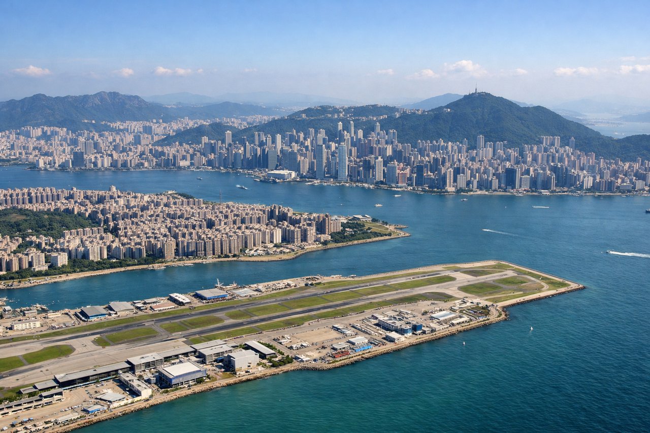
Takeoff from HKG
RIGHTRight side captures Hong Kong's dramatic harbor departure. Depending on runway direction (typically 07 in winter, 25 in summer), the right side offers views of Victoria Harbour, Kowloon Peninsula, and the New Territories' mountainous terrain during initial climb.
Landing at BPN
RIGHTRight side provides superior approach scenery into Balikpapan. The descent path typically follows the Makassar Strait coastline, revealing Borneo's dense rainforest interior, the Balikpapan Bay's distinctive crescent shape, and oil/gas industrial infrastructure along the coast—a dramatic contrast of natural and industrial landscape.
Will your flight be in sunlight?
Pick a date and time in the Sun Map to watch the sun move across your whole flight.
About This Route
Which side of the plane should I sit on flying from Hong Kong International (HKG) to Sultan Aji Muhammad Sulaiman Sepinggan International Airport (BPN)?
Sit on the Right side of the plane for the best views on flights from Hong Kong to Balikpapan. Right side scores higher (3.5 vs 2.5) due to superior scenic variety across the full flight. Takeoff offers Hong Kong's iconic harbor and mountain scenery; cruise crosses the South China Sea with occasional island views; landing delivers Borneo's dramatic rainforest-to-industrial contrast and Balikpapan Bay's distinctive geography. Left side faces open ocean for most of cruise and lacks the visual drama of either endpoint.
What can I see during takeoff from Hong Kong International in Hong Kong?
During takeoff from Hong Kong International (HKG), sit on the Right side for the best views. Right side captures Hong Kong's dramatic harbor departure. Depending on runway direction (typically 07 in winter, 25 in summer), the right side offers views of Victoria Harbour, Kowloon Peninsula, and the New Territories' mountainous terrain during initial climb. Notable sights include: Victoria Harbour with Star Ferry routes, Kowloon skyline, New Territories mountains (up to 3,000 ft elevation), Hong Kong Island's northern coast.
What can I see when landing at Sultan Aji Muhammad Sulaiman Sepinggan International Airport in Balikpapan?
When landing at Sultan Aji Muhammad Sulaiman Sepinggan International Airport (BPN), sit on the Right side for the best views. Right side provides superior approach scenery into Balikpapan. The descent path typically follows the Makassar Strait coastline, revealing Borneo's dense rainforest interior, the Balikpapan Bay's distinctive crescent shape, and oil/gas industrial infrastructure along the coast—a dramatic contrast of natural and industrial landscape. Notable sights include: Balikpapan Bay's crescent shoreline, Borneo rainforest canopy (dark green, continuous), Makassar Strait's deep blue waters, coastal oil and gas facilities near the airport.
How long is the flight from Hong Kong to Balikpapan?
The flight from Hong Kong International (HKG) to Sultan Aji Muhammad Sulaiman Sepinggan International Airport (BPN) takes about 4 hours 15 minutes. The shortest flight path between them is 1,642 miles (2,642 km); winds and air traffic control usually add a few percent.
What does the Hong Kong to Balikpapan flight path pass over?
South China Sea (open water, occasional small islands and shipping lanes visible), Sulu Archipelago's scattered islands (if visible during daylight), transition from Malaysian/Brunei airspace into Indonesian waters, Makassar Strait approach with Sulawesi's eastern coast visible on far horizon during descent