Phuket to Seoul is 2,684 miles (4,320 km), a flight of about 5 hours.
Right seats capture the more dramatic geography on departure (Phang Nga Bay karsts and Andaman Sea), while the landing view is less visually distinctive. The takeoff experience outweighs the landing advantage for left seats on this route.
Flight Path
The flight path crosses the Gulf of Thailand, then the Malay Peninsula's interior (visible as forested terrain), then over the Andaman Sea and Bay of Bengal. Around the midpoint near the Myanmar-Thailand border region, you'll see the Tenasserim Range as a distant mountain line. Crossing into the Bay of Bengal, the landscape becomes open water for several hours. As you approach South Korea, the Korean Peninsula's mountainous spine (Taebaek Mountains) becomes visible on the right side during descent, with the Yellow Sea to the left.
Great circle distance and headings ›Phase by phase
Takeoff from HKT
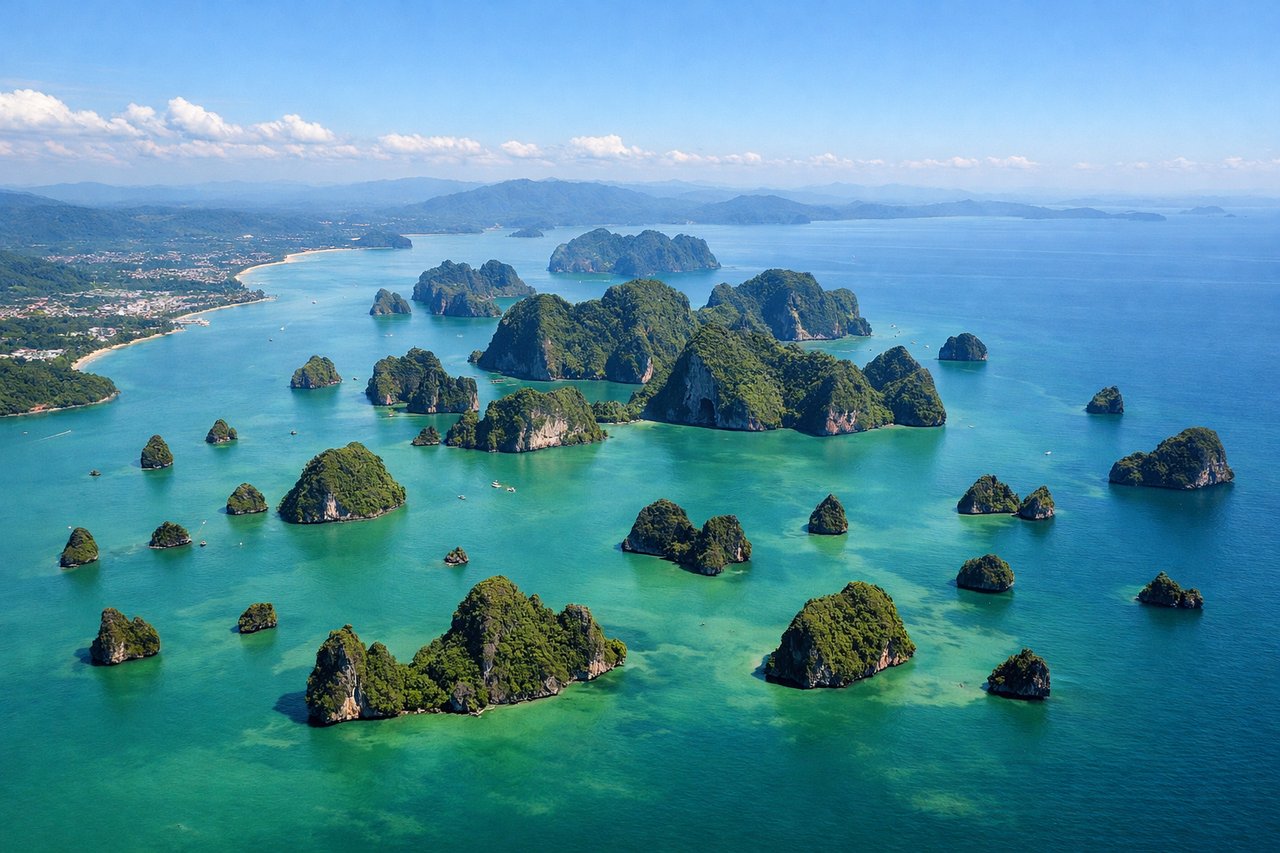
RIGHTPhuket typically departs runway 09 (westbound) or 27 (eastbound). Right-side seats on an eastbound departure (27) offer views of Phang Nga Bay's limestone karsts and the Andaman Sea. Westbound departures (09) favor left seats, but eastbound is more common for northbound traffic to Seoul, making right the better general choice.
Landing at ICN
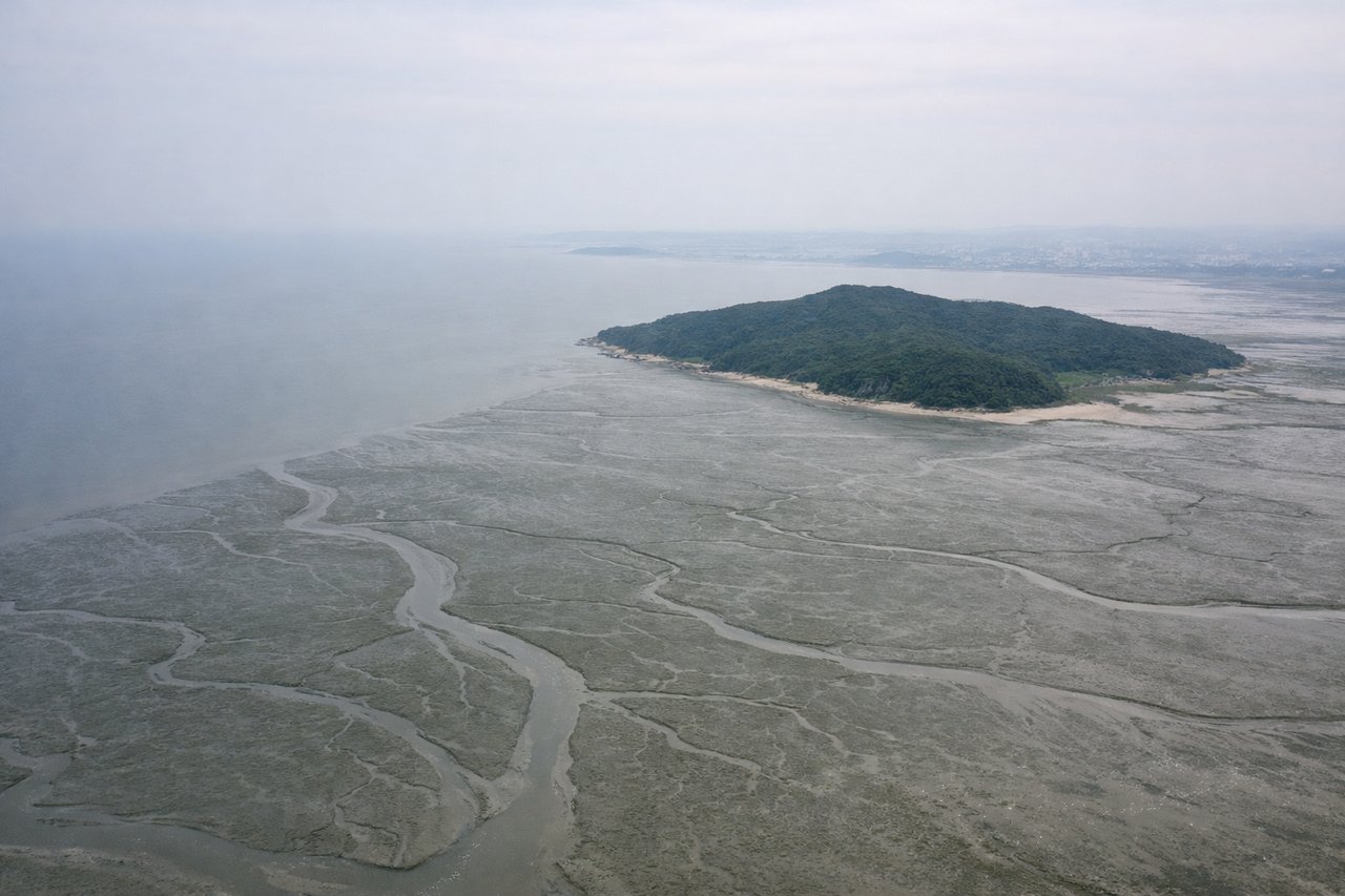
LEFTIncheon typically uses runways 03L/03R (northbound) or 15L/15R (southbound) depending on wind. Northbound approaches (03L/03R) favor left seats with views of the Yellow Sea, Incheon's reclaimed land areas, and the Han River estuary. This is the standard approach for traffic from the south, offering extended views of the coastal approach.
Landmarks on this routeAll landmarks →
Will your flight be in sunlight?
Pick a date and time in the Sun Map to watch the sun move across your whole flight.
About This Route
Which side of the plane should I sit on flying from Phuket International (HKT) to Incheon International (ICN)?
Sit on the Right side of the plane for the best views on flights from Phuket to Seoul. Right seats capture the more dramatic geography on departure (Phang Nga Bay karsts and Andaman Sea), while the landing view is less visually distinctive. The takeoff experience outweighs the landing advantage for left seats on this route.
What can I see during takeoff from Phuket International in Phuket?
During takeoff from Phuket International (HKT), sit on the Right side for the best views. Phuket typically departs runway 09 (westbound) or 27 (eastbound). Right-side seats on an eastbound departure (27) offer views of Phang Nga Bay's limestone karsts and the Andaman Sea. Westbound departures (09) favor left seats, but eastbound is more common for northbound traffic to Seoul, making right the better general choice. Notable sights include: Phang Nga Bay with distinctive limestone pinnacles (Khao Phing Kan visible as a dramatic rock formation), Andaman Sea, Phuket Town to the southeast, Patong Beach area along the western coast.
What can I see when landing at Incheon International in Seoul?
When landing at Incheon International (ICN), sit on the Left side for the best views. Incheon typically uses runways 03L/03R (northbound) or 15L/15R (southbound) depending on wind. Northbound approaches (03L/03R) favor left seats with views of the Yellow Sea, Incheon's reclaimed land areas, and the Han River estuary. This is the standard approach for traffic from the south, offering extended views of the coastal approach. Notable sights include: Yellow Sea (Hwanghae), Incheon's extensive reclaimed land and industrial zones, Han River estuary, Seoul metropolitan area skyline in the distance.
How long is the flight from Phuket to Seoul?
The flight from Phuket International (HKT) to Incheon International (ICN) takes about 5 hours. The shortest flight path between them is 2,684 miles (4,320 km); winds and air traffic control usually add a few percent.
What does the Phuket to Seoul flight path pass over?
The flight path crosses the Gulf of Thailand, then the Malay Peninsula's interior (visible as forested terrain), then over the Andaman Sea and Bay of Bengal. Around the midpoint near the Myanmar-Thailand border region, you'll see the Tenasserim Range as a distant mountain line. Crossing into the Bay of Bengal, the landscape becomes open water for several hours. As you approach South Korea, the Korean Peninsula's mountainous spine (Taebaek Mountains) becomes visible on the right side during descent, with the Yellow Sea to the left.