Honolulu to Burbank is 2,559 miles (4,118 km), a flight of about 5 hours 15 minutes.
Right-side seats win for the dramatic departure views of Oahu's windward mountains, which are the most visually striking segment of this route. The landing approach into Burbank offers comparable views from either side, but the takeoff advantage tips the overall recommendation to right.
Flight Path
The flight path crosses the central Pacific with no significant landmarks visible for roughly 4 hours. Pilots navigate via ocean waypoints. As the aircraft approaches the California coast near Point Conception, the Channel Islands may be visible in clear conditions. The Sierra Nevada mountains appear on the horizon to the east during the final descent phase, but are not the primary visual feature. The approach into Burbank brings views of the San Gabriel Mountains and the Los Angeles basin as described above.
Great circle distance and headings ›
.jpg?width=600)
Phase by phase
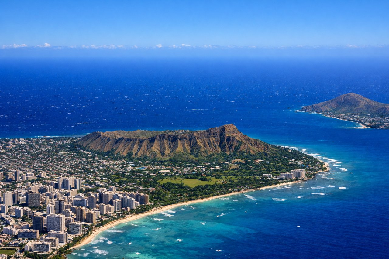
Takeoff from HNL
RIGHTRight-side seats capture the Ko'olau mountain range rising dramatically from the windward side of Oahu, and the Kailua Bay area as the aircraft climbs northeast on typical departure routing. Left side faces the open Pacific immediately after departure.
Landing at BUR
LEFTLeft-side seats provide the best view of the San Gabriel Mountains and the Los Angeles basin sprawl during descent into Burbank. Aircraft typically approach from the east or northeast, and left-side windows frame the mountain range and the urban grid of the San Fernando Valley.
Landmarks on this routeAll landmarks →
Will your flight be in sunlight?
Pick a date and time in the Sun Map to watch the sun move across your whole flight.
About This Route
Which side of the plane should I sit on flying from Honolulu International (HNL) to Burbank Glendale Pasadena (BUR)?
Sit on the Right side of the plane for the best views on flights from Honolulu to Burbank. Right-side seats win for the dramatic departure views of Oahu's windward mountains, which are the most visually striking segment of this route. The landing approach into Burbank offers comparable views from either side, but the takeoff advantage tips the overall recommendation to right.
What can I see during takeoff from Honolulu International in Honolulu?
During takeoff from Honolulu International (HNL), sit on the Right side for the best views. Right-side seats capture the Ko'olau mountain range rising dramatically from the windward side of Oahu, and the Kailua Bay area as the aircraft climbs northeast on typical departure routing. Left side faces the open Pacific immediately after departure. Notable sights include: Ko'olau mountain range (windward Oahu), Kailua Bay, Kaneohe Bay, Mokapu Peninsula.
What can I see when landing at Burbank Glendale Pasadena in Burbank?
When landing at Burbank Glendale Pasadena (BUR), sit on the Left side for the best views. Left-side seats provide the best view of the San Gabriel Mountains and the Los Angeles basin sprawl during descent into Burbank. Aircraft typically approach from the east or northeast, and left-side windows frame the mountain range and the urban grid of the San Fernando Valley. Notable sights include: San Gabriel Mountains, Los Angeles basin urban sprawl, San Fernando Valley, Verdugo Mountains.
How long is the flight from Honolulu to Burbank?
The flight from Honolulu International (HNL) to Burbank Glendale Pasadena (BUR) takes about 5 hours 15 minutes. The shortest flight path between them is 2,559 miles (4,118 km); winds and air traffic control usually add a few percent.
What does the Honolulu to Burbank flight path pass over?
The flight path crosses the central Pacific with no significant landmarks visible for roughly 4 hours. Pilots navigate via ocean waypoints. As the aircraft approaches the California coast near Point Conception, the Channel Islands may be visible in clear conditions. The Sierra Nevada mountains appear on the horizon to the east during the final descent phase, but are not the primary visual feature. The approach into Burbank brings views of the San Gabriel Mountains and the Los Angeles basin as described above.