Left seats provide superior views on both legs: windward Oahu's dramatic cliffs during departure and the Río de la Plata estuary during arrival. The landing view is particularly rewarding given the estuary's scale and visual distinctiveness.
Flight Path
The flight path crosses the equator over the central Pacific, passing south of the Galápagos Islands (not visible at cruise altitude). The route then tracks toward South America, passing east of the Andes Mountains (visible as a distant ridge on the western horizon during descent into Buenos Aires). The southern Pacific and Atlantic crossings offer minimal landmark visibility at cruise altitude, though occasional island groups (Marquesas, Society Islands) may be visible on clear days during the first 6-8 hours. The approach to South America reveals the Pampas' flat terrain and the Paraná River system before reaching the Río de la Plata.
Great circle distance and headings ›
.jpg?width=600)


_(cropped).jpg?width=600)
Phase by phase
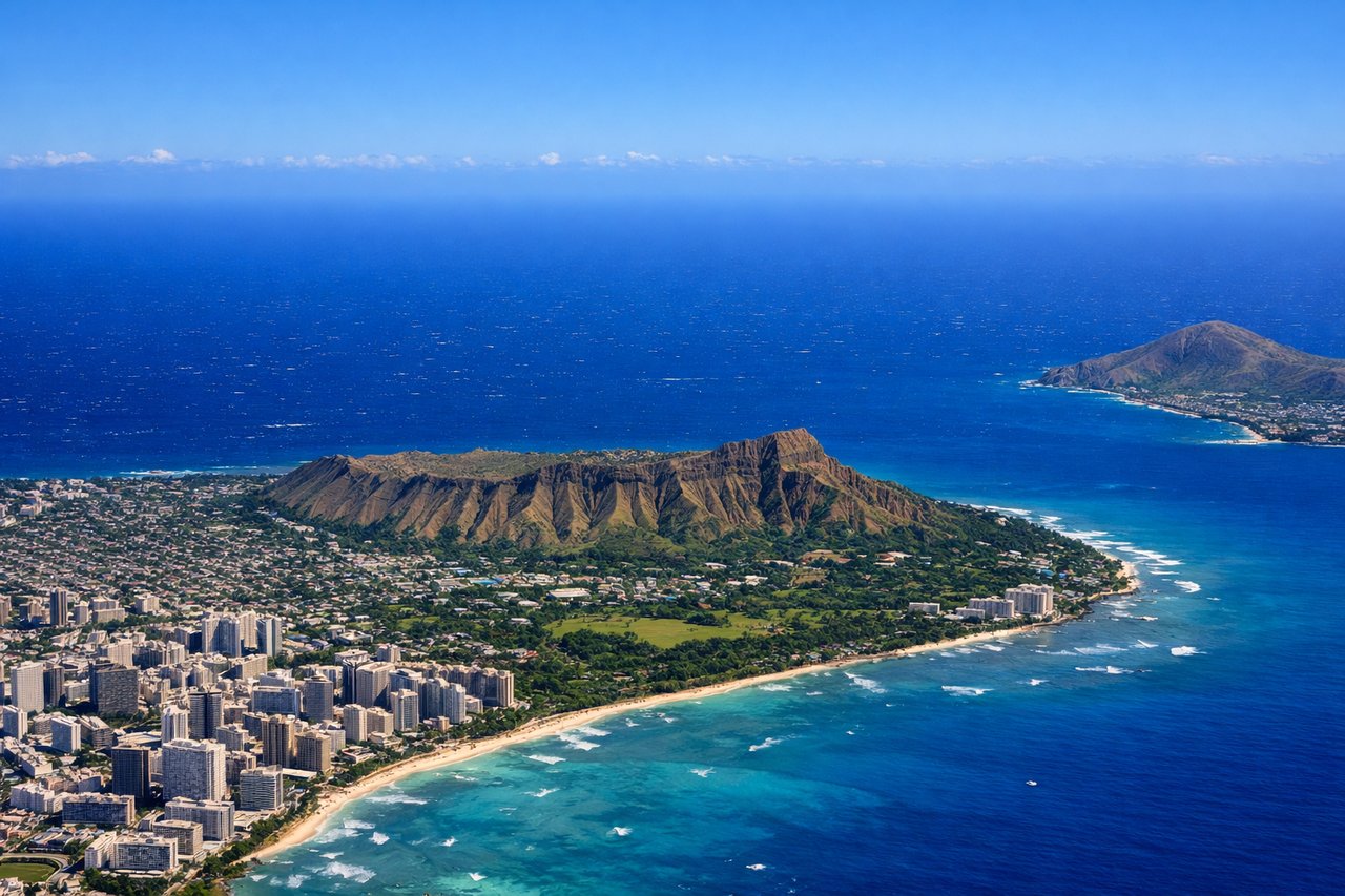
Takeoff from HNL
RIGHTHonolulu typically departs runway 08L/08R (eastbound) or 26L/26R (westbound). Right seats on eastbound departures offer views of the Ko'olau Range and windward Oahu's dramatic cliffs. Westbound departures favor right seats for views of Pearl Harbor and the Waianae Range.

Landing at EZE
LEFTEzeiza typically uses runways 09/27 (east-west). Left seats on approach from the north offer views of the Río de la Plata estuary, Buenos Aires city sprawl, and the flat Pampas landscape. Descending from the northwest provides the best perspective of the river's muddy waters and the transition from urban to agricultural terrain.
Landmarks on this routeAll landmarks →
Will your flight be in sunlight?
See exactly which side of the plane gets sun and shade at your departure time.
About This Route
Which side of the plane should I sit on flying from Honolulu International (HNL) to Ezeiza Ministro Pistarini (EZE)?
Sit on the Left side of the plane for the best views on flights from Honolulu to Buenos Aires. Left seats provide superior views on both legs: windward Oahu's dramatic cliffs during departure and the Río de la Plata estuary during arrival. The landing view is particularly rewarding given the estuary's scale and visual distinctiveness.
What can I see during takeoff from Honolulu International in Honolulu?
During takeoff from Honolulu International (HNL), sit on the Right side for the best views. Honolulu typically departs runway 08L/08R (eastbound) or 26L/26R (westbound). Right seats on eastbound departures offer views of the Ko'olau Range and windward Oahu's dramatic cliffs. Westbound departures favor right seats for views of Pearl Harbor and the Waianae Range. Notable sights include: Ko'olau Range (jagged volcanic ridgeline dominating windward Oahu), Pearl Harbor (visible as geometric water body with military installations), Waianae Range (western volcanic ridge), Diamond Head (distinctive tuff cone on southeast coast).
What can I see when landing at Ezeiza Ministro Pistarini in Buenos Aires?
When landing at Ezeiza Ministro Pistarini (EZE), sit on the Left side for the best views. Ezeiza typically uses runways 09/27 (east-west). Left seats on approach from the north offer views of the Río de la Plata estuary, Buenos Aires city sprawl, and the flat Pampas landscape. Descending from the northwest provides the best perspective of the river's muddy waters and the transition from urban to agricultural terrain. Notable sights include: Río de la Plata (massive brown-silted estuary, 35+ miles wide), Buenos Aires urban grid (visible as geometric street pattern and high-rise clusters), Pampas grasslands (flat, agricultural terrain extending to horizon), Paraná River delta (visible as braided waterways north of approach path).
How long is the flight from Honolulu to Buenos Aires?
The flight from Honolulu International (HNL) to Ezeiza Ministro Pistarini (EZE) takes Approximately 13.5 to 14.5 hours.
What does the Honolulu to Buenos Aires flight path pass over?
The flight path crosses the equator over the central Pacific, passing south of the Galápagos Islands (not visible at cruise altitude). The route then tracks toward South America, passing east of the Andes Mountains (visible as a distant ridge on the western horizon during descent into Buenos Aires). The southern Pacific and Atlantic crossings offer minimal landmark visibility at cruise altitude, though occasional island groups (Marquesas, Society Islands) may be visible on clear days during the first 6-8 hours. The approach to South America reveals the Pampas' flat terrain and the Paraná River system before reaching the Río de la Plata.