While left seats dominate the Buenos Aires departure, right seats provide the more dramatic and visually rewarding arrival over Oahu's mountain scenery. The landing view outweighs the takeoff advantage.
Flight Path
The flight path crosses the South Atlantic over open ocean with no visible landmarks for approximately 8 hours. The aircraft passes south of the Falkland Islands (not directly visible on typical routing) and crosses the Drake Passage region. After crossing into the Pacific near Easter Island's longitude, the flight continues over featureless open ocean for the remainder of the journey toward Hawaii. No significant geographic features are visible during the midpoint portion of this transoceanic route.
Great circle distance and headings ›_(cropped).jpg?width=600)


.jpg?width=600)

Phase by phase

Takeoff from EZE
LEFTLeft seats offer views of the Río de la Plata estuary and the Buenos Aires metropolitan area as the aircraft climbs northwestward. Right seats face inland toward flat pampas with minimal visual interest during initial climb.
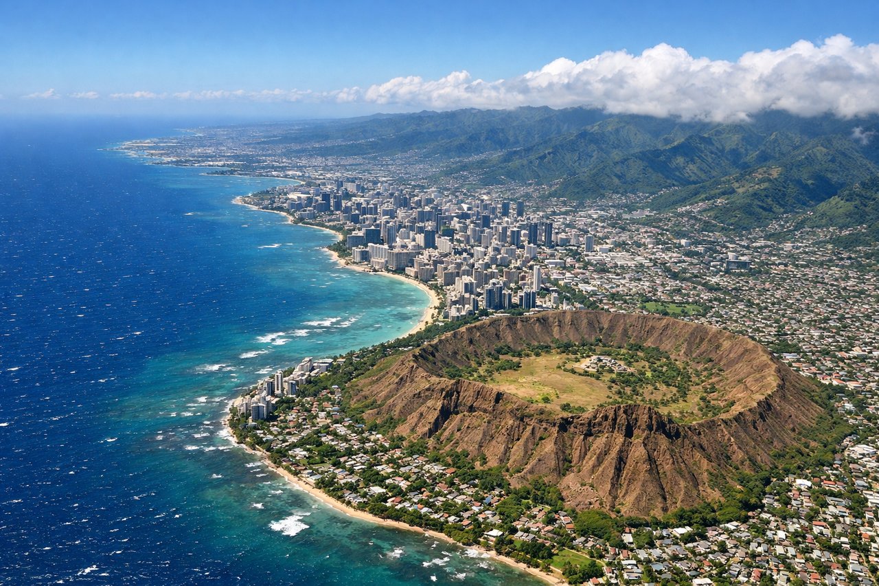
Landing at HNL
RIGHTRight seats provide views of the Ko'olau and Waianae mountain ranges framing Honolulu as the aircraft descends toward the island. Left seats face the open Pacific with minimal landmarks during final approach.
Landmarks on this routeAll landmarks →
Will your flight be in sunlight?
See exactly which side of the plane gets sun and shade at your departure time.
About This Route
Which side of the plane should I sit on flying from Ezeiza Ministro Pistarini (EZE) to Honolulu International (HNL)?
Sit on the Right side of the plane for the best views on flights from Buenos Aires to Honolulu. While left seats dominate the Buenos Aires departure, right seats provide the more dramatic and visually rewarding arrival over Oahu's mountain scenery. The landing view outweighs the takeoff advantage.
What can I see during takeoff from Ezeiza Ministro Pistarini in Buenos Aires?
During takeoff from Ezeiza Ministro Pistarini (EZE), sit on the Left side for the best views. Left seats offer views of the Río de la Plata estuary and the Buenos Aires metropolitan area as the aircraft climbs northwestward. Right seats face inland toward flat pampas with minimal visual interest during initial climb. Notable sights include: Río de la Plata (wide brown estuary), Buenos Aires city grid and port facilities, Tigre Delta (northern suburb with waterways).
What can I see when landing at Honolulu International in Honolulu?
When landing at Honolulu International (HNL), sit on the Right side for the best views. Right seats provide views of the Ko'olau and Waianae mountain ranges framing Honolulu as the aircraft descends toward the island. Left seats face the open Pacific with minimal landmarks during final approach. Notable sights include: Ko'olau mountain range (windward side, northeast), Waianae mountain range (leeward side, west), Honolulu city and harbor, Diamond Head crater.
How long is the flight from Buenos Aires to Honolulu?
The flight from Ezeiza Ministro Pistarini (EZE) to Honolulu International (HNL) takes 10h 45m.
What does the Buenos Aires to Honolulu flight path pass over?
The flight path crosses the South Atlantic over open ocean with no visible landmarks for approximately 8 hours. The aircraft passes south of the Falkland Islands (not directly visible on typical routing) and crosses the Drake Passage region. After crossing into the Pacific near Easter Island's longitude, the flight continues over featureless open ocean for the remainder of the journey toward Hawaii. No significant geographic features are visible during the midpoint portion of this transoceanic route.