The left side wins by combining a scenic Waikiki/Diamond Head departure with a dramatic Mauna Kea-dominated arrival into Hilo, while the right side spends more of the flight over open ocean channel with fewer named landmarks.
Flown HNL to ITO? Did we get it right?
Flight Path
Honolulu to Hilo is 217 miles (349 km), a flight of about 40 minutes.
Alenuihaha Channel between Maui and the Big Island, with Haleakala's summit visible to the north and the northern slopes of Mauna Kea and Mauna Loa rising ahead on the Big Island.
Great circle distance and headings ›


Phase by phase

Takeoff from HNL
LEFTDeparting HNL to the east then turning southeast, the left side offers views back toward Diamond Head and the Waikiki coastline before the aircraft angles toward the outer islands. The turn also brings Molokai's cliffs into view on the left as the plane climbs out over the channel.
Landing at ITO
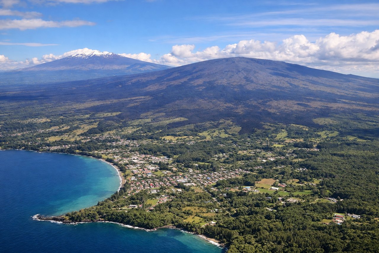
LEFTOn approach to ITO's runway 26, the aircraft descends from the east over open ocean before turning to land heading west, putting the massive shield volcano of Mauna Kea and its snow-capped summit on the left side of the cabin. Passengers also see Hilo Bay and the town's waterfront pass beneath on final approach.
Will your flight be in sunlight?
Pick a date and time in the Sun Map to watch the sun move across your whole flight.
About This Route
Which side of the plane should I sit on flying from Honolulu International (HNL) to Hilo International (ITO)?
Sit on the Left side of the plane for the best views on flights from Honolulu to Hilo. The left side wins by combining a scenic Waikiki/Diamond Head departure with a dramatic Mauna Kea-dominated arrival into Hilo, while the right side spends more of the flight over open ocean channel with fewer named landmarks.
What can I see during takeoff from Honolulu International in Honolulu?
During takeoff from Honolulu International (HNL), sit on the Left side for the best views. Departing HNL to the east then turning southeast, the left side offers views back toward Diamond Head and the Waikiki coastline before the aircraft angles toward the outer islands. The turn also brings Molokai's cliffs into view on the left as the plane climbs out over the channel. Notable sights include: Diamond Head, Waikiki coastline, Molokai's south shore, Kaiwi Channel.
What can I see when landing at Hilo International in Hilo?
When landing at Hilo International (ITO), sit on the Left side for the best views. On approach to ITO's runway 26, the aircraft descends from the east over open ocean before turning to land heading west, putting the massive shield volcano of Mauna Kea and its snow-capped summit on the left side of the cabin. Passengers also see Hilo Bay and the town's waterfront pass beneath on final approach. Notable sights include: Mauna Kea summit, Hilo Bay, Hamakua coast cliffs, Wailuku River.
How long is the flight from Honolulu to Hilo?
The flight from Honolulu International (HNL) to Hilo International (ITO) takes about 40 minutes. The shortest flight path between them is 217 miles (349 km); winds and air traffic control usually add a few percent.
What does the Honolulu to Hilo flight path pass over?
Alenuihaha Channel between Maui and the Big Island, with Haleakala's summit visible to the north and the northern slopes of Mauna Kea and Mauna Loa rising ahead on the Big Island.