The left side delivers the flight's two most striking landmark clusters — Pearl Harbor, downtown Honolulu, and Diamond Head during takeoff, followed by Kauai's Hoary Head Range and Nawiliwili Bay on arrival — while the right side faces mostly open ocean across the Kauai Channel for the brief cruise portion.
Flown HNL to LIH? Did we get it right?
Flight Path
Honolulu to Lihue is 101 miles (163 km), a flight of about 35 minutes.
Open water of the Kauai Channel separating Oahu and Kauai, with Oahu's Waianae coast fading behind and Kauai's southeastern shoreline and Hoary Head Range emerging ahead.
Great circle distance and headings ›

Phase by phase
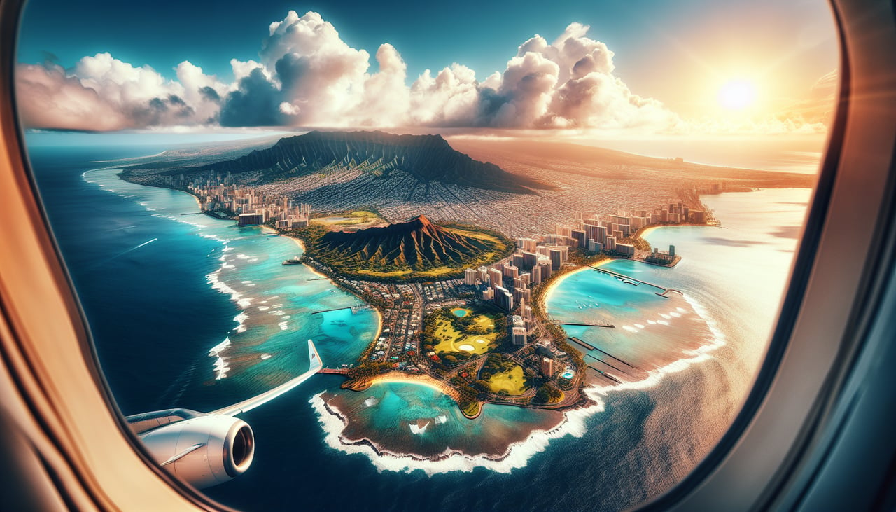
Takeoff from HNL
LEFTHNL departures head east-northeast over the reef runway, putting Pearl Harbor, Ford Island, and the Honolulu skyline directly off the left side as the aircraft climbs. Diamond Head's volcanic crater and the Waikiki coastline come into view further along the same side as the plane continues its climb and begins turning toward Kauai.
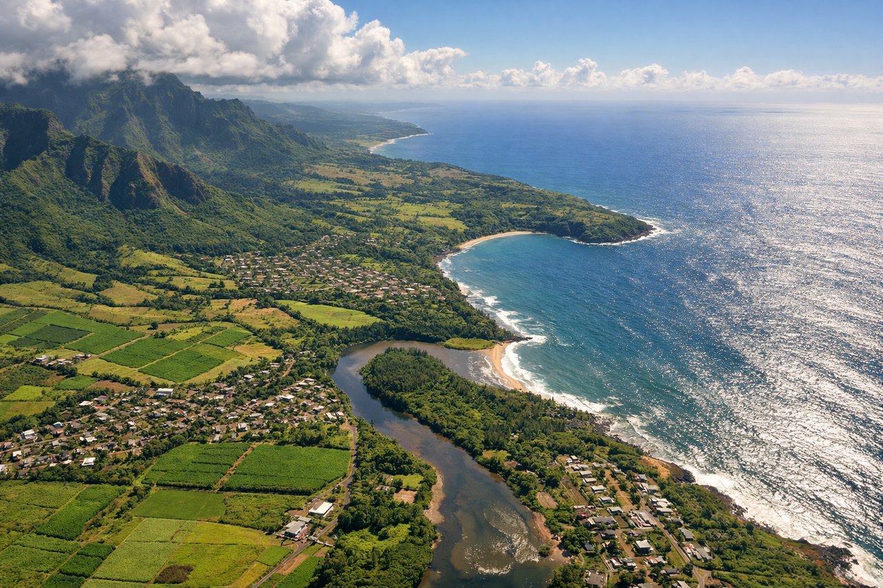
Landing at LIH
LEFTOn the approach into Lihue's Runway 03, the aircraft swings around Kauai's south shore before turning onto final, putting the dramatic green ridgeline of the Hoary Head Range on the left along with glimpses of Nawiliwili Bay and Kalapaki Beach just before touchdown. The right side mostly faces open ocean during this turn.
Will your flight be in sunlight?
Pick a date and time in the Sun Map to watch the sun move across your whole flight.
About This Route
Which side of the plane should I sit on flying from Honolulu International (HNL) to Lihue (LIH)?
Sit on the Left side of the plane for the best views on flights from Honolulu to Lihue. The left side delivers the flight's two most striking landmark clusters — Pearl Harbor, downtown Honolulu, and Diamond Head during takeoff, followed by Kauai's Hoary Head Range and Nawiliwili Bay on arrival — while the right side faces mostly open ocean across the Kauai Channel for the brief cruise portion.
What can I see during takeoff from Honolulu International in Honolulu?
During takeoff from Honolulu International (HNL), sit on the Left side for the best views. HNL departures head east-northeast over the reef runway, putting Pearl Harbor, Ford Island, and the Honolulu skyline directly off the left side as the aircraft climbs. Diamond Head's volcanic crater and the Waikiki coastline come into view further along the same side as the plane continues its climb and begins turning toward Kauai. Notable sights include: Pearl Harbor and Ford Island, Downtown Honolulu skyline, Diamond Head crater, Waikiki coastline.
What can I see when landing at Lihue in Lihue?
When landing at Lihue (LIH), sit on the Left side for the best views. On the approach into Lihue's Runway 03, the aircraft swings around Kauai's south shore before turning onto final, putting the dramatic green ridgeline of the Hoary Head Range on the left along with glimpses of Nawiliwili Bay and Kalapaki Beach just before touchdown. The right side mostly faces open ocean during this turn. Notable sights include: Hoary Head Range (Haupu Ridge), Nawiliwili Bay, Kalapaki Beach, Lihue's sugar fields.
How long is the flight from Honolulu to Lihue?
The flight from Honolulu International (HNL) to Lihue (LIH) takes about 35 minutes. The shortest flight path between them is 101 miles (163 km); winds and air traffic control usually add a few percent.
What does the Honolulu to Lihue flight path pass over?
Open water of the Kauai Channel separating Oahu and Kauai, with Oahu's Waianae coast fading behind and Kauai's southeastern shoreline and Hoary Head Range emerging ahead.