Both sides spend the vast majority of this ultra-long transpacific crossing over open ocean with nothing to see, capping the score, but the right side edges ahead thanks to the more dramatic and iconic Diamond Head/Waikiki departure sequence out of Honolulu.
Flight Path
The route crosses over 4,500 nautical miles of open central Pacific Ocean with no landmasses visible for most of the flight, passing well north of the Marshall Islands and south of the main Hawaiian-to-Japan shipping lanes before reaching the Philippine Sea and descending toward Luzon.
Great circle distance and headings ›Phase by phase
Takeoff from HNL
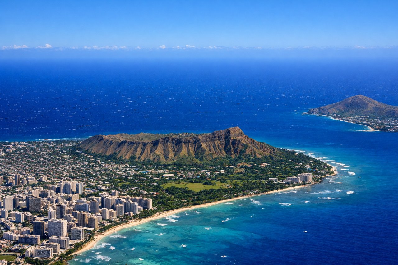
RIGHTDeparting HNL on the trade-wind runway (08), the aircraft climbs east over the ocean before turning south and west toward Manila, swinging past Oahu's south shore. Right-side (south-facing) passengers get a clear look at Diamond Head crater and the Waikiki hotel strip as the plane banks around the island.
Landing at MNL
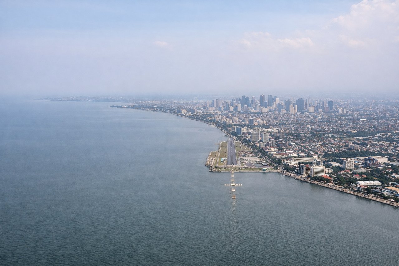
LEFTOn approach to NAIA runway 06 during the Amihan season, the aircraft crosses Manila Bay heading northeast, giving left-side passengers views of Corregidor Island and the Bataan Peninsula before the Manila skyline comes into view ahead as the plane lines up for landing.
Landmarks on this routeAll landmarks →
Will your flight be in sunlight?
See exactly which side of the plane gets sun and shade at your departure time.
About This Route
Which side of the plane should I sit on flying from Honolulu International (HNL) to Ninoy Aquino International (MNL)?
Sit on the Right side of the plane for the best views on flights from Honolulu to Manila. Both sides spend the vast majority of this ultra-long transpacific crossing over open ocean with nothing to see, capping the score, but the right side edges ahead thanks to the more dramatic and iconic Diamond Head/Waikiki departure sequence out of Honolulu.
What can I see during takeoff from Honolulu International in Honolulu?
During takeoff from Honolulu International (HNL), sit on the Right side for the best views. Departing HNL on the trade-wind runway (08), the aircraft climbs east over the ocean before turning south and west toward Manila, swinging past Oahu's south shore. Right-side (south-facing) passengers get a clear look at Diamond Head crater and the Waikiki hotel strip as the plane banks around the island. Notable sights include: Diamond Head Crater, Waikiki Beach, Honolulu/Ala Moana skyline, Koko Head in the distance.
What can I see when landing at Ninoy Aquino International in Manila?
When landing at Ninoy Aquino International (MNL), sit on the Left side for the best views. On approach to NAIA runway 06 during the Amihan season, the aircraft crosses Manila Bay heading northeast, giving left-side passengers views of Corregidor Island and the Bataan Peninsula before the Manila skyline comes into view ahead as the plane lines up for landing. Notable sights include: Corregidor Island, Bataan Peninsula, Manila Bay, Makati/BGC skyline.
How long is the flight from Honolulu to Manila?
The flight from Honolulu International (HNL) to Ninoy Aquino International (MNL) takes 10h 05m.
What does the Honolulu to Manila flight path pass over?
The route crosses over 4,500 nautical miles of open central Pacific Ocean with no landmasses visible for most of the flight, passing well north of the Marshall Islands and south of the main Hawaiian-to-Japan shipping lanes before reaching the Philippine Sea and descending toward Luzon.