While the left side offers good DC departure views, the right side delivers the more dramatic and sustained scenery, particularly the Andes arrival into Lima which is one of the more visually striking airport approaches in South America. The right side also tracks the Caribbean coastline and Colombian/Ecuadorian Andes during the cruise portion.
Flown IAD to LIM? Did we get it right?
Flight Path
Washington to Lima is 3,522 miles (5,667 km), a flight of about 8 hours 30 minutes.
The flight tracks south-southeast over the Caribbean Sea, crossing Cuba and the western Caribbean. It then crosses Colombia and Ecuador, with the northern Andes visible on the right side — the Cordillera de los Andes including peaks around Bogota and Quito may be visible on clear days. The Amazon basin's vast green canopy appears briefly before the terrain rises again toward the Peruvian coast.
Great circle distance and headings ›Phase by phase
Takeoff from IAD
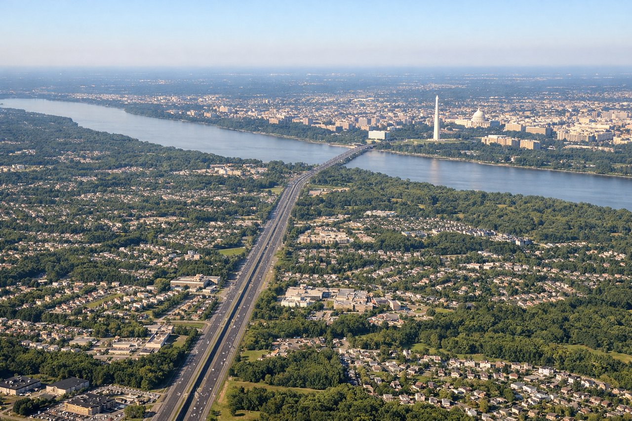
LEFTDulles typically departs on runway 01R/19L or 01L/19R. Northbound departures heading toward the southeast turn give the left side views over the DC metro area. On a southbound departure, the left side tracks over the Virginia suburbs and eventually picks up the Potomac River and the DC skyline to the northeast as the aircraft banks.
Landing at LIM
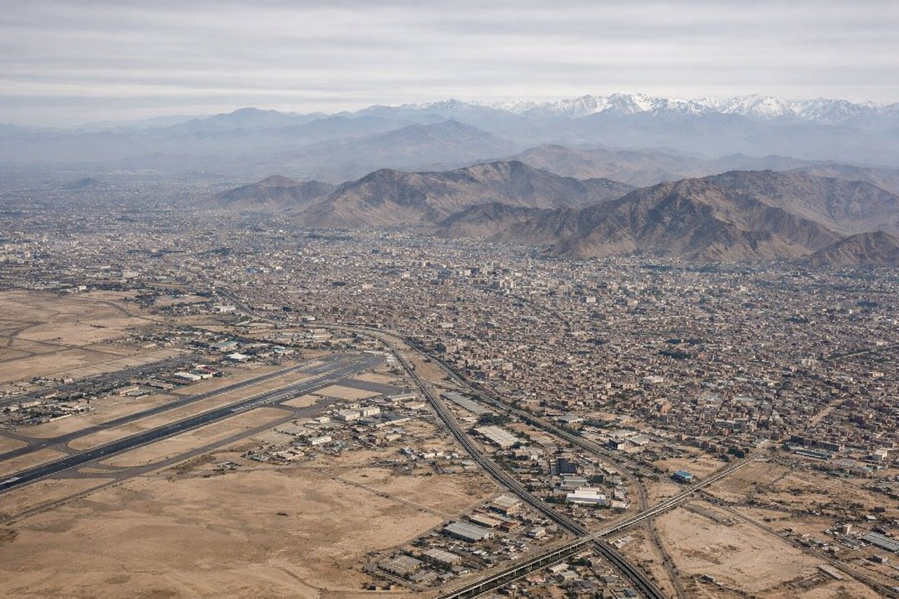
RIGHTJorge Chavez primarily uses runway 15/33. On the common approach from the north on runway 33, aircraft track southward over the Pacific coast. The right side faces east toward the Andes, giving dramatic views of the Cordillera Occidental rising sharply from the coastal desert, with Lima's urban sprawl visible below and the snow-capped peaks of Nevado Ticlio and surrounding summits on the horizon.
Will your flight be in sunlight?
Pick a date and time in the Sun Map to watch the sun move across your whole flight.
About This Route
Which side of the plane should I sit on flying from Washington Dulles International (IAD) to Jorge Chávez International Airport (LIM)?
Sit on the Right side of the plane for the best views on flights from Washington to Lima. While the left side offers good DC departure views, the right side delivers the more dramatic and sustained scenery, particularly the Andes arrival into Lima which is one of the more visually striking airport approaches in South America. The right side also tracks the Caribbean coastline and Colombian/Ecuadorian Andes during the cruise portion.
What can I see during takeoff from Washington Dulles International in Washington?
During takeoff from Washington Dulles International (IAD), sit on the Left side for the best views. Dulles typically departs on runway 01R/19L or 01L/19R. Northbound departures heading toward the southeast turn give the left side views over the DC metro area. On a southbound departure, the left side tracks over the Virginia suburbs and eventually picks up the Potomac River and the DC skyline to the northeast as the aircraft banks. Notable sights include: Potomac River, Washington DC Mall and monuments, Blue Ridge Mountains to the west, Chesapeake Bay in the distance.
What can I see when landing at Jorge Chávez International Airport in Lima?
When landing at Jorge Chávez International Airport (LIM), sit on the Right side for the best views. Jorge Chavez primarily uses runway 15/33. On the common approach from the north on runway 33, aircraft track southward over the Pacific coast. The right side faces east toward the Andes, giving dramatic views of the Cordillera Occidental rising sharply from the coastal desert, with Lima's urban sprawl visible below and the snow-capped peaks of Nevado Ticlio and surrounding summits on the horizon. Notable sights include: Cordillera Occidental of the Andes, Lima urban sprawl and coastal cliffs, Pacific Ocean coastline, Rimac River valley.
How long is the flight from Washington to Lima?
The flight from Washington Dulles International (IAD) to Jorge Chávez International Airport (LIM) takes about 8 hours 30 minutes. The shortest flight path between them is 3,522 miles (5,667 km); winds and air traffic control usually add a few percent.
What does the Washington to Lima flight path pass over?
The flight tracks south-southeast over the Caribbean Sea, crossing Cuba and the western Caribbean. It then crosses Colombia and Ecuador, with the northern Andes visible on the right side — the Cordillera de los Andes including peaks around Bogota and Quito may be visible on clear days. The Amazon basin's vast green canopy appears briefly before the terrain rises again toward the Peruvian coast.