The left side captures the dramatic Washington DC departure view with the Potomac and the Mall, and through the cruise phase tracks the Appalachian ridgelines of Maryland and Pennsylvania to the west. The right side wins at landing but the takeoff spectacle from the left is the highlight of this short route.
Flown IAD to YOW? Did we get it right?
Flight Path
Washington to Ottawa is 450 miles (724 km), a flight of about 1 hour 10 minutes.
The flight crosses the Maryland suburbs north of DC, then the rolling farmland and forested ridges of central Maryland and southern Pennsylvania. Over Pennsylvania the route passes near the Susquehanna River valley, a broad agricultural lowland visible from altitude. Crossing into New York state the terrain becomes more forested Appalachian plateau before descending over the St. Lawrence lowlands into the Ottawa Valley.
Great circle distance and headings ›Phase by phase
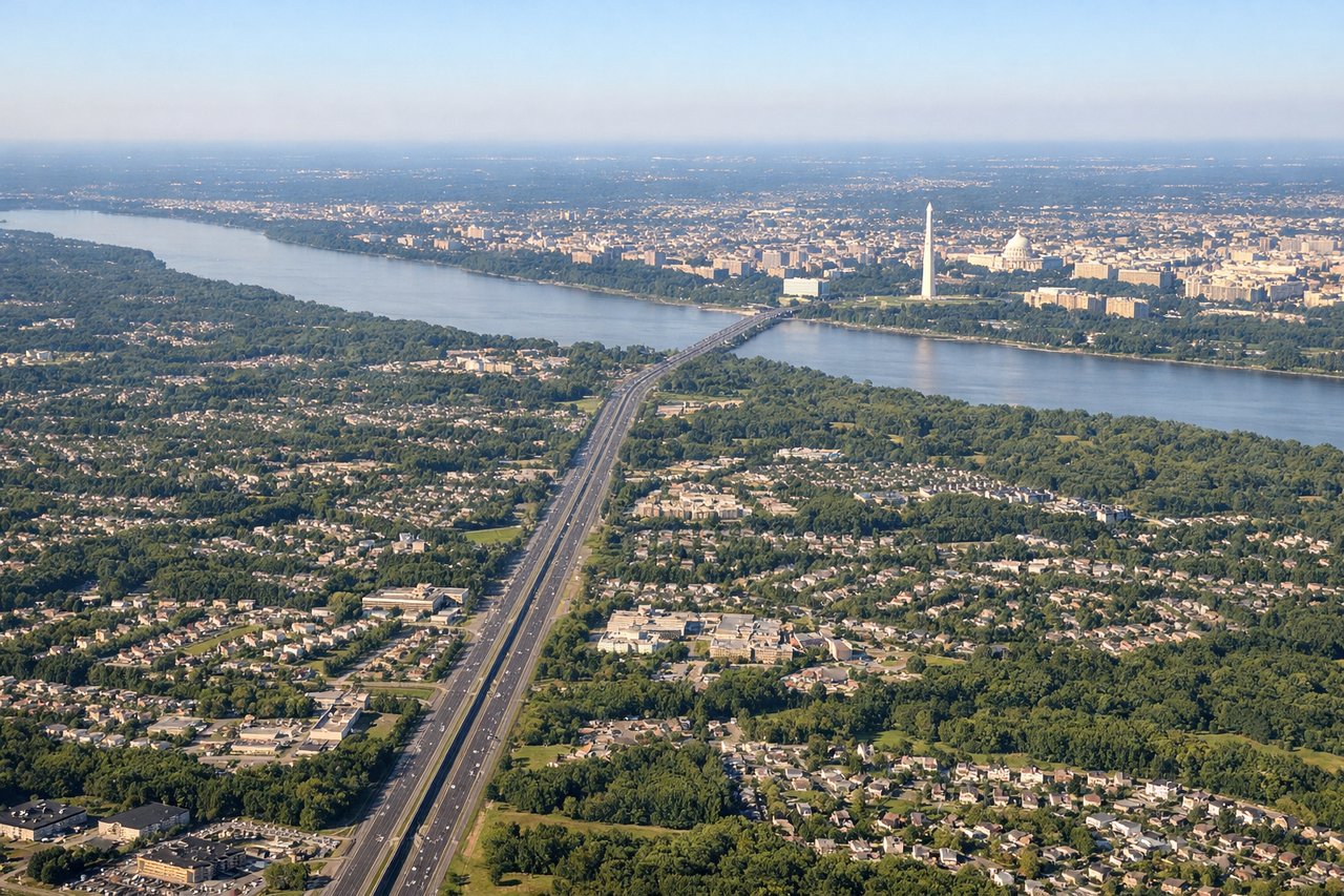
Takeoff from IAD
LEFTDulles typically departs east on runways 01L/01R or west on 19L/19R. On the dominant eastward departure heading, the left (north) side gives you a clear view over the Virginia suburbs toward the Potomac River and the Washington DC skyline in the distance. The Capitol dome, Washington Monument, and the broad sweep of the Mall are identifiable on clear days as you climb out.
Landing at YOW
RIGHTOttawa Macdonald-Cartier typically lands on runway 25 (heading west) or runway 07 (heading east). On the common westward approach to runway 25, the right (north) side looks across the Ottawa River and directly toward downtown Ottawa, with Parliament Hill's Gothic Revival buildings clearly visible on the river's south bank. The Gatineau Hills rise behind the city to the north.
Will your flight be in sunlight?
Pick a date and time in the Sun Map to watch the sun move across your whole flight.
About This Route
Which side of the plane should I sit on flying from Washington Dulles International (IAD) to Ottawa Macdonald Cartier International (YOW)?
Sit on the Left side of the plane for the best views on flights from Washington to Ottawa. The left side captures the dramatic Washington DC departure view with the Potomac and the Mall, and through the cruise phase tracks the Appalachian ridgelines of Maryland and Pennsylvania to the west. The right side wins at landing but the takeoff spectacle from the left is the highlight of this short route.
What can I see during takeoff from Washington Dulles International in Washington?
During takeoff from Washington Dulles International (IAD), sit on the Left side for the best views. Dulles typically departs east on runways 01L/01R or west on 19L/19R. On the dominant eastward departure heading, the left (north) side gives you a clear view over the Virginia suburbs toward the Potomac River and the Washington DC skyline in the distance. The Capitol dome, Washington Monument, and the broad sweep of the Mall are identifiable on clear days as you climb out. Notable sights include: Washington DC Mall and Monument corridor, Potomac River, Tysons Corner urban cluster, Reston town center grid.
What can I see when landing at Ottawa Macdonald Cartier International in Ottawa?
When landing at Ottawa Macdonald Cartier International (YOW), sit on the Right side for the best views. Ottawa Macdonald-Cartier typically lands on runway 25 (heading west) or runway 07 (heading east). On the common westward approach to runway 25, the right (north) side looks across the Ottawa River and directly toward downtown Ottawa, with Parliament Hill's Gothic Revival buildings clearly visible on the river's south bank. The Gatineau Hills rise behind the city to the north. Notable sights include: Ottawa River, Parliament Hill on its bluff above the river, Gatineau Hills rolling terrain to the north, Rideau River confluence with the Ottawa River.
How long is the flight from Washington to Ottawa?
The flight from Washington Dulles International (IAD) to Ottawa Macdonald Cartier International (YOW) takes about 1 hour 10 minutes. The shortest flight path between them is 450 miles (724 km); winds and air traffic control usually add a few percent.
What does the Washington to Ottawa flight path pass over?
The flight crosses the Maryland suburbs north of DC, then the rolling farmland and forested ridges of central Maryland and southern Pennsylvania. Over Pennsylvania the route passes near the Susquehanna River valley, a broad agricultural lowland visible from altitude. Crossing into New York state the terrain becomes more forested Appalachian plateau before descending over the St. Lawrence lowlands into the Ottawa Valley.