The left side captures the most dramatic single moment of the flight — Parliament Hill and the Ottawa River on departure — and also tracks the Appalachian foothills through central Pennsylvania and Maryland on the left side as the route trends southwest. The Blue Ridge on landing approach is better from the right, but the Ottawa departure view is the highlight of this short route.
Flown YOW to IAD? Did we get it right?
Flight Path
Ottawa to Washington is 450 miles (724 km), a flight of about 1 hour 25 minutes.
The flight crosses the St. Lawrence lowlands south of Ottawa, then tracks over the Adirondack foothills of upstate New York before crossing into Pennsylvania. The Susquehanna River is visible near Harrisburg. The route then crosses the Maryland Piedmont and the Potomac River before descending into northern Virginia. The Appalachian ridges of the Ridge and Valley province in central Pennsylvania are the most visually distinctive midpoint feature, appearing as parallel forested folds running northeast to southwest.
Great circle distance and headings ›Phase by phase
Takeoff from YOW
LEFTOttawa's dominant runway 25 departure heads southwest, putting the left (south) side facing the Ottawa River and downtown Ottawa. You get a clear view of Parliament Hill, the Rideau Canal, and the river as you climb out over the city.
Landing at IAD
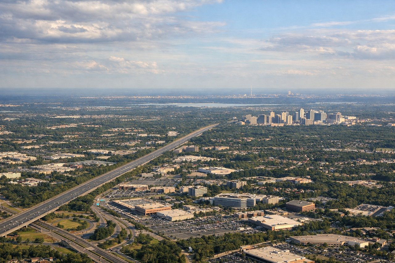
RIGHTDulles typically uses runway 01R/19L or 01L/19R aligned north-south, with most arrivals from the north coming in on a southbound heading. The right (west) side gives you the Blue Ridge Mountains on the horizon and the Virginia Piedmont rolling beneath you, while the left side faces toward the DC suburbs with less dramatic terrain.
Will your flight be in sunlight?
Pick a date and time in the Sun Map to watch the sun move across your whole flight.
About This Route
Which side of the plane should I sit on flying from Ottawa Macdonald Cartier International (YOW) to Washington Dulles International (IAD)?
Sit on the Left side of the plane for the best views on flights from Ottawa to Washington. The left side captures the most dramatic single moment of the flight — Parliament Hill and the Ottawa River on departure — and also tracks the Appalachian foothills through central Pennsylvania and Maryland on the left side as the route trends southwest. The Blue Ridge on landing approach is better from the right, but the Ottawa departure view is the highlight of this short route.
What can I see during takeoff from Ottawa Macdonald Cartier International in Ottawa?
During takeoff from Ottawa Macdonald Cartier International (YOW), sit on the Left side for the best views. Ottawa's dominant runway 25 departure heads southwest, putting the left (south) side facing the Ottawa River and downtown Ottawa. You get a clear view of Parliament Hill, the Rideau Canal, and the river as you climb out over the city. Notable sights include: Parliament Hill on the Ottawa River bluff, Rideau Canal cutting south through downtown, Gatineau Hills across the river to the north visible on climb-out, Ottawa River itself.
What can I see when landing at Washington Dulles International in Washington?
When landing at Washington Dulles International (IAD), sit on the Right side for the best views. Dulles typically uses runway 01R/19L or 01L/19R aligned north-south, with most arrivals from the north coming in on a southbound heading. The right (west) side gives you the Blue Ridge Mountains on the horizon and the Virginia Piedmont rolling beneath you, while the left side faces toward the DC suburbs with less dramatic terrain. Notable sights include: Blue Ridge Mountains on the western horizon, Shenandoah Valley visible beyond the ridgeline, Dulles Toll Road corridor below on final approach, Loudoun County farmland patchwork.
How long is the flight from Ottawa to Washington?
The flight from Ottawa Macdonald Cartier International (YOW) to Washington Dulles International (IAD) takes about 1 hour 25 minutes. The shortest flight path between them is 450 miles (724 km); winds and air traffic control usually add a few percent.
What does the Ottawa to Washington flight path pass over?
The flight crosses the St. Lawrence lowlands south of Ottawa, then tracks over the Adirondack foothills of upstate New York before crossing into Pennsylvania. The Susquehanna River is visible near Harrisburg. The route then crosses the Maryland Piedmont and the Potomac River before descending into northern Virginia. The Appalachian ridges of the Ridge and Valley province in central Pennsylvania are the most visually distinctive midpoint feature, appearing as parallel forested folds running northeast to southwest.