The left side wins on both ends: departure reveals Texas Hill Country and the Sonoran borderlands as the flight path curves south of due-west, and the Honolulu arrival's southern approach loop showcases Diamond Head, Waikiki, and the city skyline, while the right side is dominated by flat plains and featureless ocean.
Flown IAH to HNL? Did we get it right?
Flight Path
Houston to Honolulu is 3,898 miles (6,273 km), a flight of about 7 hours 55 minutes.
The route crosses the Sonoran Desert and northern Mexico's Sierra Madre Occidental foothills before passing near the Baja California peninsula and the Sea of Cortez, then continues over open Pacific Ocean for the remainder of the crossing to Oahu.
Great circle distance and headings ›Phase by phase
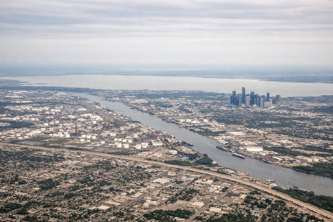
Takeoff from IAH
LEFTAs the flight climbs out of IAH and turns west-southwest toward the Pacific, the great-circle route dips south of a straight westward line, putting the Texas Hill Country and the Rio Grande borderlands on the south-facing left side. The right side mostly shows flat East Texas farmland with little relief.

Landing at HNL
LEFTTrade-wind arrivals into HNL typically loop south of Oahu before turning onto final approach for the 08 runways, putting Diamond Head, Waikiki Beach, and downtown Honolulu on the left side of the aircraft during the turn and descent. The right side mostly faces open ocean and the less developed Koolau mountain slopes.
Will your flight be in sunlight?
Pick a date and time in the Sun Map to watch the sun move across your whole flight.
About This Route
Which side of the plane should I sit on flying from George Bush Intcntl Houston (IAH) to Honolulu International (HNL)?
Sit on the Left side of the plane for the best views on flights from Houston to Honolulu. The left side wins on both ends: departure reveals Texas Hill Country and the Sonoran borderlands as the flight path curves south of due-west, and the Honolulu arrival's southern approach loop showcases Diamond Head, Waikiki, and the city skyline, while the right side is dominated by flat plains and featureless ocean.
What can I see during takeoff from George Bush Intcntl Houston in Houston?
During takeoff from George Bush Intcntl Houston (IAH), sit on the Left side for the best views. As the flight climbs out of IAH and turns west-southwest toward the Pacific, the great-circle route dips south of a straight westward line, putting the Texas Hill Country and the Rio Grande borderlands on the south-facing left side. The right side mostly shows flat East Texas farmland with little relief. Notable sights include: Texas Hill Country, Rio Grande valley, San Antonio area lights, Edwards Plateau escarpment.
What can I see when landing at Honolulu International in Honolulu?
When landing at Honolulu International (HNL), sit on the Left side for the best views. Trade-wind arrivals into HNL typically loop south of Oahu before turning onto final approach for the 08 runways, putting Diamond Head, Waikiki Beach, and downtown Honolulu on the left side of the aircraft during the turn and descent. The right side mostly faces open ocean and the less developed Koolau mountain slopes. Notable sights include: Diamond Head crater, Waikiki Beach, downtown Honolulu skyline, Pearl Harbor.
How long is the flight from Houston to Honolulu?
The flight from George Bush Intcntl Houston (IAH) to Honolulu International (HNL) takes about 7 hours 55 minutes. The shortest flight path between them is 3,898 miles (6,273 km); winds and air traffic control usually add a few percent.
What does the Houston to Honolulu flight path pass over?
The route crosses the Sonoran Desert and northern Mexico's Sierra Madre Occidental foothills before passing near the Baja California peninsula and the Sea of Cortez, then continues over open Pacific Ocean for the remainder of the crossing to Oahu.