The right side wins narrowly thanks to the dramatic Diamond Head and Waikiki view during takeoff, since the rest of the flight — five hours of open Pacific followed by flat Gulf Coast plains into Houston — offers little scenery on either side.
Flown HNL to IAH? Did we get it right?
Flight Path
Honolulu to Houston is 3,898 miles (6,273 km), a flight of about 8 hours 10 minutes.
Open Pacific Ocean for several hours, with the flight path generally staying well offshore of the California coast before crossing the desert Southwest (Arizona/New Mexico) and the flat plains of West Texas en route to Houston.
Great circle distance and headings ›Phase by phase

Takeoff from HNL
RIGHTDeparting HNL's Reef Runway to the east, the right side offers a clear view of Diamond Head crater and the Waikiki shoreline as the aircraft climbs over the south shore of Oahu before turning out to sea.
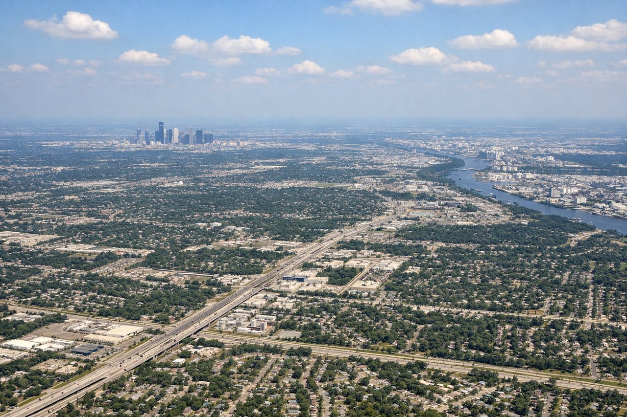
Landing at IAH
LEFTOn approach into IAH from the south, the left side may catch a glimpse of the Houston skyline and the piney, bayou-laced terrain northeast of the city before the flat final approach, offering slightly more visual interest than the featureless right side.
Will your flight be in sunlight?
Pick a date and time in the Sun Map to watch the sun move across your whole flight.
About This Route
Which side of the plane should I sit on flying from Honolulu International (HNL) to George Bush Intcntl Houston (IAH)?
Sit on the Right side of the plane for the best views on flights from Honolulu to Houston. The right side wins narrowly thanks to the dramatic Diamond Head and Waikiki view during takeoff, since the rest of the flight — five hours of open Pacific followed by flat Gulf Coast plains into Houston — offers little scenery on either side.
What can I see during takeoff from Honolulu International in Honolulu?
During takeoff from Honolulu International (HNL), sit on the Right side for the best views. Departing HNL's Reef Runway to the east, the right side offers a clear view of Diamond Head crater and the Waikiki shoreline as the aircraft climbs over the south shore of Oahu before turning out to sea. Notable sights include: Diamond Head crater, Waikiki Beach, Honolulu Harbor, Koolau Range in the distance.
What can I see when landing at George Bush Intcntl Houston in Houston?
When landing at George Bush Intcntl Houston (IAH), sit on the Left side for the best views. On approach into IAH from the south, the left side may catch a glimpse of the Houston skyline and the piney, bayou-laced terrain northeast of the city before the flat final approach, offering slightly more visual interest than the featureless right side. Notable sights include: Downtown Houston skyline, Sam Houston Tollway loop, forested bayous, Lake Houston.
How long is the flight from Honolulu to Houston?
The flight from Honolulu International (HNL) to George Bush Intcntl Houston (IAH) takes about 8 hours 10 minutes. The shortest flight path between them is 3,898 miles (6,273 km); winds and air traffic control usually add a few percent.
What does the Honolulu to Houston flight path pass over?
Open Pacific Ocean for several hours, with the flight path generally staying well offshore of the California coast before crossing the desert Southwest (Arizona/New Mexico) and the flat plains of West Texas en route to Houston.