Right side scores higher due to the exceptional volcanic and island scenery during takeoff from Ishigaki, which dominates the early flight experience. While left side offers superior landing views into Kansai, the dramatic departure from a scenic island airport with immediate views of the Yaeyama archipelago's distinctive terrain provides more memorable overall window experience than the primarily urban/industrial approach into Osaka Bay.
Flown ISG to KIX? Did we get it right?
Flight Path
Ishigaki to Osaka is 957 miles (1,540 km), a flight of about 2 hours 35 minutes.
The flight path crosses the Seto Inland Sea (Seto Naikai), Japan's largest inland sea, visible during cruise altitude. Passengers may observe Shikoku Island's northern coastline, numerous small islands dotting the Seto Inland Sea, and the transition from open ocean to the densely populated Kansai region. The Kii Peninsula's forested mountains appear on the eastern horizon during descent.
Great circle distance and headings ›Phase by phase
Takeoff from ISG
RIGHTRight side captures Ishigaki's dramatic volcanic terrain and the Yaeyama Islands archipelago during initial climb. The island's central ridges and surrounding reef systems are immediately visible on departure, providing strong visual interest in the first 10 minutes of flight.
Landing at KIX
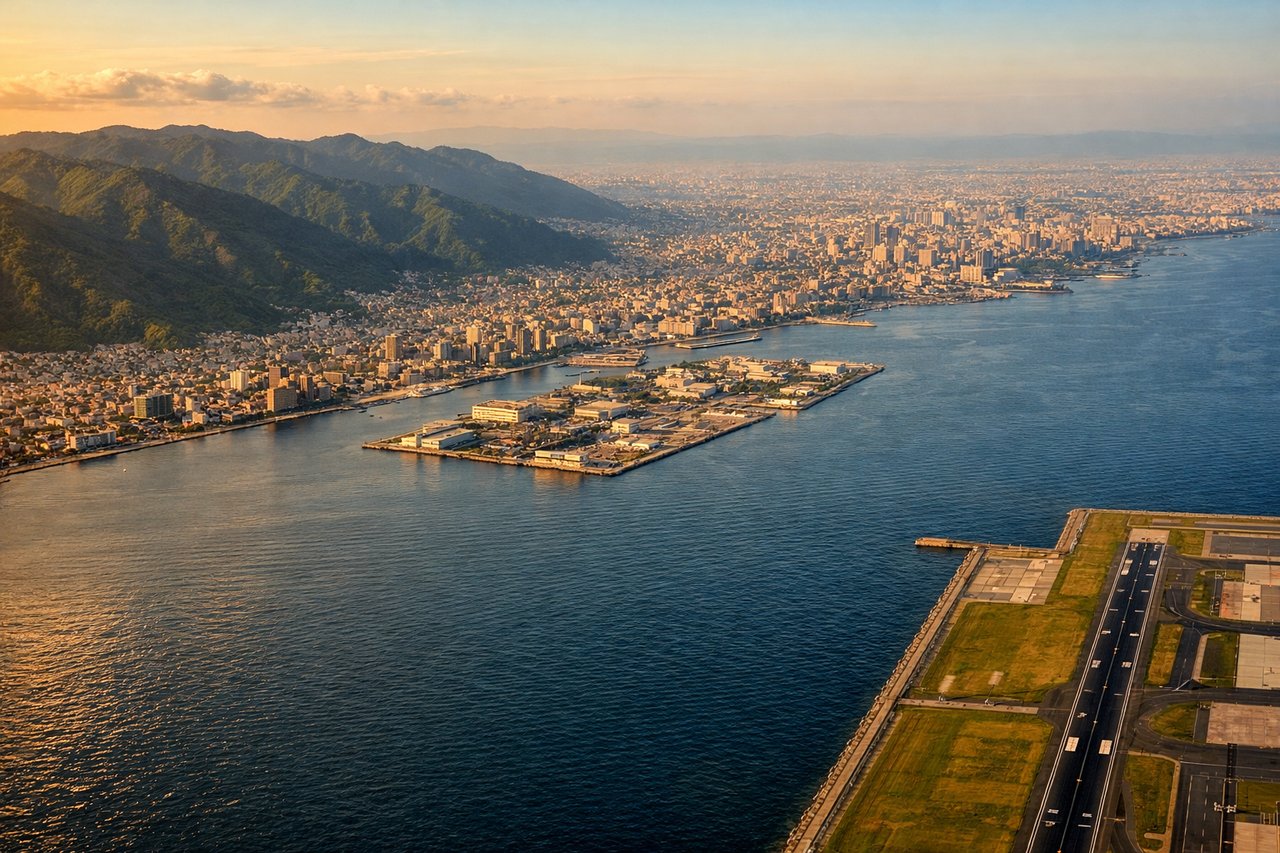
LEFTLeft side provides superior approach scenery into Kansai International. The descent path typically crosses Osaka Bay with views of Kobe's urban waterfront, the Akashi Kaikyo Bridge, and the Kobe-Awaji-Naruto expressway system. The final approach over the bay offers continuous urban and maritime interest absent on the right side.
Will your flight be in sunlight?
Pick a date and time in the Sun Map to watch the sun move across your whole flight.
About This Route
Which side of the plane should I sit on flying from New Ishigaki Airport (ISG) to Kansai International (KIX)?
Sit on the Right side of the plane for the best views on flights from Ishigaki to Osaka. Right side scores higher due to the exceptional volcanic and island scenery during takeoff from Ishigaki, which dominates the early flight experience. While left side offers superior landing views into Kansai, the dramatic departure from a scenic island airport with immediate views of the Yaeyama archipelago's distinctive terrain provides more memorable overall window experience than the primarily urban/industrial approach into Osaka Bay.
What can I see during takeoff from New Ishigaki Airport in Ishigaki?
During takeoff from New Ishigaki Airport (ISG), sit on the Right side for the best views. Right side captures Ishigaki's dramatic volcanic terrain and the Yaeyama Islands archipelago during initial climb. The island's central ridges and surrounding reef systems are immediately visible on departure, providing strong visual interest in the first 10 minutes of flight. Notable sights include: Ishigaki Island's volcanic ridges, Kabira Bay's turquoise lagoon, Iriomote Island to the southwest, surrounding coral reef systems.
What can I see when landing at Kansai International in Osaka?
When landing at Kansai International (KIX), sit on the Left side for the best views. Left side provides superior approach scenery into Kansai International. The descent path typically crosses Osaka Bay with views of Kobe's urban waterfront, the Akashi Kaikyo Bridge, and the Kobe-Awaji-Naruto expressway system. The final approach over the bay offers continuous urban and maritime interest absent on the right side. Notable sights include: Osaka Bay's shipping lanes and industrial waterfront, Akashi Kaikyo Bridge spanning to Awaji Island, Kobe's harbor and urban skyline, Kobe-Awaji-Naruto expressway infrastructure.
How long is the flight from Ishigaki to Osaka?
The flight from New Ishigaki Airport (ISG) to Kansai International (KIX) takes about 2 hours 35 minutes. The shortest flight path between them is 957 miles (1,540 km); winds and air traffic control usually add a few percent.
What does the Ishigaki to Osaka flight path pass over?
The flight path crosses the Seto Inland Sea (Seto Naikai), Japan's largest inland sea, visible during cruise altitude. Passengers may observe Shikoku Island's northern coastline, numerous small islands dotting the Seto Inland Sea, and the transition from open ocean to the densely populated Kansai region. The Kii Peninsula's forested mountains appear on the eastern horizon during descent.