The right side wins on both ends of the flight: Istanbul's waterways and skyline at departure, and the striking desert-to-mountain transition at Ashgabat on arrival, with the Kopet Dag range providing a strong scenic anchor missing from the left side's view.
Flown IST to ASB? Did we get it right?
Flight Path
Istanbul to Ashkhabad is 1,585 miles (2,551 km), a flight of about 3 hours 20 minutes.
Central Anatolian plateau, southern shoreline of the Caspian Sea, Alborz mountain foothills in northern Iran, and the western edge of the Karakum Desert in Turkmenistan
Great circle distance and headings ›

Phase by phase
Takeoff from IST
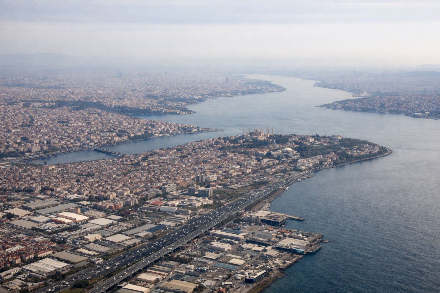
RIGHTDeparting IST toward the southeast, the right side offers a sweeping view of the Bosphorus, the Sea of Marmara, and Istanbul's historic peninsula before the aircraft turns onto its eastbound track over Anatolia. The left side mostly shows the flatter Thracian countryside with less visual interest.
Landing at ASB
RIGHTOn approach into Ashgabat, the flight path typically crosses the flat Karakum Desert before descending toward the city, which sits right at the foot of the Kopet Dag mountain range. The right side captures this dramatic contrast between desert plain and abrupt mountain wall along the Iran-Turkmenistan border.
Will your flight be in sunlight?
Pick a date and time in the Sun Map to watch the sun move across your whole flight.
About This Route
Which side of the plane should I sit on flying from İstanbul Airport (IST) to Ashgabat (ASB)?
Sit on the Right side of the plane for the best views on flights from Istanbul to Ashkhabad. The right side wins on both ends of the flight: Istanbul's waterways and skyline at departure, and the striking desert-to-mountain transition at Ashgabat on arrival, with the Kopet Dag range providing a strong scenic anchor missing from the left side's view.
What can I see during takeoff from İstanbul Airport in Istanbul?
During takeoff from İstanbul Airport (IST), sit on the Right side for the best views. Departing IST toward the southeast, the right side offers a sweeping view of the Bosphorus, the Sea of Marmara, and Istanbul's historic peninsula before the aircraft turns onto its eastbound track over Anatolia. The left side mostly shows the flatter Thracian countryside with less visual interest. Notable sights include: Bosphorus Strait, Sea of Marmara, Istanbul's historic peninsula (Hagia Sophia/Topkapi area), Princes' Islands.
What can I see when landing at Ashgabat in Ashkhabad?
When landing at Ashgabat (ASB), sit on the Right side for the best views. On approach into Ashgabat, the flight path typically crosses the flat Karakum Desert before descending toward the city, which sits right at the foot of the Kopet Dag mountain range. The right side captures this dramatic contrast between desert plain and abrupt mountain wall along the Iran-Turkmenistan border. Notable sights include: Kopet Dag mountain range, Karakum Desert edge, Ashgabat's white marble skyline, Iran-Turkmenistan border ridgeline.
How long is the flight from Istanbul to Ashkhabad?
The flight from İstanbul Airport (IST) to Ashgabat (ASB) takes about 3 hours 20 minutes. The shortest flight path between them is 1,585 miles (2,551 km); winds and air traffic control usually add a few percent.
What does the Istanbul to Ashkhabad flight path pass over?
Central Anatolian plateau, southern shoreline of the Caspian Sea, Alborz mountain foothills in northern Iran, and the western edge of the Karakum Desert in Turkmenistan