Although the Istanbul takeoff favors the right side, the long cruise phase dominates this 9+ hour flight, and the great-circle route on the left (north) side passes within view of the Zagros and Alborz ranges of Iran, the Hindu Kush, and the western Himalayan foothills of Pakistan and India — a dramatic, ever-changing mountainous panorama that far outweighs the mostly flat or oceanic scenery on the right.
Flown IST to SGN? Did we get it right?
Flight Path
Istanbul to Ho Chi Minh City is 5,102 miles (8,211 km), a flight of about 9 hours 20 minutes.
Zagros Mountains and Alborz range in Iran, the Hindu Kush in Afghanistan, western Himalayan foothills near Pakistan/India border, and the Bay of Bengal before the route continues over Myanmar and Indochina toward Vietnam
Great circle distance and headings ›


Phase by phase
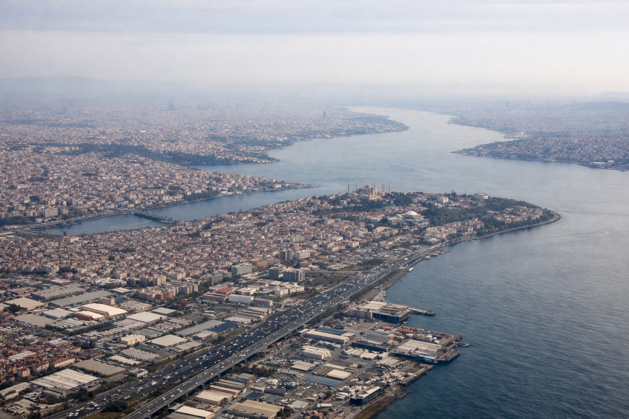
Takeoff from IST
RIGHTDeparting IST to the east, the initial turn typically banks south over the Sea of Marmara, giving right-side passengers a sweeping view of the Bosphorus strait, historic Istanbul peninsula, and the city's dense skyline before the climb continues eastward over Anatolia.

Landing at SGN
LEFTOn approach into SGN from the north, the descent path crosses the green patchwork of the Mekong Delta's rivers and canals before turning toward the airport, with the Saigon River and Ho Chi Minh City's skyline visible on the left side as the aircraft lines up for landing.
Will your flight be in sunlight?
Pick a date and time in the Sun Map to watch the sun move across your whole flight.
About This Route
Which side of the plane should I sit on flying from İstanbul Airport (IST) to Tansonnhat International (SGN)?
Sit on the Left side of the plane for the best views on flights from Istanbul to Ho Chi Minh City. Although the Istanbul takeoff favors the right side, the long cruise phase dominates this 9+ hour flight, and the great-circle route on the left (north) side passes within view of the Zagros and Alborz ranges of Iran, the Hindu Kush, and the western Himalayan foothills of Pakistan and India — a dramatic, ever-changing mountainous panorama that far outweighs the mostly flat or oceanic scenery on the right.
What can I see during takeoff from İstanbul Airport in Istanbul?
During takeoff from İstanbul Airport (IST), sit on the Right side for the best views. Departing IST to the east, the initial turn typically banks south over the Sea of Marmara, giving right-side passengers a sweeping view of the Bosphorus strait, historic Istanbul peninsula, and the city's dense skyline before the climb continues eastward over Anatolia. Notable sights include: Bosphorus Strait, Sea of Marmara, Istanbul historic peninsula (Hagia Sophia/Topkapi area), Princes' Islands.
What can I see when landing at Tansonnhat International in Ho Chi Minh City?
When landing at Tansonnhat International (SGN), sit on the Left side for the best views. On approach into SGN from the north, the descent path crosses the green patchwork of the Mekong Delta's rivers and canals before turning toward the airport, with the Saigon River and Ho Chi Minh City's skyline visible on the left side as the aircraft lines up for landing. Notable sights include: Mekong Delta waterways, Saigon River, Ho Chi Minh City skyline (District 1), rice paddy patchwork.
How long is the flight from Istanbul to Ho Chi Minh City?
The flight from İstanbul Airport (IST) to Tansonnhat International (SGN) takes about 9 hours 20 minutes. The shortest flight path between them is 5,102 miles (8,211 km); winds and air traffic control usually add a few percent.
What does the Istanbul to Ho Chi Minh City flight path pass over?
Zagros Mountains and Alborz range in Iran, the Hindu Kush in Afghanistan, western Himalayan foothills near Pakistan/India border, and the Bay of Bengal before the route continues over Myanmar and Indochina toward Vietnam