The right side wins overall because the Las Vegas arrival view is one of the most dramatic in domestic US aviation — the Strip emerging from the desert with the Spring Mountains as a backdrop is genuinely spectacular. The takeoff from JAX on the left is interesting but the flat coastal marshland, while scenic, is less dramatic than the desert mountain arrival.
Flown JAX to LAS? Did we get it right?
Flight Path
Jacksonville to Las Vegas is 1,961 miles (3,156 km), a flight of about 4 hours 30 minutes.
The flight crosses the Florida Panhandle, then the Mississippi River near Baton Rouge or Natchez, then tracks over central Louisiana and Texas. Over Texas you cross the Hill Country and then the vast Permian Basin flatlands. New Mexico brings the Sacramento Mountains and White Sands visible as a bright white patch on the desert floor. Arizona's Mogollon Rim and the Colorado River crossing near Hoover Dam mark the final approach into Nevada.
Great circle distance and headings ›


Phase by phase
Takeoff from JAX
LEFTJAX primarily departs on runway 07/25 or 13/31. Westbound flights to Las Vegas typically depart heading west or northwest, putting the St. Johns River and downtown Jacksonville on the left side during the initial climb. The left seat also captures the broad coastal marshlands and the Atlantic coastline receding behind you.
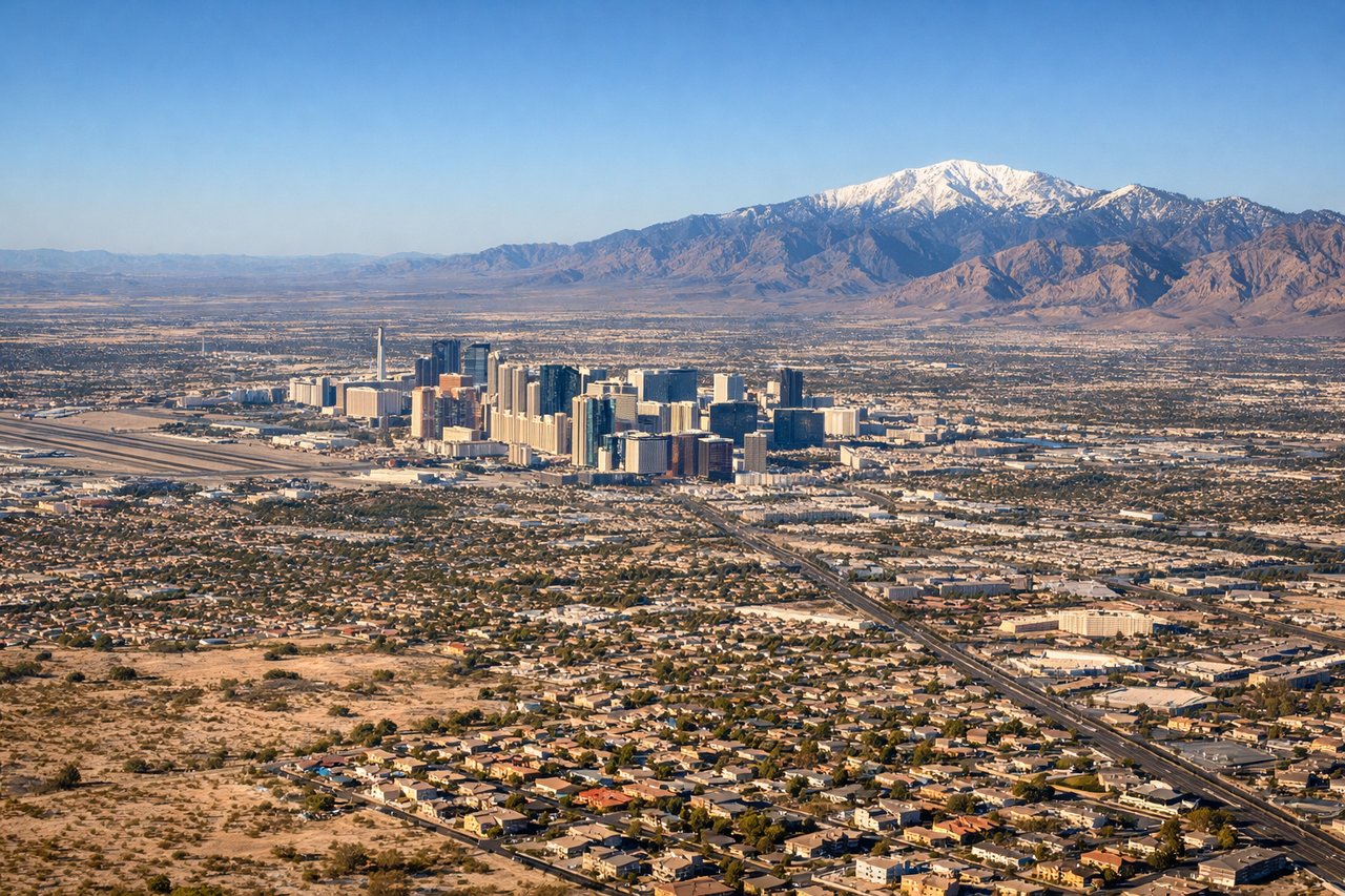
Landing at LAS
RIGHTArriving into Las Vegas from the east, aircraft typically approach on runway 26L/26R or 19L heading west or southwest. The right side gives you the Las Vegas Strip running north-south in the valley, with the Spring Mountains and Red Rock Canyon escarpment clearly visible to the west. The left side faces north toward largely featureless desert.
Will your flight be in sunlight?
Pick a date and time in the Sun Map to watch the sun move across your whole flight.
About This Route
Which side of the plane should I sit on flying from Jacksonville International (JAX) to Mc Carran International (LAS)?
Sit on the Right side of the plane for the best views on flights from Jacksonville to Las Vegas. The right side wins overall because the Las Vegas arrival view is one of the most dramatic in domestic US aviation — the Strip emerging from the desert with the Spring Mountains as a backdrop is genuinely spectacular. The takeoff from JAX on the left is interesting but the flat coastal marshland, while scenic, is less dramatic than the desert mountain arrival.
What can I see during takeoff from Jacksonville International in Jacksonville?
During takeoff from Jacksonville International (JAX), sit on the Left side for the best views. JAX primarily departs on runway 07/25 or 13/31. Westbound flights to Las Vegas typically depart heading west or northwest, putting the St. Johns River and downtown Jacksonville on the left side during the initial climb. The left seat also captures the broad coastal marshlands and the Atlantic coastline receding behind you. Notable sights include: St. Johns River bends, Jacksonville downtown skyline, Amelia Island to the north, Talbot Island marshes.
What can I see when landing at Mc Carran International in Las Vegas?
When landing at Mc Carran International (LAS), sit on the Right side for the best views. Arriving into Las Vegas from the east, aircraft typically approach on runway 26L/26R or 19L heading west or southwest. The right side gives you the Las Vegas Strip running north-south in the valley, with the Spring Mountains and Red Rock Canyon escarpment clearly visible to the west. The left side faces north toward largely featureless desert. Notable sights include: Las Vegas Strip, Spring Mountains (Charleston Peak), Red Rock Canyon escarpment, Lake Mead to the east on approach.
How long is the flight from Jacksonville to Las Vegas?
The flight from Jacksonville International (JAX) to Mc Carran International (LAS) takes about 4 hours 30 minutes. The shortest flight path between them is 1,961 miles (3,156 km); winds and air traffic control usually add a few percent.
What does the Jacksonville to Las Vegas flight path pass over?
The flight crosses the Florida Panhandle, then the Mississippi River near Baton Rouge or Natchez, then tracks over central Louisiana and Texas. Over Texas you cross the Hill Country and then the vast Permian Basin flatlands. New Mexico brings the Sacramento Mountains and White Sands visible as a bright white patch on the desert floor. Arizona's Mogollon Rim and the Colorado River crossing near Hoover Dam mark the final approach into Nevada.