Right-side seats capture the superior geography on departure (Lake Kivu, Rwandan highlands) and offer reasonable views during descent into Johannesburg. The flight path generally trends south-southwest, making the right side more favorable for the majority of the journey over Rwanda and northern South Africa.
Flown KGL to JNB? Did we get it right?
Flight Path
Kigali to Johannesburg is 1,675 miles (2,695 km), a flight of about 3 hours 50 minutes.
The flight crosses the Rwanda-Burundi border region and passes over the northern reaches of the East African Rift Valley. Lake Tanganyika lies to the east (left side) but typically beyond visual range. The terrain transitions from Rwanda's highlands through Burundi's rolling country into Tanzania's southern highlands. The Tanzanian plateau becomes visible in the midpoint, with scattered lakes and vegetation patterns. As you approach South Africa, the landscape becomes drier with the transition to the South African highveld. The Limpopo River valley marks the Zimbabwe-South Africa border and is occasionally visible on clear days. The final approach crosses the Magaliesburg and Witwatersrand ranges before reaching Johannesburg.
Great circle distance and headings ›

Phase by phase
Takeoff from KGL
RIGHTKigali typically departs runway 06 (northeast heading). Right-side seats offer views of the Rwandan highlands rolling away to the east and south, with Lake Kivu visible to the northwest as you climb. Left side faces the city and western terrain with less distinctive geography.
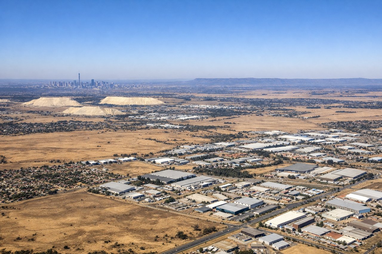
Landing at JNB
LEFTJohannesburg approaches typically use runway 03 (north heading) or 21 (south heading). For a southbound approach on runway 21, left-side seats provide views of the Witwatersrand ridge and the city's northern suburbs as you descend. The approach path crosses over Pretoria's northern reaches and the Johannesburg CBD becomes visible on the left during final descent.
Will your flight be in sunlight?
Pick a date and time in the Sun Map to watch the sun move across your whole flight.
About This Route
Which side of the plane should I sit on flying from Kigali International (KGL) to O.R. Tambo International Airport (JNB)?
Sit on the Right side of the plane for the best views on flights from Kigali to Johannesburg. Right-side seats capture the superior geography on departure (Lake Kivu, Rwandan highlands) and offer reasonable views during descent into Johannesburg. The flight path generally trends south-southwest, making the right side more favorable for the majority of the journey over Rwanda and northern South Africa.
What can I see during takeoff from Kigali International in Kigali?
During takeoff from Kigali International (KGL), sit on the Right side for the best views. Kigali typically departs runway 06 (northeast heading). Right-side seats offer views of the Rwandan highlands rolling away to the east and south, with Lake Kivu visible to the northwest as you climb. Left side faces the city and western terrain with less distinctive geography. Notable sights include: Lake Kivu (northwest, visible as a large water body during initial climb), Rwandan highlands (rolling terrain to the east and south), Kigali city sprawl (directly below), Virunga Mountains (distant northern horizon, visible as a ridge line on clear days).
What can I see when landing at O.R. Tambo International Airport in Johannesburg?
When landing at O.R. Tambo International Airport (JNB), sit on the Left side for the best views. Johannesburg approaches typically use runway 03 (north heading) or 21 (south heading). For a southbound approach on runway 21, left-side seats provide views of the Witwatersrand ridge and the city's northern suburbs as you descend. The approach path crosses over Pretoria's northern reaches and the Johannesburg CBD becomes visible on the left during final descent. Notable sights include: Witwatersrand ridge (the elevated terrain running east-west through Johannesburg), Johannesburg CBD and northern suburbs (visible as urban sprawl), Pretoria city (to the north, visible during approach), Magaliesburg Mountains (distant western horizon, visible as a low range).
How long is the flight from Kigali to Johannesburg?
The flight from Kigali International (KGL) to O.R. Tambo International Airport (JNB) takes about 3 hours 50 minutes. The shortest flight path between them is 1,675 miles (2,695 km); winds and air traffic control usually add a few percent.
What does the Kigali to Johannesburg flight path pass over?
The flight crosses the Rwanda-Burundi border region and passes over the northern reaches of the East African Rift Valley. Lake Tanganyika lies to the east (left side) but typically beyond visual range. The terrain transitions from Rwanda's highlands through Burundi's rolling country into Tanzania's southern highlands. The Tanzanian plateau becomes visible in the midpoint, with scattered lakes and vegetation patterns. As you approach South Africa, the landscape becomes drier with the transition to the South African highveld. The Limpopo River valley marks the Zimbabwe-South Africa border and is occasionally visible on clear days. The final approach crosses the Magaliesburg and Witwatersrand ranges before reaching Johannesburg.