While takeoff favors the right, the landing approach into Brisbane is significantly more scenic from the left, and the landing experience dominates the passenger's memory of the flight. Left-side seats capture Moreton Bay's islands and the Brisbane River approach, which are more visually striking than the Taiwan Strait departure.
Flown KHH to BNE? Did we get it right?
Flight Path
Kaohsiung to Brisbane is 4,087 miles (6,577 km), a flight of about 8 hours.
The flight path crosses the South China Sea, passing east of the Philippines (Luzon visible on some routes), then over the Coral Sea toward Australia. Notable features include the Coral Sea's deep blue waters, occasional tropical cloud formations, and the approach to the Australian continent via the Great Barrier Reef region (visible from high altitude as a lighter-colored band along the Queensland coast). The flight typically maintains cruising altitude of 35,000-43,000 feet over open ocean for most of the journey, limiting ground detail visibility in the midpoint.
Great circle distance and headings ›Phase by phase
Takeoff from KHH
RIGHTRight-side seats capture the Taiwan Strait and the northern Taiwan coastline as the aircraft climbs southwestward out of Kaohsiung. You'll see the urban sprawl of Kaohsiung itself receding, then the coastal plain and strait opening up. Left side faces inland toward the Central Mountain Range, which is less visually distinctive during initial climb.
Landing at BNE
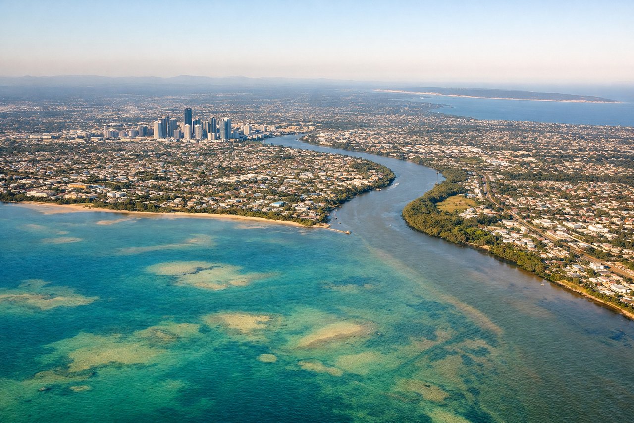
LEFTLeft-side seats offer the best views during the descent into Brisbane. The aircraft approaches from the northeast over Moreton Bay, and left-side passengers see the bay's islands, coastal suburbs, and the Brisbane River winding through the city center. Right side faces inland toward less visually distinctive terrain.
Will your flight be in sunlight?
Pick a date and time in the Sun Map to watch the sun move across your whole flight.
About This Route
Which side of the plane should I sit on flying from Kaohsiung International (KHH) to Brisbane International (BNE)?
Sit on the Left side of the plane for the best views on flights from Kaohsiung to Brisbane. While takeoff favors the right, the landing approach into Brisbane is significantly more scenic from the left, and the landing experience dominates the passenger's memory of the flight. Left-side seats capture Moreton Bay's islands and the Brisbane River approach, which are more visually striking than the Taiwan Strait departure.
What can I see during takeoff from Kaohsiung International in Kaohsiung?
During takeoff from Kaohsiung International (KHH), sit on the Right side for the best views. Right-side seats capture the Taiwan Strait and the northern Taiwan coastline as the aircraft climbs southwestward out of Kaohsiung. You'll see the urban sprawl of Kaohsiung itself receding, then the coastal plain and strait opening up. Left side faces inland toward the Central Mountain Range, which is less visually distinctive during initial climb. Notable sights include: Taiwan Strait (body of water separating Taiwan from mainland China), Kaohsiung urban area and harbor, northern Taiwan coastline, Central Mountain Range (distant, inland).
What can I see when landing at Brisbane International in Brisbane?
When landing at Brisbane International (BNE), sit on the Left side for the best views. Left-side seats offer the best views during the descent into Brisbane. The aircraft approaches from the northeast over Moreton Bay, and left-side passengers see the bay's islands, coastal suburbs, and the Brisbane River winding through the city center. Right side faces inland toward less visually distinctive terrain. Notable sights include: Moreton Bay and its islands (North Stradbroke Island, Bribie Island), Brisbane River and central business district, coastal suburbs and beaches, Pacific Ocean coastline.
How long is the flight from Kaohsiung to Brisbane?
The flight from Kaohsiung International (KHH) to Brisbane International (BNE) takes about 8 hours. The shortest flight path between them is 4,087 miles (6,577 km); winds and air traffic control usually add a few percent.
What does the Kaohsiung to Brisbane flight path pass over?
The flight path crosses the South China Sea, passing east of the Philippines (Luzon visible on some routes), then over the Coral Sea toward Australia. Notable features include the Coral Sea's deep blue waters, occasional tropical cloud formations, and the approach to the Australian continent via the Great Barrier Reef region (visible from high altitude as a lighter-colored band along the Queensland coast). The flight typically maintains cruising altitude of 35,000-43,000 feet over open ocean for most of the journey, limiting ground detail visibility in the midpoint.