The right side wins both the takeoff, with Kingston's harbor and the Blue Mountains, and the landing, with the San Blas coastline and a glimpse of Panama City, while the left side spends most of the short flight over featureless open Caribbean water.
Flown KIN to PTY? Did we get it right?
Flight Path
Kingston to Panama City is 637 miles (1,025 km), a flight of about 1 hour 50 minutes.
Open Caribbean Sea with no significant landmarks until the Panamanian coastline and San Blas Islands come into view near descent.
Great circle distance and headings ›Phase by phase
Takeoff from KIN
RIGHTDeparting KIN on runway 12 climbs out over Kingston Harbour before the aircraft banks toward Panama, giving right-side passengers a clear view back over the city and the Blue Mountains rising sharply behind it. The left side mostly sees open Caribbean water almost immediately.
Landing at PTY
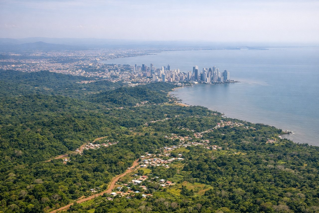
RIGHTOn approach into PTY from the north over the Caribbean, right-side passengers get a good look at the San Blas coastline and outer islands before the turn inland toward Tocumen, plus glimpses of Panama City's skyline and the canal's Caribbean entrance. The left side faces mostly interior jungle with fewer distinct landmarks.
Will your flight be in sunlight?
Pick a date and time in the Sun Map to watch the sun move across your whole flight.
About This Route
Which side of the plane should I sit on flying from Norman Manley International (KIN) to Tocumen International (PTY)?
Sit on the Right side of the plane for the best views on flights from Kingston to Panama City. The right side wins both the takeoff, with Kingston's harbor and the Blue Mountains, and the landing, with the San Blas coastline and a glimpse of Panama City, while the left side spends most of the short flight over featureless open Caribbean water.
What can I see during takeoff from Norman Manley International in Kingston?
During takeoff from Norman Manley International (KIN), sit on the Right side for the best views. Departing KIN on runway 12 climbs out over Kingston Harbour before the aircraft banks toward Panama, giving right-side passengers a clear view back over the city and the Blue Mountains rising sharply behind it. The left side mostly sees open Caribbean water almost immediately. Notable sights include: Blue Mountains, Kingston Harbour, Palisadoes spit, Caribbean Sea.
What can I see when landing at Tocumen International in Panama City?
When landing at Tocumen International (PTY), sit on the Right side for the best views. On approach into PTY from the north over the Caribbean, right-side passengers get a good look at the San Blas coastline and outer islands before the turn inland toward Tocumen, plus glimpses of Panama City's skyline and the canal's Caribbean entrance. The left side faces mostly interior jungle with fewer distinct landmarks. Notable sights include: San Blas Islands, Caribbean coastline of Panama, Panama City skyline, Gatun Lake area.
How long is the flight from Kingston to Panama City?
The flight from Norman Manley International (KIN) to Tocumen International (PTY) takes about 1 hour 50 minutes. The shortest flight path between them is 637 miles (1,025 km); winds and air traffic control usually add a few percent.
What does the Kingston to Panama City flight path pass over?
Open Caribbean Sea with no significant landmarks until the Panamanian coastline and San Blas Islands come into view near descent.