Both sides score equally for the full flight due to the short duration and ocean-dominated route, but the right side edges ahead on landing approach. Sint Maarten's central ridge, salt ponds, and neighboring island views during descent provide more concentrated scenic interest than Kingston's takeoff, which, while dramatic, is brief. The right side captures the most visually distinctive phase of the journey.
Flight Path
Open Caribbean Sea with no major landmarks; flight path crosses the Windward Passage region between Jamaica and the Lesser Antilles. Occasional cumulus cloud formations over warm tropical waters. No significant terrain features visible during cruise altitude over open ocean.
Great circle distance and headings ›Phase by phase
Takeoff from KIN
LEFTKingston's harbor and Blue Mountains provide immediate scenic interest during climb-out. The left side captures the urban waterfront and the dramatic ridge of the Blue Mountains rising inland, creating visual relief from the ocean-dominated route.
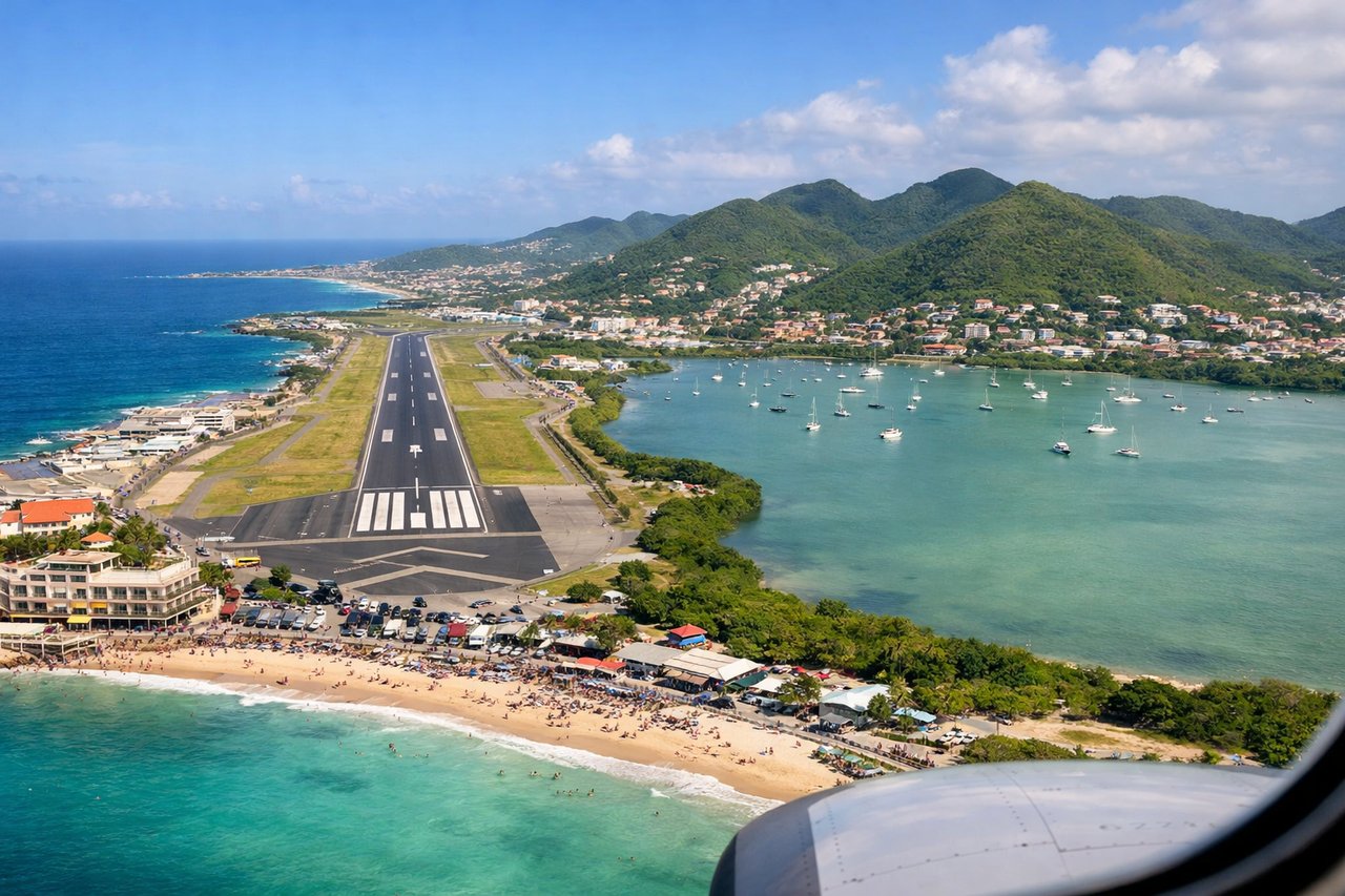
Landing at SXM
RIGHTThe approach to SXM from the southwest offers views of Sint Maarten's dramatic topography and the island's distinctive geography. The right side captures the island's central ridge, salt ponds, and the approach over Anguilla Channel with neighboring islands visible.
Landmarks on this routeAll landmarks →
Will your flight be in sunlight?
See exactly which side of the plane gets sun and shade at your departure time.
About This Route
Which side of the plane should I sit on flying from Norman Manley International (KIN) to Princess Juliana International (SXM)?
Sit on the Right side of the plane for the best views on flights from Kingston to Philipsburg. Both sides score equally for the full flight due to the short duration and ocean-dominated route, but the right side edges ahead on landing approach. Sint Maarten's central ridge, salt ponds, and neighboring island views during descent provide more concentrated scenic interest than Kingston's takeoff, which, while dramatic, is brief. The right side captures the most visually distinctive phase of the journey.
What can I see during takeoff from Norman Manley International in Kingston?
During takeoff from Norman Manley International (KIN), sit on the Left side for the best views. Kingston's harbor and Blue Mountains provide immediate scenic interest during climb-out. The left side captures the urban waterfront and the dramatic ridge of the Blue Mountains rising inland, creating visual relief from the ocean-dominated route. Notable sights include: Kingston Harbor with Port Authority facilities, Blue Mountains (eastern ridge), Palisadoes Airport spit, Caribbean Sea coastline.
What can I see when landing at Princess Juliana International in Philipsburg?
When landing at Princess Juliana International (SXM), sit on the Right side for the best views. The approach to SXM from the southwest offers views of Sint Maarten's dramatic topography and the island's distinctive geography. The right side captures the island's central ridge, salt ponds, and the approach over Anguilla Channel with neighboring islands visible. Notable sights include: Sint Maarten's central ridge and Pitons du Carbet peaks, Great Salt Pond (western side), Anguilla island to the north, Simpson Bay Lagoon.
How long is the flight from Kingston to Philipsburg?
The flight from Norman Manley International (KIN) to Princess Juliana International (SXM) takes 1h 15m.
What does the Kingston to Philipsburg flight path pass over?
Open Caribbean Sea with no major landmarks; flight path crosses the Windward Passage region between Jamaica and the Lesser Antilles. Occasional cumulus cloud formations over warm tropical waters. No significant terrain features visible during cruise altitude over open ocean.